Category:De Vennenweg 1 (Tinallinge)
Jump to navigation
Jump to search
| Object location | | View all coordinates using: OpenStreetMap |
|---|
 | |||||
| Upload media | |||||
| Instance of | |||||
|---|---|---|---|---|---|
| Location | Tinallinge, Het Hogeland, Groningen, Netherlands | ||||
| Located on street |
| ||||
| Heritage designation |
| ||||
 | |||||
Nederlands: Kop-hals-rompboerderij, Tinallinge
|
This is a category about rijksmonument number 8591
|
| Address |
|
Media in category "De Vennenweg 1 (Tinallinge)"
The following 35 files are in this category, out of 35 total.
-
 Achtergevel, linker gedeelte - Tinallinge - 20380658 - RCE.jpg 1,200 × 1,200; 462 KB
-
 Achtergevel, middengedeelte tussen de twee schuren in - Tinallinge - 20380671 - RCE.jpg 1,200 × 1,200; 408 KB
-
 Achtergevel, overzicht linker schuur - Tinallinge - 20380672 - RCE.jpg 1,200 × 1,200; 462 KB
-
 Achtergevel, overzicht rechter schuur - Tinallinge - 20380673 - RCE.jpg 1,200 × 1,200; 446 KB
-
 Achtergevel, rechtergedeelte van de grote schuur - Tinallinge - 20380670 - RCE.jpg 1,200 × 1,200; 492 KB
-
 De Venneweg 1, achtergevel - Tinallinge - 20209637 - RCE.jpg 1,200 × 1,200; 359 KB
-
 De Venneweg 1, linkerzijde - Tinallinge - 20209636 - RCE.jpg 1,200 × 1,200; 487 KB
-
 De Venneweg 1, overzicht - Tinallinge - 20209634 - RCE.jpg 1,200 × 1,200; 476 KB
-
 De Venneweg 1, rechter voorzijde - Tinallinge - 20209635 - RCE.jpg 1,198 × 1,200; 390 KB
-

-

-
 Detail voorgevel- gevelsteen met slecht leesbare tekst - Tinallinge - 20380676 - RCE.jpg 1,200 × 1,200; 452 KB
-
-
 Overzicht achtergevels - Tinallinge - 20380657 - RCE.jpg 1,200 × 1,200; 434 KB
-
 Overzicht achterzijde met omgeving - Tinallinge - 20380677 - RCE.jpg 1,200 × 1,200; 467 KB
-
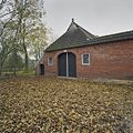
 Overzicht kop-hals-romp boerderij - Tinallinge - 20380663 - RCE.jpg 1,200 × 1,200; 527 KB
-
 Overzicht linker zijde - Tinallinge - 20380678 - RCE.jpg 1,200 × 1,200; 476 KB
-

-
 Overzicht linker zijgevels met stookhut - Tinallinge - 20380680 - RCE.jpg 1,200 × 1,200; 497 KB
-
 Overzicht linker zijgevels met stookhut - Tinallinge - 20380681 - RCE.jpg 1,200 × 1,200; 479 KB
-

-

-
 Overzicht stookhut - Tinallinge - 20380679 - RCE.jpg 1,200 × 1,200; 498 KB
-
 Overzicht stookhut, vanaf de voorzijde gezien - Tinallinge - 20380685 - RCE.jpg 1,200 × 1,200; 475 KB
-
 Overzicht voorgevel en zijkant van de bijschuur - Tinallinge - 20380660 - RCE.jpg 1,200 × 1,200; 374 KB
-
 Overzicht woongedeelte kop-hals-romp boerderij - Tinallinge - 20380662 - RCE.jpg 1,200 × 1,200; 454 KB
-
 Overzicht woonhuis van de kop-hals-romp boerderij - Tinallinge - 20380664 - RCE.jpg 1,200 × 1,200; 449 KB
-
 Overzicht zijaanzicht links achter met omgeving - Tinallinge - 20380659 - RCE.jpg 1,200 × 1,200; 484 KB
-
 Rechter zijgevel van de grote schuur - Tinallinge - 20380661 - RCE.jpg 1,200 × 1,200; 415 KB
-
 Sluitsteen met afbeelding van een paard - Tinallinge - 20380675 - RCE.jpg 1,200 × 1,200; 303 KB
-
 Sluitsteen met tekst "1918" - Tinallinge - 20380668 - RCE.jpg 1,200 × 1,200; 250 KB
-
 Sluitsteen met voorstelling van een paard - Tinallinge - 20380666 - RCE.jpg 1,200 × 1,200; 263 KB
-
 Steenhuisterheerd - achterzijde.jpg 4,896 × 2,754; 14.14 MB
-
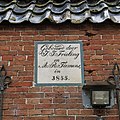
 Steenhuisterheerd - plaquette.jpg 4,249 × 2,833; 11.54 MB
-
 Tinallinge - De Vennenweg 1.jpg 6,000 × 3,375; 18.33 MB


