Category:De Vriendschap, Weesp
Jump to navigation
Jump to search
| Object location | | View all coordinates using: OpenStreetMap |
|---|
windmill in Weesp, Netherlands  | |||||
| Upload media | |||||
| Instance of | |||||
|---|---|---|---|---|---|
| Location | Weesp, Amsterdam, North Holland, Netherlands | ||||
| Street address |
| ||||
| Located on street |
| ||||
| Has use | |||||
| Heritage designation |
| ||||
| Source of energy | |||||
 | |||||
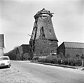
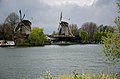
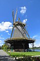
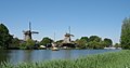
Nederlands: De Vriendschap is een in 1900 gebouwde windmolen op de plaats van de in 1899 afgebrande molen en staat aan de Utrechtseweg 11a aan de Utrechtse Vecht in Weesp.
|
This is a category about rijksmonument number 38645
|
| Address |
|
Media in category "De Vriendschap, Weesp"
The following 46 files are in this category, out of 46 total.
-

-

-

-

-

-
 Korenmolen "De Vriendschap" aanzicht - Weesp - 20252688 - RCE.jpg 813 × 1,200; 192 KB
-

-
 Korenmolen "De Vriendschap" tussen tafelm. - Weesp - 20252673 - RCE.jpg 1,200 × 1,180; 346 KB
-
 Korenmolen "De Vriendschap", 1e zolder gekraakt bint - Weesp - 20252691 - RCE.jpg 1,200 × 1,182; 226 KB
-

-
 Korenmolen "De Vriendschap", aanzicht - Weesp - 20252687 - RCE.jpg 1,200 × 1,191; 213 KB
-
 Korenmolen "De Vriendschap", aanzicht - Weesp - 20252689 - RCE.jpg 1,200 × 1,172; 268 KB
-
 Korenmolen "De Vriendschap", aanzicht - Weesp - 20252690 - RCE.jpg 1,200 × 1,174; 246 KB
-
 Korenmolen "De Vriendschap", het opzetten van de kap - Weesp - 20252707 - RCE.jpg 1,200 × 1,172; 234 KB
-
 Korenmolen "De Vriendschap", in restauratie - Weesp - 20252664 - RCE.jpg 1,200 × 1,185; 267 KB
-
 Korenmolen "De Vriendschap", in restauratie - Weesp - 20252665 - RCE.jpg 1,200 × 1,172; 320 KB
-
 Korenmolen "De Vriendschap", in verval - Weesp - 20252674 - RCE.jpg 802 × 1,200; 134 KB
-
 Korenmolen "De Vriendschap", in verval - Weesp - 20252675 - RCE.jpg 1,200 × 802; 172 KB
-
 Korenmolen "De Vriendschap", in verval - Weesp - 20252676 - RCE.jpg 791 × 1,200; 175 KB
-
 Korenmolen "De Vriendschap", in verval - Weesp - 20252677 - RCE.jpg 787 × 1,200; 156 KB
-
 Korenmolen "De Vriendschap", molenaarswoning - Weesp - 20252681 - RCE.jpg 1,200 × 1,191; 216 KB
-
 Korenmolen "De Vriendschap", onttakeld - Weesp - 20252682 - RCE.jpg 1,200 × 1,180; 181 KB
-
 Korenmolen "De Vriendschap", onttakeld - Weesp - 20252683 - RCE.jpg 1,200 × 1,183; 206 KB
-
 Korenmolen "De Vriendschap", onttakeld - Weesp - 20252684 - RCE.jpg 1,200 × 1,189; 237 KB
-
 Korenmolen "De Vriendschap", onttakeld - Weesp - 20252685 - RCE.jpg 1,200 × 1,185; 193 KB
-
 Korenmolen "De Vriendschap", overzicht - Weesp - 20252672 - RCE.jpg 1,200 × 1,181; 184 KB
-
 Korenmolen "De Vriendschap", verval onderweeg - Weesp - 20252686 - RCE.jpg 1,200 × 1,195; 258 KB
-
 Korenmolen De Vriendschap - Weesp - 20252654 - RCE.jpg 1,200 × 1,179; 254 KB
-
 Korenmolen De Vriendschap - Weesp - 20252655 - RCE.jpg 1,200 × 1,163; 264 KB
-
 Korenmolen De Vriendschap - Weesp - 20252656 - RCE.jpg 1,200 × 1,175; 277 KB
-
 Langs de Vecht - panoramio (1).jpg 4,928 × 3,264; 13.65 MB
-
 Langs de Vecht - panoramio (2).jpg 4,928 × 3,264; 22.14 MB
-
 Molen "De Vriendschap" reproductie van oude foto - Weesp - 20252693 - RCE.jpg 1,200 × 879; 221 KB
-
 Molen De Vriendschap - panoramio.jpg 3,456 × 4,608; 5.69 MB
-
 Molen de Vriendschap en Molen de Eendragt - panoramio.jpg 4,608 × 3,456; 6.04 MB
-
 Molens De Eendracht en De Vriendschap te Weesp, RP-F-1999-207.jpg 5,040 × 3,856; 1.49 MB
-

-
 Overzicht - Weesp - 20369818 - RCE.jpg 1,200 × 1,200; 238 KB
-
 Overzicht, zonder stelling - Weesp - 20367875 - RCE.jpg 1,200 × 1,200; 230 KB
-

-
 Weesp - Molen de Vriendschap RM38645.JPG 3,006 × 4,581; 2.87 MB
-
 Weesp and Amsterdam (Netherland, June 2020) - 23 (50550749852).jpg 5,472 × 3,648; 20.84 MB
-
 Weesp molen De Vriendschap tegenlicht.jpg 1,200 × 1,200; 811 KB
-
 Weesp molen De Vriendschap.jpg 1,000 × 1,500; 832 KB
-
 Weesp3181.jpg 1,000 × 525; 418 KB
-
 Windmill, Weesp, Netherlands.jpg 3,040 × 4,048; 5.7 MB


.jpg)
.jpg)


_-_23_(50550749852).jpg)


