Category:December 2007 in Kent
Jump to navigation
Jump to search
Deutsch: Bilder, die im Dezember 2007 in Kent aufgenommen worden sind. Bitte beachten Sie, dass dies weder das Datum des Uploads noch das Datum des Scannens eines Fotos ist.
English: Images/pictures taken in Kent during December 2007. Note this is not the date of the upload, nor the date a photo was scanned.
Español: Fotografías o imágenes tomadas en Kent durante diciembre 2007. No es la fecha de subida ni escaneo, sino la fecha en que las fotografías o imágenes se crearon.
Esperanto: Bildoj faritaj en Kent en decembro 2007. Tio ne estas la dato, kiam la bildoj estis alŝutitaj aŭ skanitaj.
Français : Photographies ou images prises en Kent durant décembre 2007. Ce n'est pas la date du téléchargement ou du scan.
Galego: Fotografías ou imaxes tomadas en Kent durante decembro 2007. Non é a data de subida nin escaneamento, senón a data na que se crearon as fotografías ou imaxes.
Italiano: Fotografie o immagini scattate a Kent nel dicembre 2007. Nota bene: la data non si riferisce né a quella di upload né a quella in cui la foto è stata digitalizzata.
Norsk bokmål: Bilder tatt i Kent i løpet av desember 2007. Merk at dette ikke er datoen for opplasting, eller når et bilde har blitt skannet.
Norsk nynorsk: Bilete teke i Kent i løpet av desember 2007. Merk at dette ikkje er datoen for opplasting, eller når eit bilete har vorte skanna.
Русский: Изображения, сделанные в Kent в течение декабрь 2007 (не дата загрузки изображения).
Українська: Зображення, зроблені в Kent протягом грудень 2007. Зауважте, що це не дата завантаження чи дата сканування фотографії.
| December 2006 | ← | December 2007 | → | December 2008 | |||||||
| Jan | Feb | Mar | Apr | May | Jun | Jul | Aug | Sep | Oct | Nov | Dec |
| 52 | 92 | 126 | 165 | 55 | 76 | 58 | 39 | 61 | 99 | 45 | 94 |
|---|---|---|---|---|---|---|---|---|---|---|---|
Subcategories
This category has the following 2 subcategories, out of 2 total.
Media in category "December 2007 in Kent"
The following 92 files are in this category, out of 92 total.
-
 Ebbsfleet3732.JPG 2,848 × 2,136; 1.47 MB
-
 The Drum Inn, Stanford, Kent, UK.jpg 640 × 480; 256 KB
-
 A225 bridge over M26 - geograph.org.uk - 635108.jpg 640 × 426; 65 KB
-
 About as flat as it gets... - geograph.org.uk - 643721.jpg 640 × 480; 117 KB
-
 All Saint's church notice board - geograph.org.uk - 643535.jpg 640 × 480; 311 KB
-

-
 Ashford, Kent - geograph.org.uk - 1149363.jpg 480 × 640; 89 KB
-
 Brook Multi Storey Car Park, Chatham - geograph.org.uk - 636917.jpg 640 × 480; 85 KB
-
 Canterbury Law Courts.jpg 640 × 480; 147 KB
-
 Cockleshell Hard - geograph.org.uk - 637867.jpg 640 × 480; 119 KB
-
 Coldred's bus shelter - geograph.org.uk - 634019.jpg 640 × 480; 266 KB
-
 Dartford County Court.jpg 2,048 × 1,536; 1.37 MB
-
 Dartford3792.JPG 2,136 × 2,848; 1.21 MB
-
 DartfordCivicCentre3803.JPG 2,848 × 2,136; 1.37 MB
-
 DartfordMuseumLibrary3791.JPG 2,848 × 2,136; 1.67 MB
-
 Deal Railway Station.jpg 640 × 480; 183 KB
-
 Disused, overgrown footpath gate - geograph.org.uk - 641103.jpg 640 × 429; 112 KB
-
 EastPeckhamLittleMill3493.JPG 2,848 × 2,136; 1.34 MB
-
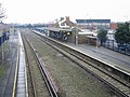
 Eythorne station - geograph.org.uk - 633978.jpg 640 × 480; 255 KB
-

-

-

-
 Garrison Sports Ground, Gillingham - geograph.org.uk - 636792.jpg 640 × 480; 91 KB
-

-
 Gates on the marsh - geograph.org.uk - 1026033.jpg 576 × 432; 129 KB
-
 George House, Newington - geograph.org.uk - 634488.jpg 640 × 457; 104 KB
-
 Grain Crossing.jpg 640 × 480; 93 KB
-
 King's Street, Sandwich - geograph.org.uk - 646966.jpg 640 × 480; 165 KB
-

-
 Looking NW along The Street, Guston - geograph.org.uk - 624650.jpg 640 × 480; 53 KB
-
 Margaterailwaystation.JPG 2,456 × 930; 626 KB
-
 MeophamGreen3566.JPG 2,848 × 2,136; 1.31 MB
-
 MeophamGreen3570.JPG 2,848 × 2,136; 1.43 MB
-

-
 New Rides Farm near Eastchurch Prison - geograph.org.uk - 641098.jpg 640 × 429; 84 KB
-
-

-
 Pier at Rushenden - geograph.org.uk - 634318.jpg 640 × 480; 53 KB
-

-
 Pond on New Rides Farm, Eastchurch - geograph.org.uk - 641080.jpg 640 × 429; 97 KB
-
 Poplar Trees beside Railway Line - geograph.org.uk - 634424.jpg 640 × 480; 161 KB
-

-
 Railway line heading for Birchington - geograph.org.uk - 631125.jpg 640 × 480; 80 KB
-
 Railway Siding at Rushenden Pier - geograph.org.uk - 634317.jpg 640 × 480; 77 KB
-

-
 Rocks at Barton's Point, Sheppey - geograph.org.uk - 641076.jpg 640 × 429; 63 KB
-

-
-
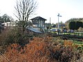
 Snowdown Railway Station.jpg 640 × 480; 220 KB
-
 St Margaret's church Womenswold - geograph.org.uk - 643241.jpg 640 × 480; 191 KB
-
 St. Andrew's Church, Shepherds Well - geograph.org.uk - 643598.jpg 640 × 480; 83 KB
-
 St. Pancras Church, Coldred - geograph.org.uk - 643654.jpg 640 × 480; 97 KB
-
 Stile with Dog-Door - geograph.org.uk - 633641.jpg 640 × 480; 137 KB
-
 Stone out building on New Rides Farm - geograph.org.uk - 641099.jpg 640 × 429; 74 KB
-

-

-
 Village sign, Ripple - geograph.org.uk - 634855.jpg 480 × 640; 344 KB
-

-
 Watercress beds, Newington - geograph.org.uk - 639160.jpg 640 × 480; 118 KB
-
 Watercress beds, Newington - geograph.org.uk - 639161.jpg 640 × 480; 128 KB
-
 Watercress beds, Newington - geograph.org.uk - 639166.jpg 640 × 480; 192 KB
-
 Watercress beds, Newington - geograph.org.uk - 639171.jpg 640 × 480; 131 KB
-
 Westenhanger Railway Station.jpg 640 × 480; 157 KB
-
 A green area near Canterbury city centre - geograph.org.uk - 647231.jpg 640 × 480; 192 KB
-
 Beach and Sheerness Docks - geograph.org.uk - 634400.jpg 640 × 480; 67 KB
-
 Beach huts at Minnis Bay - geograph.org.uk - 631178.jpg 640 × 480; 53 KB
-
 Cattle at Bonnington Farm, Goodnestone - geograph.org.uk - 641610.jpg 640 × 480; 203 KB
-

-
 Chetney Hill - geograph.org.uk - 633574.jpg 640 × 480; 77 KB
-

-
 Drainage Channel on Chetney Marsh - geograph.org.uk - 633597.jpg 640 × 480; 81 KB
-
 Drainage Channel, Rushenden Marshes - geograph.org.uk - 634311.jpg 640 × 480; 74 KB
-

-
 Farm Buildings on Chetney Marsh - geograph.org.uk - 633583.jpg 640 × 480; 96 KB
-
 Farm Track on Chetney Marsh - geograph.org.uk - 633591.jpg 640 × 480; 69 KB
-
 Farm Track on Chetney Marsh - geograph.org.uk - 633607.jpg 640 × 480; 65 KB
-

-
 Faversham creek at low tide - geograph.org.uk - 637937.jpg 480 × 640; 72 KB
-
 Fishing boat on Faversham creek - geograph.org.uk - 637932.jpg 640 × 480; 58 KB
-
 Footpath off Church Road, Eastchurch - geograph.org.uk - 641107.jpg 640 × 429; 80 KB
-
 High tide at Minnis Bay - geograph.org.uk - 631168.jpg 640 × 480; 52 KB
-
 Joan Fleet, Rushenden Marshes - geograph.org.uk - 634312.jpg 640 × 480; 74 KB
-
 Lake in Chetney Marsh - geograph.org.uk - 633550.jpg 640 × 480; 54 KB
-
 Overgrown ditch on the Wingham Road - geograph.org.uk - 629239.jpg 640 × 480; 81 KB
-
 Piers at Sheerness Docks - geograph.org.uk - 634379.jpg 640 × 480; 84 KB
-
 Queenborough Water Treatment Works - geograph.org.uk - 634314.jpg 640 × 465; 101 KB
-
 Rough seas at Minnis Bay - geograph.org.uk - 631173.jpg 640 × 480; 50 KB
-
 Rushenden Marsh - geograph.org.uk - 634407.jpg 640 × 480; 122 KB
-
 Saxon Shore Way, Chetney Marsh - geograph.org.uk - 633615.jpg 640 × 480; 57 KB
-
 Sea wall by beach huts at Minnis Bay - geograph.org.uk - 631179.jpg 640 × 480; 102 KB
-
 Ship Leaving Sheerness Docks - geograph.org.uk - 634389.jpg 640 × 480; 62 KB
-
 Swans on Chetney Marsh - geograph.org.uk - 633562.jpg 640 × 480; 54 KB


