Category:Dehtáry (Jenštejn)
Jump to navigation
Jump to search
village in Praha-východ District of Central Bohemian region  Hlavní ulice | |||||
| Upload media | |||||
| Instance of | |||||
|---|---|---|---|---|---|
| Location | Jenštejn, Prague-East District, Central Bohemian Region, Czechia | ||||
| Population |
| ||||
| Area |
| ||||
 | |||||
Media in category "Dehtáry (Jenštejn)"
The following 6 files are in this category, out of 6 total.
-
 Dehtáry 01.JPG 3,872 × 2,592; 2.37 MB
-
 Dehtáry 02.JPG 3,872 × 2,592; 4.42 MB
-
 Dehtáry 03.JPG 3,872 × 2,592; 2.29 MB
-
 Dehtáry chapel 02.JPG 2,592 × 3,872; 3.78 MB
-
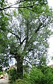 Dehtáry topol černý.jpg 2,971 × 4,613; 5.25 MB
-
 Jenštejn, Dehtáry, main street.jpg 2,200 × 1,665; 1.59 MB


