Category:Delaware gubernatorial election maps
Jump to navigation
Jump to search
States of the United States: Alabama · Alaska · Arizona · Arkansas · California · Colorado · Connecticut · Delaware · Florida · Georgia · Hawaii · Idaho · Illinois · Indiana · Iowa · Kansas · Kentucky · Louisiana · Maine · Maryland · Massachusetts · Michigan · Minnesota · Mississippi · Missouri · Montana · Nebraska · Nevada · New Hampshire · New Jersey · New Mexico · New York · North Carolina · North Dakota · Ohio · Oklahoma · Oregon · Pennsylvania · Rhode Island · South Carolina · South Dakota · Tennessee · Texas · Utah · Vermont · Virginia · Washington · West Virginia · Wisconsin · Wyoming
Guam
Guam
Subcategories
This category has only the following subcategory.
Media in category "Delaware gubernatorial election maps"
The following 14 files are in this category, out of 14 total.
-
 1792 Delaware gubernatorial election results map by county.png 800 × 1,556; 48 KB
-
 1968 Delaware gubernatorial results map by house district.svg 810 × 810; 37 KB
-
 1976 Delaware gubernatorial results map by house district.svg 810 × 810; 185 KB
-
 1980 Delaware gubernatorial results map by house district.svg 810 × 810; 185 KB
-
 1984 Delaware gubernatorial results map by house district.svg 810 × 810; 40 KB
-
 1988 Delaware gubernatorial results map by house district.svg 810 × 810; 40 KB
-
 1992 Delaware gubernatorial results map by house district.svg 810 × 810; 62 KB
-
 1996 Delaware gubernatorial results map by house district.svg 810 × 810; 62 KB
-
 2000 Delaware gubernatorial results map by house district.svg 810 × 810; 62 KB
-
 2008 Delaware gubernatorial results map by house district.svg 810 × 810; 65 KB
-
 2012 Delaware gubernatorial results map by house district.svg 810 × 810; 132 KB
-
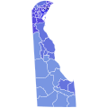
 DE Governor 2016.svg 810 × 810; 3.01 MB
-
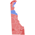
 Delaware Election Results by county, all Democrat.png 252 × 600; 22 KB
-
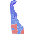
 Delaware2000GubernatorialElectionResultsByCounty.png 261 × 406; 19 KB


