Category:Denby Dale
Jump to navigation
Jump to search
village and civil parish in West Yorkshire, UK  | |||||
| Upload media | |||||
| Instance of | |||||
|---|---|---|---|---|---|
| Location | Kirklees, West Yorkshire, Yorkshire and the Humber, England | ||||
| Said to be the same as | Denby Dale (Wikimedia duplicated page, civil parish) | ||||
 | |||||
English: Denby Dale is a village and civil parish in the metropolitan borough of Kirklees in West Yorkshire, England, to the South East of Huddersfield. As a civil parish it covers the villages of Denby Dale, Lower Denby, Upper Denby, Upper Cumberworth, Lower Cumberworth, Skelmanthorpe, Emley, Emley Moor. This parish had a population of 14,982 according to the 2001 census. The parish council gives the electorate of the village itself as 2,143.
Français : Denby Dale ( en français vallée de Denby )est un village et une paroisse civile dans le district de Kirklees dans le West Yorkshire, Angleterre, au sud-est de Huddersfield. Comme paroisse civile, il couvre les villages de la vallée de Denby, Lower Denby, Upper Denby, Upper Cumberworth, Lower Cumberworth, Skelmanthorpe, Emley, Emley Moor. Cette paroisse a eu une population de 14 982 hab. selon le recensement de 2001. La population du village est de 2 143.
Nederlands: Denby Dale is een dorp (village) en civil parish in het bestuurlijke gebied Kirklees, in het Engelse graafschap West Yorkshire. De civil parish telt
Subcategories
This category has the following 12 subcategories, out of 12 total.
B
- Birdsedge (8 F)
C
- Crawshaw, West Yorkshire (2 F)
D
- Denby Dale railway station (7 F)
- Denby Dale Viaduct (13 F)
E
L
- Lower Cumberworth (5 F)
- Lower Denby, West Yorkshire (5 F)
S
U
Media in category "Denby Dale"
The following 200 files are in this category, out of 1,178 total.
(previous page) (next page)-
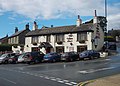 "The White Hart", Denby Dale - geograph.org.uk - 3659753.jpg 3,425 × 2,447; 1.64 MB
-

-
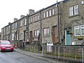
 11, Lodge Street, Skelmanthorpe - geograph.org.uk - 1884059.jpg 516 × 640; 107 KB
-
 1920s bungalow, The Royds - geograph.org.uk - 2574079.jpg 1,024 × 768; 170 KB
-
 1988 Denby Dale Pie - geograph.org.uk - 1195556.jpg 640 × 438; 139 KB
-
 1988 Denby Dale Pie - geograph.org.uk - 1195569.jpg 640 × 429; 96 KB
-
 22-24 Elm Street - geograph.org.uk - 1885710.jpg 640 × 480; 90 KB
-
 253 Wakefield Road, Denby Dale - geograph.org.uk - 4473725.jpg 2,448 × 1,624; 1.29 MB
-
 A Barnsley field gate - geograph.org.uk - 2753438.jpg 1,024 × 768; 140 KB
-
 A change in the speed limit on Denby Lane - geograph.org.uk - 2754121.jpg 1,024 × 768; 139 KB
-
 A mirror for the bend - geograph.org.uk - 2753115.jpg 1,024 × 768; 117 KB
-

-
 A significant crossroads - geograph.org.uk - 2753426.jpg 1,024 × 768; 136 KB
-
 A stand of winter trees - geograph.org.uk - 2754114.jpg 1,024 × 768; 158 KB
-
 A vestigial field boundary of twisted trees - geograph.org.uk - 2250065.jpg 1,024 × 768; 141 KB
-
 A view of Emley Moor - geograph.org.uk - 4708000.jpg 4,992 × 3,744; 3.2 MB
-
 A629 entering Birds Edge - geograph.org.uk - 3436646.jpg 640 × 427; 63 KB
-
 A629 towards Huddersfield - geograph.org.uk - 4193863.jpg 640 × 480; 81 KB
-
 A629, High Flatts - geograph.org.uk - 3431056.jpg 640 × 415; 36 KB
-
 A635 heading west - geograph.org.uk - 4864247.jpg 640 × 480; 78 KB
-
 A636 Wakefield Road ahead - geograph.org.uk - 4691232.jpg 1,024 × 768; 153 KB
-
 Aagrah restaurant on Wakefield Road, Denby Dale - geograph.org.uk - 4473732.jpg 2,448 × 1,624; 1.49 MB
-
 Across Skelmanthorpe Common - geograph.org.uk - 3659735.jpg 2,645 × 3,306; 1.78 MB
-

-
 Airstrip below Birds Edge Hill - geograph.org.uk - 2872390.jpg 1,024 × 683; 156 KB
-
 Airstrip below Birds Edge Hill - geograph.org.uk - 2872457.jpg 1,024 × 683; 145 KB
-

-

-
 All Saints Close - Ings Mill Avenue - geograph.org.uk - 5286479.jpg 640 × 489; 61 KB
-
 Allotments near Cemetery - geograph.org.uk - 1885891.jpg 640 × 480; 72 KB
-

-
 Another view of the Emley mast - geograph.org.uk - 2783103.jpg 2,000 × 1,500; 911 KB
-
 Arable fields east of Park Lane - geograph.org.uk - 2493054.jpg 1,024 × 768; 165 KB
-
 Ashfield Avenue - Lidgett Lane - geograph.org.uk - 5310769.jpg 640 × 480; 89 KB
-
 Aspen Court - Church Street - geograph.org.uk - 5085940.jpg 640 × 480; 83 KB
-
 At Bagden Hall Farm - geograph.org.uk - 3662843.jpg 3,648 × 2,736; 2.22 MB
-
 At Manor House Farm, Nether End - geograph.org.uk - 3662864.jpg 3,418 × 2,734; 2.22 MB
-
 At the 197 spot height, Park Lane - geograph.org.uk - 2493057.jpg 1,024 × 768; 198 KB
-
 At Upper Crawshaw Farm - geograph.org.uk - 4120840.jpg 5,103 × 3,645; 4.96 MB
-
 Atypical Kitchenroyd homes - geograph.org.uk - 2624864.jpg 1,024 × 768; 149 KB
-
 Auckland Opticians - Huddersfield Road - geograph.org.uk - 1885266.jpg 640 × 620; 103 KB
-
 Back Lane - geograph.org.uk - 3666639.jpg 1,600 × 1,200; 647 KB
-
 Back Lane Clayton West - geograph.org.uk - 4691227.jpg 1,024 × 768; 219 KB
-
 Back Lane, Clayton West - geograph.org.uk - 2574061.jpg 1,024 × 768; 117 KB
-
 Back of Victoria Terrace - geograph.org.uk - 4375329.jpg 3,229 × 3,759; 1.86 MB
-

-
 Bagden Hall Farm - geograph.org.uk - 4375294.jpg 4,135 × 2,409; 2.22 MB
-

-

-
 Bagden Lane - geograph.org.uk - 5262160.jpg 4,608 × 3,456; 3.69 MB
-
 Bagden Lane Approaching Deffer Hill - geograph.org.uk - 5262164.jpg 4,608 × 3,456; 3.75 MB
-
 Bales by Kirkby Lane - geograph.org.uk - 5672585.jpg 800 × 600; 101 KB
-
 Balfour Beatty premises, in Rusby Wood - geograph.org.uk - 2753452.jpg 1,024 × 768; 144 KB
-
 Balk Farm, Upper Cumberworth - geograph.org.uk - 2753086.jpg 1,024 × 768; 235 KB
-
 Balk Lane, Cumberworth - geograph.org.uk - 5143804.jpg 1,600 × 1,065; 426 KB
-
 Bank Lane towards Denby Dale - geograph.org.uk - 5092799.jpg 1,600 × 1,065; 571 KB
-
 Bank Lane, Upper Denby - geograph.org.uk - 5092778.jpg 1,600 × 1,065; 624 KB
-
 Bank Lane, Upper Denby - geograph.org.uk - 5092783.jpg 1,600 × 1,065; 787 KB
-
 Barclays - Station Road - geograph.org.uk - 1885388.jpg 480 × 640; 81 KB
-
 Bare rock in the cutting - geograph.org.uk - 2577366.jpg 1,024 × 768; 223 KB
-
 Barn conversion at Kirkby Grange Farm - geograph.org.uk - 4120842.jpg 2,449 × 1,749; 1.84 MB
-
 Barnsley Road (A635) - geograph.org.uk - 4864215.jpg 640 × 480; 70 KB
-
 Barnsley Road (A635) - geograph.org.uk - 4864268.jpg 640 × 480; 70 KB
-
 Barnsley Road - Wakefield Road - geograph.org.uk - 5340792.jpg 640 × 464; 62 KB
-
 Barnsley Road bends (A635) near Cawthorne - geograph.org.uk - 4234939.jpg 1,024 × 768; 184 KB
-
 Barrowstead - Commercial Road - geograph.org.uk - 1885738.jpg 640 × 480; 77 KB
-
 Barton Cottages, High Flatts - geograph.org.uk - 4090280.jpg 1,600 × 1,200; 456 KB
-
 Base of Emley Moor telecommunications mast - geograph.org.uk - 3659718.jpg 3,446 × 2,585; 1.61 MB
-

-
 Beck at Toby Spout - geograph.org.uk - 4375273.jpg 3,240 × 4,320; 3.37 MB
-
 Bedale Avenue - Cumberworth Road - geograph.org.uk - 5310034.jpg 640 × 480; 64 KB
-
 Bedale Close - Cumberworth Road - geograph.org.uk - 5310037.jpg 640 × 451; 71 KB
-

-
 Beer Garden at Foresters Arms - geograph.org.uk - 4472588.jpg 2,448 × 1,624; 1.97 MB
-
 Bell pits on the north side of Little Dyke - geograph.org.uk - 2249950.jpg 1,024 × 768; 120 KB
-
 Benchmark Commercial Road Skelmanthorpe - geograph.org.uk - 4198885.jpg 1,202 × 1,600; 317 KB
-
 Benchmark on a gatepost on Ash Lane - geograph.org.uk - 2902377.jpg 3,072 × 2,304; 1.11 MB
-
 Benchmark on the milestone at Upper Cumberworth - geograph.org.uk - 3037744.jpg 2,048 × 1,536; 517 KB
-
 Benchmark on The Star public house, Upper Cumberworth - geograph.org.uk - 3213515.jpg 2,048 × 1,536; 516 KB
-
 Bentley Grange Farm - geograph.org.uk - 3501415.jpg 1,600 × 1,200; 451 KB
-
 Between Furnace Grange and Kirkby Grange - geograph.org.uk - 4120856.jpg 2,428 × 1,942; 1.79 MB
-
 Beware of Adders^ - geograph.org.uk - 3409213.jpg 768 × 1,024; 237 KB
-
 Bilham Grange - geograph.org.uk - 3666643.jpg 1,600 × 1,200; 664 KB
-
 Bilham Road turning into a footpath - geograph.org.uk - 2574105.jpg 1,024 × 768; 194 KB
-
 Bilham Road, Clayton West - geograph.org.uk - 2576197.jpg 1,024 × 768; 130 KB
-
 Birchfield Grove - Elmfield Drive - geograph.org.uk - 5310777.jpg 640 × 480; 83 KB
-
 Birds Edge phone box on the A629 - geograph.org.uk - 4250411.jpg 1,024 × 767; 84 KB
-
 Birds Edge School Zone - geograph.org.uk - 2753396.jpg 1,024 × 768; 137 KB
-
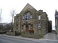
 Birds Edge Wesleyan Reform Church - geograph.org.uk - 2753163.jpg 1,024 × 768; 129 KB
-
 Birdsedge School - geograph.org.uk - 4193855.jpg 640 × 480; 74 KB
-
 Birk House Farm - geograph.org.uk - 3213563.jpg 2,048 × 1,536; 557 KB
-
 Birk House Farm cottages - geograph.org.uk - 2759821.jpg 1,024 × 768; 110 KB
-
 Birk House Lane - geograph.org.uk - 2759811.jpg 1,024 × 768; 98 KB
-
 Black sheep grazing, Pog Hall Farm - geograph.org.uk - 4193846.jpg 640 × 480; 71 KB
-
 Blackberry hedgerow, Pool Hill Lane - geograph.org.uk - 2621894.jpg 1,024 × 768; 216 KB
-
 Blackthorn Way - Holly Road - geograph.org.uk - 5341014.jpg 640 × 462; 58 KB
-
 Blenheim Chase - Barnsley Road - geograph.org.uk - 5340780.jpg 640 × 463; 66 KB
-
 Blocked field entrance, off Woodhouse Lane - geograph.org.uk - 2249893.jpg 1,024 × 768; 199 KB
-
 Blocked Public Footpath - geograph.org.uk - 3052105.jpg 1,024 × 768; 305 KB
-
 Bluebells in Deffer Wood - geograph.org.uk - 1295298.jpg 480 × 640; 163 KB
-
 Boundary wall, White House, Lower Denby - geograph.org.uk - 2622107.jpg 1,024 × 768; 186 KB
-
 Bowling Green - geograph.org.uk - 980250.jpg 640 × 480; 80 KB
-
 Breakfast at Manor House Farm - geograph.org.uk - 1132256.jpg 640 × 351; 53 KB
-

-
 Bridge and stile at Clough Dike - geograph.org.uk - 2902387.jpg 3,072 × 2,304; 1.63 MB
-
 Bridge Close - Wakefield Road - geograph.org.uk - 5341007.jpg 640 × 480; 92 KB
-
 Bridge on Langley Lane - geograph.org.uk - 5671743.jpg 1,024 × 768; 290 KB
-
 Bridge over the Dearne - geograph.org.uk - 4375261.jpg 3,240 × 4,320; 4.11 MB
-
 Bridge over the miniature railway - geograph.org.uk - 2576357.jpg 1,024 × 768; 173 KB
-
 Bridge warning on Lower Denby Lane - geograph.org.uk - 5647332.jpg 1,024 × 768; 145 KB
-
 Bridleway - Langley Lane - geograph.org.uk - 5286311.jpg 640 × 480; 60 KB
-
 Bridleway from Frank Lane to Kiln Lane - geograph.org.uk - 5671771.jpg 1,024 × 768; 379 KB
-
 Bridleway junction - geograph.org.uk - 4691230.jpg 1,024 × 768; 205 KB
-
 Broadstone Lodge from Horn Lane - geograph.org.uk - 2754257.jpg 640 × 480; 73 KB
-
 Brook Meadows, Denby Dale - geograph.org.uk - 4473752.jpg 2,448 × 1,624; 1,008 KB
-
 Broomfield Close - Beaumont Street - geograph.org.uk - 5085931.jpg 640 × 480; 72 KB
-
 Broomfield Lane - geograph.org.uk - 5672581.jpg 1,024 × 768; 163 KB
-
 Broomhey Avenue - Upper Lane - geograph.org.uk - 5086171.jpg 640 × 480; 67 KB
-
 Brow Lane - geograph.org.uk - 2947646.jpg 3,072 × 2,304; 1.49 MB
-
 Brow Lane descending towards Denby Hall Farm - geograph.org.uk - 2621864.jpg 1,024 × 768; 191 KB
-
 Brow Lane, northern end - geograph.org.uk - 2621884.jpg 1,024 × 768; 204 KB
-
 Building - Radcliffe Street - geograph.org.uk - 1885372.jpg 640 × 480; 76 KB
-
 Bulrushes lining the duck pond - geograph.org.uk - 2576368.jpg 1,024 × 768; 199 KB
-
 Bungalow on Cumberworth Lane - geograph.org.uk - 5143670.jpg 1,600 × 1,065; 1.22 MB
-
 Bungalow on Cumberworth Lane - geograph.org.uk - 5143674.jpg 1,600 × 1,065; 859 KB
-
 Bus shelter opposite Stringer House Lane - geograph.org.uk - 5672554.jpg 1,024 × 768; 156 KB
-

-

-
 Businesses on Wakefield Road, Denby Dale - geograph.org.uk - 4473954.jpg 2,448 × 1,624; 1.72 MB
-
 Busker Lane - geograph.org.uk - 4204965.jpg 640 × 480; 122 KB
-

-
 Butchers - Commercial Road - geograph.org.uk - 1885384.jpg 562 × 640; 85 KB
-
 By Tyburn Lane, Emley - geograph.org.uk - 4707985.jpg 5,184 × 3,888; 5.13 MB
-
 Carr Hill Road, looking east - geograph.org.uk - 2753139.jpg 1,024 × 768; 102 KB
-
 Carr Hill Road, looking west - geograph.org.uk - 2753134.jpg 986 × 740; 448 KB
-
 Carr Mount from Carr Hill Road - geograph.org.uk - 2753143.jpg 1,024 × 768; 120 KB
-
-
 Cattle at White Cross Farm - geograph.org.uk - 4707972.jpg 4,804 × 3,603; 4.21 MB
-
 Cattle grazing near a wind turbine - geograph.org.uk - 2624819.jpg 1,024 × 768; 103 KB
-
 Cattle outside their winter quarters - geograph.org.uk - 2753016.jpg 1,024 × 768; 117 KB
-
 Cemetery - geograph.org.uk - 1885877.jpg 480 × 640; 106 KB
-
 Cemetery - geograph.org.uk - 1885884.jpg 640 × 480; 85 KB
-
 Cereal crop, Taylor Hill - geograph.org.uk - 2493063.jpg 1,024 × 768; 224 KB
-
 Chapel Close - Commercial Road - geograph.org.uk - 5310910.jpg 640 × 480; 90 KB
-

-

-

-
 Chapel Lane on a sunny Sunday morning - geograph.org.uk - 2490475.jpg 1,024 × 768; 113 KB
-
 Chapel Royd - Church Street - geograph.org.uk - 5086029.jpg 640 × 480; 61 KB
-
 Checking for speeding at Kithchenroyd phone box - geograph.org.uk - 2624833.jpg 1,024 × 768; 199 KB
-

-
 Children's playground, Emley - geograph.org.uk - 3314101.jpg 1,024 × 768; 171 KB
-
 Church Lane - Scott Hill - geograph.org.uk - 5286350.jpg 640 × 480; 83 KB
-
-
 Church Lane, Clayton West - geograph.org.uk - 2576319.jpg 1,024 × 768; 143 KB
-
 Church on Barnsley Road (A635) - geograph.org.uk - 4864254.jpg 640 × 480; 70 KB
-
 Church Street - Upper Lane - geograph.org.uk - 5085918.jpg 640 × 480; 70 KB
-
-
-
 Churchfield, Denby Dale - geograph.org.uk - 2625571.jpg 2,000 × 1,500; 1.06 MB
-
 Clapper bridge at Denby Dale - geograph.org.uk - 3662792.jpg 3,525 × 2,644; 1.94 MB
-
 Clayton Village Stores - Scott Hill - geograph.org.uk - 5286351.jpg 640 × 480; 75 KB
-
 Clayton West packhorse bridge - geograph.org.uk - 4199020.jpg 809 × 1,024; 319 KB
-
 Cliffe Street - Church Lane - geograph.org.uk - 5286456.jpg 640 × 480; 60 KB
-

-
 Cliffe View - Cliffe Street - geograph.org.uk - 5340739.jpg 640 × 480; 84 KB
-
 Cliffewood Rise - Dukewood Road - geograph.org.uk - 5340746.jpg 640 × 480; 64 KB
-
 Clifton View - High Street - geograph.org.uk - 5340727.jpg 640 × 480; 69 KB
-
-

-
 Closer view of outbuilding at Emley Lodge - geograph.org.uk - 2754705.jpg 1,600 × 1,200; 519 KB
-
 Clough House Lane - geograph.org.uk - 2810998.jpg 3,072 × 2,304; 1.36 MB
-

-
 Common Lane at Cross Roads - geograph.org.uk - 5312030.jpg 640 × 480; 50 KB
-
 Conservation land near Lowhouse Farm - geograph.org.uk - 2442320.jpg 640 × 480; 136 KB
-
 Contrasting house styles, Lower Cumberworth - geograph.org.uk - 2752974.jpg 1,024 × 768; 129 KB
-
 Converted barn at Low House Farm - geograph.org.uk - 4090277.jpg 1,600 × 1,200; 581 KB
-
 Converted Mill - geograph.org.uk - 980192.jpg 640 × 480; 64 KB
-
 Cottages at Hillside Farm, Clayton West - geograph.org.uk - 4708140.jpg 5,042 × 3,665; 5.92 MB
-
 Countryside east of Emley - geograph.org.uk - 4707969.jpg 5,121 × 3,693; 5.31 MB
-
 Crawshaw Lane - geograph.org.uk - 2916148.jpg 3,072 × 2,304; 1.12 MB
-
 Crawshaw Lane towards Six Lanes End - geograph.org.uk - 2916155.jpg 3,072 × 2,304; 1.11 MB
-
 Cricket ground, Emley - geograph.org.uk - 3314107.jpg 1,024 × 768; 118 KB
-
 Cricket ground, Lower Cumberworth - geograph.org.uk - 3314117.jpg 1,024 × 768; 105 KB
-
 Cricket Match at Lower Cumberworth - geograph.org.uk - 4638092.jpg 4,000 × 3,000; 1.77 MB
-
 Cricket Pavilion at Lower Cumberworth - geograph.org.uk - 4472427.jpg 2,448 × 1,624; 1.08 MB
-
 Cricket Pavilion at Lower Cumberworth - geograph.org.uk - 4472432.jpg 2,448 × 1,624; 1.57 MB
-
 Cricket pavilion weather vane - geograph.org.uk - 4472446.jpg 689 × 712; 122 KB
-
 Croft Head - Dale Street - geograph.org.uk - 5345345.jpg 640 × 480; 93 KB
-
 Croft Head - Savile Road - geograph.org.uk - 5345348.jpg 640 × 480; 76 KB
-
 Croft Head, Skelmanthorpe - geograph.org.uk - 4376124.jpg 2,703 × 1,706; 947 KB
-
 Croft House Bakery - Commercial Road - geograph.org.uk - 1885166.jpg 480 × 640; 64 KB
-
 Cross Lane - viewed from Smithy Lane - geograph.org.uk - 5310821.jpg 640 × 480; 70 KB
-
 Cross-field path, west of Lower Cumberworth - geograph.org.uk - 3314137.jpg 1,024 × 768; 167 KB
-
 Crossed wires - geograph.org.uk - 5671781.jpg 1,024 × 768; 180 KB
-
 Crossing Little Dike - geograph.org.uk - 3052115.jpg 1,024 × 768; 305 KB
-
 Cuckstool Road Denby Dale - geograph.org.uk - 980248.jpg 480 × 640; 101 KB
-
 Cumberworth Common from the air - geograph.org.uk - 5954767.jpg 1,024 × 768; 285 KB
-
 Cumberworth Lane - geograph.org.uk - 2753062.jpg 1,024 × 768; 100 KB
-
 Cumberworth Lane - geograph.org.uk - 4193865.jpg 640 × 480; 54 KB


,_Wakefield_Road,_Scissett,_Denby_Dale,_Near_Huddersfield_-_3_-_geograph.org.uk_-_3645042.jpg)


_-_geograph.org.uk_-_4864215.jpg)
_-_geograph.org.uk_-_4864268.jpg)

_near_Cawthorne_-_geograph.org.uk_-_4234939.jpg)


_-_geograph.org.uk_-_4864271.jpg)


_-_geograph.org.uk_-_4864254.jpg)


