Category:Denford
Jump to navigation
Jump to search
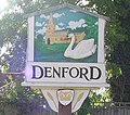
English: Denford is a small village and civil parish situated in East Northamptonshire, England. At the time of the 2001 census, the parish population was 250 people.
village and civil parish in East Northamptonshire, England in United Kingdom .jpg)  | |||||
| Upload media | |||||
| Instance of | |||||
|---|---|---|---|---|---|
| Location | North Northamptonshire, Northamptonshire, East Midlands, England | ||||
 | |||||
Subcategories
This category has the following 3 subcategories, out of 3 total.
H
- Holy Trinity Church, Denford (2 F)
I
- The Inn at Denford (2 F)
Media in category "Denford"
The following 54 files are in this category, out of 54 total.
-
 A14 near Thrapston - geograph.org.uk - 3819732.jpg 640 × 480; 272 KB
-
 A45 heading south - geograph.org.uk - 2995791.jpg 640 × 480; 56 KB
-
 A45 near Denford - geograph.org.uk - 4577851.jpg 4,608 × 3,456; 2.64 MB
-
 A45 southbound - geograph.org.uk - 5366752.jpg 640 × 480; 36 KB
-
 A45 southbound - geograph.org.uk - 5366754.jpg 640 × 480; 29 KB
-
 A45 southbound - geograph.org.uk - 5366761.jpg 640 × 480; 32 KB
-
 Bridleway along a dismantled railway - geograph.org.uk - 130464.jpg 640 × 480; 60 KB
-

-
 Crop field near Denford - geograph.org.uk - 2995738.jpg 640 × 480; 89 KB
-
 Crop field near Thrapston - geograph.org.uk - 2995807.jpg 640 × 480; 72 KB
-
 Denford Ash Water Tower - geograph.org.uk - 129907.jpg 480 × 640; 74 KB
-
 Denford Garage - geograph.org.uk - 2995740.jpg 640 × 480; 71 KB
-
 Denford Lock on the River Nene - geograph.org.uk - 1381821.jpg 640 × 480; 59 KB
-

-
 Denford view near river.jpg 3,264 × 2,448; 2.97 MB
-
 Denford water Tower.jpg 1,920 × 2,640; 2.58 MB
-
 Denford, Holy Trinity - geograph.org.uk - 6364906.jpg 3,456 × 4,608; 5.2 MB
-
 Eastbound A14 near Thrapston - geograph.org.uk - 3819740.jpg 640 × 480; 255 KB
-
 Farmland near Denford - geograph.org.uk - 2995785.jpg 640 × 480; 78 KB
-
 Farmland near Denford North Lodge - geograph.org.uk - 2995798.jpg 640 × 480; 76 KB
-
 Footpath from Raunds to Denford Ash - geograph.org.uk - 129911.jpg 640 × 480; 73 KB
-
 Footpath to Denford (geograph 4299924).jpg 640 × 480; 58 KB
-
 Footpath to Denford Ash - geograph.org.uk - 129898.jpg 640 × 480; 100 KB
-
 Footpath to Ringstead - geograph.org.uk - 2995734.jpg 640 × 480; 76 KB
-
 Footpath to Ringstead from Raunds - geograph.org.uk - 143546.jpg 640 × 480; 91 KB
-
 Grazing by the River Nene, Denford - geograph.org.uk - 2995753.jpg 640 × 480; 56 KB
-
 Green Lane near Denford Ash - geograph.org.uk - 373569.jpg 640 × 480; 102 KB
-
 Green Lane with Blackthorn blossom - geograph.org.uk - 373574.jpg 640 × 480; 110 KB
-
 Hedgerow near Thrapston - geograph.org.uk - 2995804.jpg 640 × 480; 94 KB
-
 Holy Trinity, Denford - geograph.org.uk - 4482650.jpg 1,024 × 704; 244 KB
-
 Lane heading east towards the A14 - geograph.org.uk - 2995788.jpg 640 × 480; 59 KB
-
 Layby on the A45, Thrapston - geograph.org.uk - 6212930.jpg 1,858 × 1,180; 1.24 MB
-

-
 River Nene - geograph.org.uk - 4299904.jpg 640 × 480; 46 KB
-
 River Nene - geograph.org.uk - 4516534.jpg 480 × 640; 106 KB
-
 River Nene approaching Denford - geograph.org.uk - 130456.jpg 640 × 480; 86 KB
-
 River Nene north of Denford - geograph.org.uk - 130469.jpg 640 × 480; 67 KB
-
 River Nene north of Denford - geograph.org.uk - 2995756.jpg 640 × 480; 79 KB
-
 River Nene, Denford - geograph.org.uk - 2995751.jpg 640 × 480; 84 KB
-

-
 The Cock pub, Denford - geograph.org.uk - 4514227.jpg 4,320 × 3,240; 4.75 MB
-
 Top Lodge - geograph.org.uk - 2995810.jpg 640 × 480; 52 KB
-
 Track to Denford North Lodge - geograph.org.uk - 2995796.jpg 640 × 480; 59 KB
-
 Triangulation Pillar near Denford Ash - geograph.org.uk - 2341738.jpg 640 × 480; 151 KB
-
 UK Denford-2.jpg 836 × 741; 412 KB
-
 UK Denford.jpg 836 × 1,747; 330 KB
-
 Water Tower near Briggs Lodge Farm - geograph.org.uk - 2341744.jpg 640 × 480; 91 KB
-
 Westbound A14 approaching Junction 12 - geograph.org.uk - 3819745.jpg 640 × 480; 246 KB
-
 Woodford Lock - geograph.org.uk - 2059159.jpg 640 × 480; 84 KB
-
 A quiet Backwater^ - geograph.org.uk - 356539.jpg 480 × 640; 87 KB
-
 Bridleway from Keyston to Denford - geograph.org.uk - 129901.jpg 640 × 480; 90 KB
-
 Farm Road at Ringstead - geograph.org.uk - 143548.jpg 640 × 480; 69 KB
-
 Field-edge Footpath - geograph.org.uk - 129880.jpg 640 × 476; 70 KB
-
 Over the A 14 - geograph.org.uk - 378193.jpg 640 × 480; 107 KB


