Category:Dereham
Jump to navigation
Jump to search
English: Dereham, also known historically as East Dereham, is a town and civil parish in the English county of Norfolk. It is situated on the A47 road, some 15 miles (25 km) west of the city of Norwich and 25 miles (40 km) east of King's Lynn. The civil parish has an area of and in the 2001 census had a population of 15,659 in 6,941 households. For the purposes of local government, Dereham falls within, and is the centre of administration for, the district of Breckland.
Italiano: Dereham, nota storicamente anche come East Dereham, è un paese di 15.659 abitanti della contea del Norfolk, in Inghilterra.
Polski: Dereham - miasto w Wielkiej Brytanii, w Anglii, w regionie East of England, w hrabstwie Norfolk. W 2001r. miasto to zamieszkiwało 15 659 osób.
Română: Dereham sau East Dereham este un oraş în comitatul Norfolk, regiunea East, Anglia. Oraşul se află în districtul Breckland a cărui reşedinţă este.
town in Norfolk, England  La place du marché | |||||
| Upload media | |||||
| Instance of | |||||
|---|---|---|---|---|---|
| Location | Breckland, Norfolk, East of England, England | ||||
| Population |
| ||||
| Area |
| ||||
| Said to be the same as | Dereham (Wikimedia duplicated page, civil parish) | ||||
| official website | |||||
 | |||||
Subcategories
This category has the following 12 subcategories, out of 12 total.
Media in category "Dereham"
The following 200 files are in this category, out of 405 total.
(previous page) (next page)-
 A field of beet - geograph.org.uk - 4370370.jpg 640 × 426; 75 KB
-

-
 A1075, Shipdham Road, Toftwood - geograph.org.uk - 6110010.jpg 3,456 × 2,592; 3.79 MB
-
 A47 Eastbound near Etling Green - geograph.org.uk - 4725744.jpg 640 × 427; 355 KB
-
 A47 Entering East Dereham - geograph.org.uk - 4724503.jpg 640 × 480; 356 KB
-
 A47 Flyover at Scarning - geograph.org.uk - 463605.jpg 640 × 480; 55 KB
-
 A47 Westbound - geograph.org.uk - 4725807.jpg 640 × 480; 410 KB
-
 A47 Westbound near East Dereham - geograph.org.uk - 4724513.jpg 640 × 480; 389 KB
-
 A47 Westbound near to Dereham - geograph.org.uk - 4725849.jpg 640 × 480; 331 KB
-
 A47, Dereham Bypass - geograph.org.uk - 4364727.jpg 640 × 426; 62 KB
-
 A47, Dereham Bypass - geograph.org.uk - 4364729.jpg 640 × 426; 62 KB
-
 Allotments In East Dereham - geograph.org.uk - 275718.jpg 640 × 480; 100 KB
-
 An old course of the B1147 - geograph.org.uk - 4373079.jpg 640 × 426; 116 KB
-

-
 B1146 near Dereham Golf Club - geograph.org.uk - 5013936.jpg 2,024 × 1,346; 1.4 MB
-
 B1147 - geograph.org.uk - 4365463.jpg 640 × 426; 66 KB
-
 B1147 - geograph.org.uk - 4370319.jpg 640 × 426; 66 KB
-
 B1147 - geograph.org.uk - 4370362.jpg 640 × 426; 73 KB
-
 B1147 - geograph.org.uk - 4370368.jpg 640 × 426; 62 KB
-
 B1147 - geograph.org.uk - 4370375.jpg 640 × 426; 100 KB
-
 B1147 - geograph.org.uk - 4370421.jpg 640 × 426; 70 KB
-
 B1147 - geograph.org.uk - 4370426.jpg 640 × 426; 79 KB
-
 B1147, Elsing Lane junction - geograph.org.uk - 4370326.jpg 640 × 426; 93 KB
-
 B1147, Etling Green - geograph.org.uk - 4365492.jpg 640 × 426; 64 KB
-
 B1147, Mowles Rd junction - geograph.org.uk - 4373089.jpg 640 × 426; 77 KB
-
 B1147, Norwich Rd - geograph.org.uk - 4365466.jpg 640 × 426; 69 KB
-
 Back Lane, (path) east of Dereham - geograph.org.uk - 6682271.jpg 5,184 × 2,912; 5.46 MB
-

-
 Barn by Mattishall Rd - geograph.org.uk - 4361479.jpg 640 × 368; 56 KB
-
 Beech House, Dereham - geograph.org.uk - 3396813.jpg 640 × 397; 177 KB
-
 Bend, Mattishall Rd - geograph.org.uk - 4359040.jpg 640 × 426; 65 KB
-
 Bend, Mattishall Rd - geograph.org.uk - 4361461.jpg 640 × 426; 97 KB
-
 Black soil - geograph.org.uk - 4361459.jpg 640 × 426; 79 KB
-
 Boarded up house, Dereham - geograph.org.uk - 4954637.jpg 1,600 × 1,200; 759 KB
-

-

-

-

-
 Bridge 1692 over the line - geograph.org.uk - 1766757.jpg 800 × 531; 152 KB
-

-
 Bridge over A47 at Dereham - geograph.org.uk - 4725728.jpg 640 × 480; 359 KB
-
 Bridge over MNR - geograph.org.uk - 5097883.jpg 640 × 480; 105 KB
-

-

-
 Broadway Farm from The Broadway - geograph.org.uk - 527097.jpg 640 × 425; 97 KB
-
 Bungalows on Shipdham Road, Toftwood - geograph.org.uk - 6546763.jpg 1,916 × 1,272; 1.54 MB
-
 Bungalows on Shipdham Road, Toftwood - geograph.org.uk - 6546767.jpg 1,920 × 1,280; 1.38 MB
-
 By Mattishall Rd - geograph.org.uk - 4361473.jpg 640 × 426; 87 KB
-
 By Mattishall Rd - geograph.org.uk - 4361481.jpg 640 × 426; 84 KB
-

-
 Cereal field on the southern edge of Dereham - geograph.org.uk - 5823995.jpg 1,024 × 768; 154 KB
-
 Chaffinch searching out a tidbit - geograph.org.uk - 6028917.jpg 3,264 × 2,448; 1.58 MB
-

-

-
 Class 33 hauled train on the Mid-Norfolk Railway.jpg 3,237 × 2,377; 1.62 MB
-
 Class 55 55022 near Dereham.jpg 2,592 × 1,952; 1.19 MB
-
 Cleared area, Dereham - geograph.org.uk - 4948799.jpg 1,600 × 1,200; 759 KB
-
 Completed Maltings - geograph.org.uk - 1955901.jpg 800 × 531; 130 KB
-
 Completed Maltings - geograph.org.uk - 1956007.jpg 800 × 531; 117 KB
-
 Coppicing on Elsing Lane - geograph.org.uk - 4370334.jpg 640 × 426; 142 KB
-
 Cottesmore House - geograph.org.uk - 357044.jpg 640 × 480; 102 KB
-
 Council Depot, Dereham - geograph.org.uk - 2878057.jpg 3,888 × 2,592; 2.99 MB
-
 Crisps Maltings Dereham - geograph.org.uk - 1766834.jpg 800 × 531; 95 KB
-
 Crisps Maltings Dereham - geograph.org.uk - 1766839.jpg 800 × 531; 130 KB
-

-
 Dereham - "The Bull" public house (geograph 7572859).jpg 3,000 × 4,000; 2.92 MB
-
 Dereham - Becclesgate - geograph.org.uk - 5228135.jpg 4,608 × 3,456; 5.76 MB
-
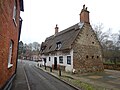 Dereham - Bishop Bonner's Cottage Museum - geograph.org.uk - 5228133.jpg 4,608 × 3,456; 6.64 MB
-
 Dereham - Canterbury House (geograph 7575216).jpg 1,600 × 988; 370 KB
-
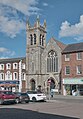 Dereham - Cowper Congregational Church (geograph 7575206).jpg 1,962 × 2,823; 3.19 MB
-
 Dereham - Old House next to Church - geograph.org.uk - 5227465.jpg 4,608 × 3,456; 6.66 MB
-
 Dereham Allotment Gardens - geograph.org.uk - 5470335.jpg 640 × 444; 145 KB
-
 Dereham Allotments - geograph.org.uk - 296666.jpg 640 × 480; 100 KB
-
 Dereham Allotments - geograph.org.uk - 3641465.jpg 640 × 424; 284 KB
-
 Dereham Banner.jpg 3,637 × 520; 435 KB
-
 Dereham Baptist Church (geograph 7572850).jpg 2,549 × 3,203; 1.31 MB
-
 Dereham Baptist Church - geograph.org.uk - 2983271.jpg 1,024 × 768; 128 KB
-
 Dereham Bell Tower - geograph.org.uk - 2685688.jpg 856 × 1,280; 149 KB
-
 Dereham entrance sign - geograph.org.uk - 2282615.jpg 640 × 484; 88 KB
-
 Dereham fire station - geograph.org.uk - 1394957.jpg 640 × 426; 185 KB
-
 Dereham Maltings - geograph.org.uk - 1035659.jpg 640 × 480; 77 KB
-
 Dereham Maltings - geograph.org.uk - 1204622.jpg 640 × 480; 97 KB
-
 Dereham market place.JPG 3,642 × 2,730; 1.4 MB
-
 Dereham south, aerial 2015 - geograph.org.uk - 4666505.jpg 640 × 427; 71 KB
-
 Dereham south, aerial 2017 - geograph.org.uk - 5522047.jpg 800 × 533; 92 KB
-
 Dereham Town FC - geograph.org.uk - 2337634.jpg 2,560 × 1,920; 1.64 MB
-
 Dereham Town FC - geograph.org.uk - 2337644.jpg 2,560 × 1,920; 1.58 MB
-
 Dereham Town FC - geograph.org.uk - 4365433.jpg 640 × 426; 61 KB
-
 Dereham Town FC - geograph.org.uk - 4365436.jpg 640 × 426; 64 KB
-
 Dereham Town FC - geograph.org.uk - 4365439.jpg 640 × 426; 70 KB
-
 Dereham Town FC - geograph.org.uk - 4365441.jpg 640 × 426; 144 KB
-
 Dereham Town FC - geograph.org.uk - 4365442.jpg 640 × 426; 133 KB
-
 Dereham water tower, aerial 2017 (2) - geograph.org.uk - 5522162.jpg 800 × 533; 121 KB
-
 Dereham water tower, aerial 2017 - geograph.org.uk - 5522157.jpg 800 × 599; 122 KB
-
 Dereham World War One War Memorial on the chancel screen - geograph.org.uk - 6296948.jpg 3,008 × 2,000; 4.89 MB
-

-

-
 Dillington Hall - a grand house - geograph.org.uk - 522817.jpg 640 × 480; 143 KB
-

-
 Door inside a farm shed, East Dereham - geograph.org.uk - 2344314.jpg 640 × 480; 157 KB
-
 Driver's view MNR - geograph.org.uk - 5097859.jpg 640 × 480; 69 KB
-
 Duck Pond - geograph.org.uk - 1324256.jpg 640 × 480; 57 KB
-
 Dumpling Green, East Dereham - geograph.org.uk - 4279215.jpg 640 × 480; 138 KB
-
 Dumpling Green, East Dereham - geograph.org.uk - 4279216.jpg 640 × 480; 121 KB
-
 East Dereham - Bishop Bonner's Cottage Museum - geograph.org.uk - 3752248.jpg 1,024 × 768; 157 KB
-
 East Dereham Congregational church - geograph.org.uk - 4615775.jpg 480 × 640; 80 KB
-
 East Dereham, The Old Maltings - geograph.org.uk - 4281418.jpg 800 × 522; 158 KB
-
 East Dereham, UK.jpg 4,160 × 2,340; 1.08 MB
-
 East Derehammap 1946.png 1,073 × 909; 2.13 MB
-

-

-
 Elsing Lane - geograph.org.uk - 4370327.jpg 640 × 426; 107 KB
-
 Elsing Lane - geograph.org.uk - 4370331.jpg 640 × 426; 101 KB
-
 Elsing Lane - geograph.org.uk - 4370332.jpg 640 × 426; 87 KB
-
 Elsing Lane - geograph.org.uk - 4370341.jpg 640 × 426; 96 KB
-
 Elsing Lane - geograph.org.uk - 4370359.jpg 640 × 426; 82 KB
-

-

-
 Entrance to QD store, East Dereham - geograph.org.uk - 2983265.jpg 768 × 1,024; 134 KB
-
 Etling Green - geograph.org.uk - 4365480.jpg 640 × 426; 58 KB
-
 Etling Green - geograph.org.uk - 4365484.jpg 640 × 426; 73 KB
-
 Etling Green - geograph.org.uk - 4365504.jpg 640 × 426; 107 KB
-
 Etling Green - geograph.org.uk - 4365507.jpg 640 × 426; 71 KB
-
 Etling Green - geograph.org.uk - 4365510.jpg 640 × 426; 76 KB
-
 Etling Green - geograph.org.uk - 4365511.jpg 640 × 426; 70 KB
-
 Etling Green - geograph.org.uk - 4365515.jpg 640 × 426; 123 KB
-
 Etling View - geograph.org.uk - 4365423.jpg 640 × 426; 59 KB
-
 Etling View - geograph.org.uk - 4365428.jpg 640 × 426; 62 KB
-
 Etling View - geograph.org.uk - 4365430.jpg 640 × 426; 60 KB
-
 Eye Candy - geograph.org.uk - 2685651.jpg 1,280 × 856; 135 KB
-
 Farm shed doors, East Dereham - geograph.org.uk - 2344293.jpg 640 × 517; 271 KB
-
 Farm sheds, East Dereham - geograph.org.uk - 2344284.jpg 640 × 480; 196 KB
-
 Farm sheds, East Dereham - geograph.org.uk - 2344287.jpg 640 × 480; 204 KB
-
 Farm Track - geograph.org.uk - 1272275.jpg 640 × 480; 127 KB
-

-

-
 Farming scene - geograph.org.uk - 4370325.jpg 640 × 394; 63 KB
-
 Farmland by Mattishall Rd - geograph.org.uk - 4361458.jpg 640 × 426; 69 KB
-
 Farmland by Norwich Rd - geograph.org.uk - 4365450.jpg 640 × 426; 84 KB
-
 Farmland in Early Morning Mist - geograph.org.uk - 304739.jpg 640 × 427; 65 KB
-

-
 Field between the B1147 and A47 - geograph.org.uk - 4370414.jpg 640 × 426; 66 KB
-
 Field boundary - geograph.org.uk - 4361453.jpg 640 × 426; 62 KB
-
 Field boundary - geograph.org.uk - 4361456.jpg 640 × 426; 62 KB
-
 Field Boundary - geograph.org.uk - 4361463.jpg 640 × 426; 78 KB
-
 Field by Mattishall Rd - geograph.org.uk - 4359032.jpg 640 × 426; 58 KB
-
 Field by Mattishall Rd - geograph.org.uk - 4361450.jpg 640 × 382; 46 KB
-
 Field by Mattishall Rd - geograph.org.uk - 4361480.jpg 640 × 426; 49 KB
-
 Field by Swanton Road - geograph.org.uk - 4954650.jpg 1,600 × 1,200; 610 KB
-
 Field south of Dereham - geograph.org.uk - 4954360.jpg 1,600 × 1,146; 550 KB
-
 Fields beside the B1147 (Tuddenham Road) - geograph.org.uk - 4275050.jpg 640 × 480; 186 KB
-
 Fields Near Yaxham - geograph.org.uk - 5470357.jpg 640 × 444; 87 KB
-
 Fields south of Toftwood - geograph.org.uk - 2368897.jpg 3,888 × 2,592; 3.37 MB
-
 Five wind turbines, Etling Green - geograph.org.uk - 4370321.jpg 640 × 426; 76 KB
-

-
 Flytip in a layby, there are some ignorant pigs about - geograph.org.uk - 6028939.jpg 3,264 × 2,448; 1.8 MB
-
 Footbridge in hedgerow - geograph.org.uk - 1041472.jpg 480 × 640; 187 KB
-
-
 Footpath off Mattishall Rd - geograph.org.uk - 4361451.jpg 640 × 426; 90 KB
-
 Footpath off Norwich Rd - geograph.org.uk - 4365473.jpg 640 × 426; 119 KB
-
 Footpath sign, Mattishall Rd - geograph.org.uk - 4361483.jpg 640 × 426; 76 KB
-
 For All Your Steel Needs - geograph.org.uk - 5470350.jpg 640 × 437; 108 KB
-
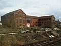
 Former Maltings - geograph.org.uk - 2893246.jpg 1,024 × 623; 574 KB
-
 Foxbow from Swanton Road - geograph.org.uk - 4954721.jpg 1,600 × 1,200; 794 KB
-

-
 Foxley Wood - geograph.org.uk - 1041745.jpg 640 × 480; 116 KB
-
 Foxley Wood - geograph.org.uk - 969221.jpg 640 × 480; 107 KB
-
 French Prisoner Of War Grave - geograph.org.uk - 3794988.jpg 683 × 1,024; 254 KB
-
-
 Gates into fields, Elsing Lane - geograph.org.uk - 4370335.jpg 640 × 426; 66 KB
-
 Gooch's Cottages in Tuddenham Road - geograph.org.uk - 4275049.jpg 640 × 480; 215 KB
-
 Grange Farmhouse - geograph.org.uk - 4365471.jpg 640 × 426; 86 KB
-
 Grassy field near Hill Farm - geograph.org.uk - 4370376.jpg 640 × 426; 60 KB
-
 Green field by Mattishall Rd - geograph.org.uk - 4359028.jpg 640 × 426; 44 KB
-

-

-

-

-

-

-
 Greens Road Industrial Estate, Dereham - geograph.org.uk - 2878048.jpg 3,888 × 2,592; 2.89 MB
-
 Greens Road, Dereham - geograph.org.uk - 5817869.jpg 1,024 × 768; 141 KB
-
 Halfords, East Dereham - geograph.org.uk - 2185058.jpg 3,504 × 2,336; 2 MB
-

-
 Headstone of a Zeppelin victim at Dereham - geograph.org.uk - 5629654.jpg 2,592 × 3,456; 3.22 MB
-
 Heron Mead - geograph.org.uk - 4361457.jpg 640 × 426; 78 KB
-
 High School and Cemetery Road - geograph.org.uk - 3671134.jpg 1,600 × 1,200; 427 KB
-
 Hill Farm - geograph.org.uk - 4370413.jpg 640 × 426; 85 KB
-
 Hill Farm - geograph.org.uk - 4370416.jpg 640 × 426; 67 KB
-
 Hill Farm - geograph.org.uk - 4370417.jpg 640 × 426; 76 KB
-
 Hill House Hotel.jpg 640 × 416; 45 KB
-
 Historic Building in Cowper Street - geograph.org.uk - 2893276.jpg 1,024 × 654; 527 KB
-
 Hoe Road South, Elsing - geograph.org.uk - 4279249.jpg 640 × 480; 147 KB
-
 Hoe Road South, Elsing - geograph.org.uk - 4279253.jpg 640 × 480; 121 KB
-
 Hollies Farm - geograph.org.uk - 4361468.jpg 640 × 426; 92 KB
-
 House on Mattishall Rd - geograph.org.uk - 4364717.jpg 640 × 426; 68 KB
-

-

-
 Houses next to the churchyard - geograph.org.uk - 1084726.jpg 640 × 426; 95 KB
-
 Houses on Shipdham Road, Dereham - geograph.org.uk - 6546770.jpg 1,872 × 1,204; 1.35 MB

_With_6_plates_and_88_text-figures_(1909)_(14755589675).jpg)


_east_of_Dereham_-_geograph.org.uk_-_6682271.jpg)


_-_geograph.org.uk_-_2344262.jpg)


.jpg)


.jpg)
.jpg)


.jpg)


_-_geograph.org.uk_-_5522162.jpg)


_-_geograph.org.uk_-_4281407.jpg)


_-_geograph.org.uk_-_4275050.jpg)


_(14597416707).jpg)


