Category:Devil's Elbow, Linlithgow
Jump to navigation
Jump to search
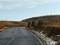
The Devil's Elbow is an acute bend in the roads between Linlithgow and Beecraigs Country Park.
Subcategories
This category has only the following subcategory.
T
- Trough Stane, Devil's Elbow (2 F)
Media in category "Devil's Elbow, Linlithgow"
The following 7 files are in this category, out of 7 total.
-
 Devil's Elbow, Linlithgow - geograph.org.uk - 1147822.jpg 640 × 480; 67 KB
-
 Devil's Elbow, Linlithgow - geograph.org.uk - 1147831.jpg 640 × 480; 108 KB
-
 Devil's Elbow, Linlithgow - geograph.org.uk - 1147846.jpg 640 × 480; 68 KB
-
 Minor road near Linlithgow - geograph.org.uk - 1214462.jpg 640 × 428; 44 KB
-

-

-
 Shortcut, Linlithgow - geograph.org.uk - 1147839.jpg 640 × 480; 84 KB


