Category:Dictionnaire géographique et administratif universel d'Haïti (1892) by ROUZIER
Jump to navigation
Jump to search
English: Dictionnaire géographique et administratif universel d'Haïti illustré ... ou guide général en Haïti. By ROUZIER (1892)
| This category includes images from a book scanned for the British Library Mechanical Curator collection.
The full set of images from the book is available on Flickr. |
1892 edition of book by S. Rouzier | |||||
| Upload media | |||||
| Instance of |
| ||||
|---|---|---|---|---|---|
| Author |
| ||||
| Place of publication |
| ||||
| Distribution format |
| ||||
| Full work available at URL | |||||
| Collection | |||||
| Publication date |
| ||||
| |||||
Media in category "Dictionnaire géographique et administratif universel d'Haïti (1892) by ROUZIER"
The following 57 files are in this category, out of 57 total.
-
 ROUZIER1892GuideGenerale HAITI.png 486 × 730; 264 KB
-

-

-
 Carte de ville Santo Domingo (1888).jpg 1,639 × 1,381; 1.02 MB
-
 Habitation gardey ou gardel dans la commune de Port-Au-Prince (p16).jpg 2,370 × 1,441; 2.39 MB
-
 Godet (22).jpg 2,314 × 1,409; 2.34 MB
-
 Plan de la baie des Gonaives.jpg 1,417 × 2,457; 1.27 MB
-
 Plan de la ville des Gonaives.jpg 1,289 × 2,463; 1.08 MB
-
 Gonaives (44).jpg 2,333 × 1,413; 2.36 MB
-
 Carte Generale des Antilles.jpg 2,431 × 1,369; 1.42 MB
-
 Grand Yaque (70).jpg 2,358 × 1,408; 2.38 MB
-
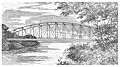 Pont suspendu sur L'Artibonite (77).jpg 2,388 × 1,325; 2.37 MB
-
 La grande rivere de Leogane (79).jpg 2,349 × 1,417; 2.6 MB
-
 L' embouchure de l'artibonite a la Grande Saline (89.jpg 2,351 × 1,420; 2.45 MB
-
 Plan de la baie de Henne.jpg 2,465 × 1,398; 1.45 MB
-
 Plan de Bainet.jpg 1,865 × 1,385; 1.25 MB
-
 1888 Coats of arms of Haiti.jpg 804 × 921; 391 KB
-
 Jean-Jaques Dessalines (Fondateur de l'Independance d'Haiti).jpg 917 × 1,378; 704 KB
-
 Les basses (119).jpg 2,347 × 1,346; 2.03 MB
-
 Petion (President d'Haiti 1807-1818).jpg 999 × 1,320; 754 KB
-
 Henri I. Christophe (1811-1820).jpg 1,157 × 1,496; 851 KB
-
 Jean-Pierre Boyer (President d'Haiti 1818-1843) (cropped).jpg 995 × 1,094; 743 KB
-
 Jean-Pierre Boyer (President d'Haiti 1818-1843).jpg 1,120 × 1,308; 900 KB
-
 Riviere (President d'Haiti 1843-1844).jpg 1,216 × 1,298; 809 KB
-
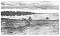
 Vue de Bizonton (149).jpg 2,418 × 1,353; 1.81 MB
-
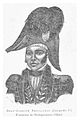
 Philippe Guerrier (President d'Haiti 1844-1845).jpg 1,185 × 1,353; 852 KB
-
 Pierrot (President d'Haiti 1845-1846) (cropped).jpg 1,140 × 1,188; 757 KB
-
 Pierrot (President d'Haiti 1845-1846).jpg 1,215 × 1,370; 839 KB
-
 Riche (President d'Haiti 1846-1847).jpg 1,160 × 1,312; 856 KB
-
 Soulouque-Faustin (President d'Haiti 1847-1859).jpg 1,231 × 1,399; 764 KB
-
 Fabre Geffrard (President d'Haiti 1859-1867).jpg 1,228 × 1,412; 797 KB
-
 Sylvain Salnave (President d'Haiti).jpg 1,192 × 1,293; 814 KB
-
 Plan du port de Cabarete.jpg 1,725 × 1,355; 955 KB
-
 Plan de la ville du Cap Francais.jpg 2,443 × 1,373; 2.39 MB
-
 Plan de la baie de Caracol.jpg 1,863 × 1,369; 1.03 MB
-
 Nissage Saget (President d'Haiti 1870-1874).jpg 1,115 × 1,373; 716 KB
-
 1888 Coats of arms of DomRep.jpg 902 × 1,034; 457 KB
-
 Michel Domingue (President d'Haiti 1874-1876).jpg 1,299 × 1,372; 867 KB
-
 Carte des Caimites.jpg 2,053 × 1,377; 1.4 MB
-
 Le General Boisrond-Canal (President d'Haiti 1876-1879).jpg 1,232 × 1,295; 870 KB
-
 Plan de la ville des Cayes.jpg 2,413 × 1,351; 1.92 MB
-
 Le General Salomon (President d'Haiti.jpg 1,215 × 1,298; 898 KB
-
 Le General Hippolyte (President d'Haiti 1889).jpg 1,252 × 1,343; 873 KB
-
 Croix-des-Bouquets (323).jpg 2,380 × 1,315; 2.5 MB
-
 Plan de la ville de Fort Liberte.jpg 1,983 × 1,383; 1.73 MB
-
 Carte de l'Ille d' Haiti (1888).jpg 4,457 × 3,141; 7.44 MB
-

-

-

-

-

-

-

-

-

-

-
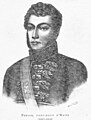
 Charles Rivière-Hérard.jpg 1,151 × 1,124; 355 KB

.jpg)
.jpg)
.jpg)
.jpg)
.jpg)


.jpg)

.jpg)
.jpg)
.jpg)


.jpg)
.jpg)
.jpg)
.jpg)
_(cropped).jpg)
.jpg)
.jpg)
.jpg)
.jpg)
_(cropped).jpg)
.jpg)
.jpg)
.jpg)
.jpg)
.jpg)


.jpg)

.jpg)

.jpg)


.jpg)
.jpg)

.jpg)
.jpg)
.jpg)
.jpg)
.jpg)
.jpg)
.jpg)
.jpg)
.jpg)
.jpg)
.jpg)
