Category:Dijk 70, Enkhuizen
Jump to navigation
Jump to search
| Object location | | View all coordinates using: OpenStreetMap |
|---|
building in Enkhuizen, Netherlands  | |||||
| Upload media | |||||
| Instance of | |||||
|---|---|---|---|---|---|
| Location | Enkhuizen, North Holland, Netherlands | ||||
| Street address |
| ||||
| Located on street | |||||
| Heritage designation |
| ||||
 | |||||
|
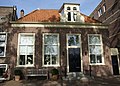
This is a category about rijksmonument number 15033
|
| Address |
|
Media in category "Dijk 70, Enkhuizen"
The following 3 files are in this category, out of 3 total.
-
 Enkhuizen - rijksmonument 15033 - Dijk 70 20110924.jpg 800 × 576; 268 KB
-
 Huizen aan straat - Enkhuizen - 20326798 - RCE.jpg 891 × 1,200; 142 KB
-
 Voorgevel - Enkhuizen - 20070708 - RCE.jpg 822 × 1,200; 222 KB

