Category:Dirt roads in Conwy County Borough
Jump to navigation
Jump to search
Media in category "Dirt roads in Conwy County Borough"
The following 72 files are in this category, out of 72 total.
-
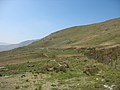
 A quad-bike track towards the mountain - geograph.org.uk - 398081.jpg 640 × 480; 111 KB
-
 A ruined sheepfold by the trackway - geograph.org.uk - 410656.jpg 640 × 394; 57 KB
-
 An Easter Walk in the Conwy Valley - 5 - geograph.org.uk - 406849.jpg 640 × 360; 105 KB
-

-

-
-
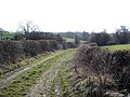
 Bends in the farm road - geograph.org.uk - 566957.jpg 640 × 480; 104 KB
-
 Bridleway to Llangwstenin - geograph.org.uk - 1013832.jpg 640 × 480; 99 KB
-
 Cefn Cyfarwydd - geograph.org.uk - 1830546.jpg 640 × 480; 79 KB
-
 Cwm Eigiau to Melynllyn Track - geograph.org.uk - 223840.jpg 640 × 427; 81 KB
-
 Diwedd y ffordd. End of the track - geograph.org.uk - 379213.jpg 640 × 448; 137 KB
-
 Farm road above Bryn Gefeilia' - geograph.org.uk - 403530.jpg 640 × 480; 133 KB
-
-
 Farm track and wall - geograph.org.uk - 1099572.jpg 640 × 480; 89 KB
-
 Farm Track at Rowlyn Uchaf - geograph.org.uk - 261734.jpg 600 × 435; 113 KB
-
 Farm track leading down to Gorddinan - geograph.org.uk - 617913.jpg 640 × 480; 114 KB
-
 Farm track near Dolwen - geograph.org.uk - 29889.jpg 512 × 384; 59 KB
-

-
 Forest crossroads - geograph.org.uk - 558178.jpg 640 × 480; 68 KB
-

-
 Forest road east of the track junction - geograph.org.uk - 409036.jpg 640 × 476; 118 KB
-
 Forestry road east of Blaen Glasgwm - geograph.org.uk - 557694.jpg 640 × 480; 132 KB
-
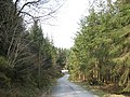
 Forestry road on Llechweddhafod - geograph.org.uk - 554631.jpg 640 × 501; 119 KB
-
 Forestry track above Penmachno - geograph.org.uk - 172945.jpg 640 × 480; 105 KB
-
 Forestry track above Ty Mawr - geograph.org.uk - 172916.jpg 640 × 480; 103 KB
-
 Forestry track approaching Llyn Bychan - geograph.org.uk - 2446940.jpg 4,000 × 3,000; 3.37 MB
-

-
-
 Lakeside track at Llyn Crafnant - geograph.org.uk - 1437082.jpg 640 × 433; 71 KB
-
 Leat service track from the A5 - geograph.org.uk - 424884.jpg 640 × 480; 83 KB
-
 Llwybr ceffyl. Bridleway. - geograph.org.uk - 417361.jpg 640 × 480; 104 KB
-
 Llyn Crafnant - geograph.org.uk - 1816966.jpg 480 × 640; 88 KB
-
 Moel Eilio Track near Llyn Coedty - geograph.org.uk - 220279.jpg 640 × 427; 120 KB
-
 Rough track to Ty Isa Gell - geograph.org.uk - 345215.jpg 640 × 480; 144 KB
-

-
 The path beyond the ford - geograph.org.uk - 701432.jpg 480 × 640; 77 KB
-
 The path, portal and sheepfold - geograph.org.uk - 717748.jpg 640 × 480; 125 KB
-

-
 The track towards Clogwynyreryr - geograph.org.uk - 717465.jpg 640 × 480; 90 KB
-

-
 Trac. Track - geograph.org.uk - 423885.jpg 640 × 480; 131 KB
-
 Track off Moel Seisiog - geograph.org.uk - 638716.jpg 640 × 480; 71 KB
-
 Track to Pen-y-garnedd - geograph.org.uk - 340676.jpg 640 × 480; 79 KB
-
 Track to Tal y Braich Uchaf - geograph.org.uk - 222579.jpg 640 × 427; 101 KB
-

-
 Alwen tracks - geograph.org.uk - 117704.jpg 640 × 480; 54 KB
-

-
 Farm track - geograph.org.uk - 125445.jpg 640 × 480; 71 KB
-
 Footpath near Nant-y-cerrig farm - geograph.org.uk - 201893.jpg 640 × 427; 95 KB
-
 Footpath to Capel Garmon - geograph.org.uk - 165744.jpg 640 × 480; 175 KB
-
 Forestry barrier at road junction - geograph.org.uk - 197109.jpg 640 × 427; 103 KB
-
 Forestry road west of Hafod-las - geograph.org.uk - 402518.jpg 640 × 480; 134 KB
-
 Forestry track - geograph.org.uk - 117698.jpg 640 × 480; 87 KB
-

-
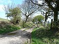
 Gated road - geograph.org.uk - 157479.jpg 640 × 480; 61 KB
-
 Gated track - geograph.org.uk - 181765.jpg 640 × 480; 132 KB
-
 Hen ffordd - geograph.org.uk - 379335.jpg 640 × 480; 153 KB
-
 Lane to Ty-nant-y-llwyn - geograph.org.uk - 181920.jpg 640 × 480; 79 KB
-
 Little used lane - geograph.org.uk - 124532.jpg 640 × 480; 111 KB
-
 Llwybr. Path - geograph.org.uk - 410336.jpg 640 × 480; 105 KB
-
 Lôn y fferm. Farm Lane. - geograph.org.uk - 410369.jpg 640 × 480; 127 KB
-
 Menter Coedwigaeth - geograph.org.uk - 152765.jpg 640 × 480; 116 KB
-
 Road Junction at Hafodunos Farm - geograph.org.uk - 218450.jpg 640 × 427; 74 KB
-
 Road junction near Bryniau Gleision - geograph.org.uk - 209656.jpg 640 × 427; 109 KB
-
 Road Junction near Pen Gallt y Foel - geograph.org.uk - 222131.jpg 640 × 427; 119 KB
-
 Road junction near Rhyd Loyw farm - geograph.org.uk - 201892.jpg 640 × 427; 100 KB
-
 The parting of the ways - geograph.org.uk - 410632.jpg 640 × 480; 83 KB
-

-
 Track across the field to Ty Gwyn - geograph.org.uk - 218473.jpg 640 × 427; 63 KB
-
-
 Track with gate - geograph.org.uk - 439051.jpg 640 × 360; 96 KB
-
 Tyddyn Eli - geograph.org.uk - 260679.jpg 640 × 480; 143 KB


