Category:District-maps of Rosenthal am Rennsteig
Jump to navigation
Jump to search
Media in category "District-maps of Rosenthal am Rennsteig"
The following 11 files are in this category, out of 11 total.
-
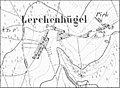 1873 - TK25 Birkenhügel.jpg 831 × 612; 263 KB
-
 RR19-Birkenhügel.png 3,276 × 2,382; 375 KB
-
 RR19-Blankenberg.png 3,276 × 2,382; 375 KB
-
 RR19-Blankenstein.png 3,276 × 2,382; 376 KB
-
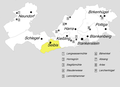
 RR19-Gemeindegliederung.png 3,276 × 2,382; 376 KB
-
 RR19-Harra.png 3,276 × 2,382; 373 KB
-
 RR19-Kießling.png 3,276 × 2,382; 375 KB
-
 RR19-Neundorf.png 3,276 × 2,382; 374 KB
-
 RR19-Pottiga.png 3,276 × 2,382; 373 KB
-
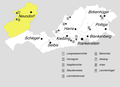
 RR19-Schlegel.png 3,276 × 2,382; 374 KB
-
 RR19-Seibis.png 3,276 × 2,382; 375 KB


