Category:Dive site maps of South Australia
Jump to navigation
Jump to search
Media in category "Dive site maps of South Australia"
The following 13 files are in this category, out of 13 total.
-
 Dive regions of South Australia.png 3,000 × 2,099; 562 KB
-
 Dive sites of Kangaroo Island.png 3,000 × 1,711; 615 KB
-
 Dive sites of Rapid Bay.png 3,000 × 2,127; 468 KB
-
 Dive sites of South Australia.png 3,000 × 2,099; 421 KB
-
 Dive sites of the Eyre Peninsula.png 3,000 × 1,833; 662 KB
-
 Dive sites of the Fleurieu Peninsula.png 3,000 × 1,858; 651 KB
-
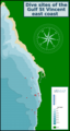 Dive sites of the Gulf St Vincent east coast.png 1,600 × 3,000; 566 KB
-
 Dive sites of the Limestone coast.png 2,023 × 3,000; 564 KB
-
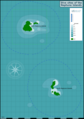 Dive sites of the Neptune Islands.png 2,113 × 3,000; 424 KB
-
 Dive sites of the north Spencer Gulf.png 2,365 × 3,000; 902 KB
-
 Dive sites of the Yorke Peninsula.png 2,035 × 3,000; 867 KB
-
 Dive sites of Victor Harbour.png 2,032 × 3,000; 620 KB
-
 Neptune Islands depths.png 318 × 449; 15 KB


