Category:Dodi Island
Jump to navigation
Jump to search
Dodi Island is an island in the upper Volta Lake and belongs administrative to the Asuogyaman District of the Eastern Region of Ghana.
| Object location | | View all coordinates using: OpenStreetMap |
|---|
in Lake Volta, Ghana  | |||||
| Upload media | |||||
| Instance of | |||||
|---|---|---|---|---|---|
| Location |
| ||||
| Located in or next to body of water | |||||
| Population |
| ||||
| Area |
| ||||
 | |||||
Media in category "Dodi Island"
The following 7 files are in this category, out of 7 total.
-
 A Ghanaian woman riding a camel on the Dodi Island.jpg 888 × 1,758; 236 KB
-
 Dodi Island and Rocky Shore − Lake Volta.jpg 2,048 × 1,536; 447 KB
-
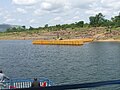
 Dodi Island Pier 2.jpg 2,048 × 1,536; 585 KB
-
 Dodi Island Pier and Rocky Shore.jpg 2,048 × 1,536; 636 KB
-
 Dodi Island Pier and Shoreline.jpg 2,048 × 1,536; 559 KB
-
 Dodi Island Pier.jpg 2,048 × 1,536; 548 KB
-
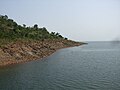 Dodi Island Rocky Shore.jpg 2,048 × 1,536; 469 KB


