Category:Dodside
Jump to navigation
Jump to search
Dodside is a linear village running along the B769 road in the south of East Renfrewshire council area. It is named after the nearby Dod Hill.
Media in category "Dodside"
The following 4 files are in this category, out of 4 total.
-
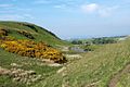 Dod Hill - geograph.org.uk - 183291.jpg 640 × 427; 76 KB
-
 Fields of Sheep near Dodside - geograph.org.uk - 245421.jpg 640 × 480; 172 KB
-
 Highland cattle at Bannerbank Farm - geograph.org.uk - 259324.jpg 640 × 480; 48 KB
-
 Old wall at Dodside - geograph.org.uk - 259327.jpg 640 × 480; 50 KB


