Category:Dolmen d'Aubevoye
Jump to navigation
Jump to search
| Object location | | View all coordinates using: OpenStreetMap |
|---|
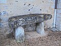
historic structure in Eure, France  | |||||
| Upload media | |||||
| Instance of | |||||
|---|---|---|---|---|---|
| Location | |||||
 | |||||
Media in category "Dolmen d'Aubevoye"
The following 6 files are in this category, out of 6 total.
-
 Aubevoye - Dolmen du Cimetiere.JPG 4,320 × 3,240; 5.45 MB
-
 Dolmen Aubevoye 1.jpg 3,648 × 2,736; 1.74 MB
-
 Dolmen Aubevoye 2.jpg 3,648 × 2,736; 1.3 MB
-
 Dolmen Aubevoye 3.jpg 2,736 × 3,648; 1.42 MB
-
 Dolmen Aubevoye.JPG 3,648 × 2,736; 3.58 MB
-
 Dolmen d'Aubevoye dessiné par Léon Coutil.jpg 349 × 251; 23 KB


