Category:Dolwyddelan
Jump to navigation
Jump to search
village in Conwy County Borough, Wales  | |||||
| Upload media | |||||
| Instance of | |||||
|---|---|---|---|---|---|
| Named after |
| ||||
| Location | Conwy County Borough, Wales | ||||
| Population |
| ||||
| Area |
| ||||
| official website | |||||
 | |||||
 | |||||


Cymraeg: Mae Dolwyddelan yn bentref yn Sir Conwy, yn Nyffryn Lledr. Mae ym Mharc Cenedlaethol Eryri. Enwir y pentref ar ôl Sant Gwyddelan, nawddsant y plwyf. Mae'r A470 a Rheilffordd Dyffryn Conwy yn pasio drwy'r pentref.
English: Dolwyddelan, Welsh language : 'the meadow of Gwyddelan', is a village and community in Conwy county borough, Wales, on the main A470 road between Blaenau Ffestiniog and Betws-y-Coed. The name of the village translates as "Gwyddelan's meadow", referring to the 5th or 6th century Saint Gwyddelan, after whom the parish church is named.
Subcategories
This category has the following 12 subcategories, out of 12 total.
A
- Afon Ystumiau (13 F)
B
- Blaenau Tunnel (10 F)
D
- Dolwyddelan railway station (17 F)
L
- Llynnau Diwaunedd (9 F)
P
- Penrhiw quarry (5 F)
- Pont Gethin (9 F)
- Pont-y-Pant Lower Tunnel (1 F)
R
- Dolwyddelan Reservoir (7 F)
S
T
- Ty'n-y-Bryn quarry (4 F)
Media in category "Dolwyddelan"
The following 200 files are in this category, out of 817 total.
(previous page) (next page)-
 61994 Heading To Blaenau Tunnel.jpg 4,000 × 2,248; 5 MB
-
 A boggy path above Blaenau Dolwyddelan - geograph.org.uk - 4958352.jpg 3,264 × 1,836; 3.54 MB
-
 A boggy shelf - geograph.org.uk - 412352.jpg 640 × 480; 72 KB
-

-

-

-

-
 A pool on the Afon Lledr - geograph.org.uk - 5080404.jpg 4,896 × 3,672; 6.58 MB
-
 A Roche Moutonnée - geograph.org.uk - 2949444.jpg 640 × 480; 56 KB
-
 A short-cut to the summit of Y Ro Wen - geograph.org.uk - 566582.jpg 640 × 486; 93 KB
-
 A470 - geograph.org.uk - 134998.jpg 640 × 480; 90 KB
-
 A470 and Benar (Wood) - geograph.org.uk - 240588.jpg 480 × 640; 43 KB
-
 A470 at Bryn-moel - geograph.org.uk - 3015873.jpg 3,264 × 2,448; 3.26 MB
-
 A470 at Dolwyddelan - geograph.org.uk - 6184905.jpg 2,048 × 1,536; 825 KB
-
 A470 at Dolwyddelan Castle - geograph.org.uk - 3015897.jpg 3,264 × 2,448; 3.45 MB
-
 A470 Crimea Pass - geograph.org.uk - 5745327.jpg 640 × 480; 99 KB
-
 A470 eastbound - geograph.org.uk - 3362634.jpg 640 × 480; 70 KB
-
 A470 from entrance to forest track - geograph.org.uk - 4720509.jpg 640 × 499; 46 KB
-
 A470 Near Dolwyddelan - geograph.org.uk - 380221.jpg 640 × 480; 77 KB
-
 A470 near the top of the Crimea Pass - geograph.org.uk - 4054606.jpg 1,024 × 768; 143 KB
-
 A470 northbound - geograph.org.uk - 3266976.jpg 640 × 480; 55 KB
-
 A470 northbound - geograph.org.uk - 3266985.jpg 640 × 480; 56 KB
-
 A470 northbound - geograph.org.uk - 3266988.jpg 640 × 480; 53 KB
-
 A470 northbound - geograph.org.uk - 3266990.jpg 640 × 480; 51 KB
-
 A470 northbound - geograph.org.uk - 3266992.jpg 640 × 480; 49 KB
-
 A470 northbound - geograph.org.uk - 3266995.jpg 640 × 480; 48 KB
-
 A470 northbound - geograph.org.uk - 3266996.jpg 640 × 480; 54 KB
-
 A470 northbound - geograph.org.uk - 3266997.jpg 640 × 480; 59 KB
-
 A470 northbound - geograph.org.uk - 3266998.jpg 640 × 430; 38 KB
-
 A470 northbound - geograph.org.uk - 3267000.jpg 640 × 448; 37 KB
-
 A470 northbound - geograph.org.uk - 3267001.jpg 640 × 480; 45 KB
-
 A470 northbound - geograph.org.uk - 3267009.jpg 640 × 435; 66 KB
-
 A470 roadworks Dolwyddelan - geograph.org.uk - 4800456.jpg 1,024 × 616; 96 KB
-
 A470 south of Minffordd - geograph.org.uk - 4720523.jpg 640 × 468; 73 KB
-

-
 A470 through rock cutting - geograph.org.uk - 4720514.jpg 640 × 501; 61 KB
-
 A470 to Betws-y-Coed - geograph.org.uk - 4720549.jpg 640 × 454; 79 KB
-
 A470 viewpoint - geograph.org.uk - 134936.jpg 640 × 480; 75 KB
-
 A470 westbound - geograph.org.uk - 3362616.jpg 640 × 480; 89 KB
-
 Adfael mwsoglyd - A moss-clad ruin - geograph.org.uk - 5122952.jpg 640 × 450; 101 KB
-
 Adfail. Ruin. - geograph.org.uk - 379652.jpg 640 × 480; 161 KB
-
 Adopted station^ - geograph.org.uk - 1568674.jpg 480 × 640; 100 KB
-
 Afon Bwlch y Groes - geograph.org.uk - 5062855.jpg 1,200 × 1,600; 698 KB
-
 Afon Cwm Penamnen - geograph.org.uk - 2693396.jpg 3,888 × 2,592; 5.52 MB
-
 Afon Cwm Penanmen - geograph.org.uk - 165701.jpg 640 × 480; 84 KB
-
 Afon Gorddinan - geograph.org.uk - 6612881.jpg 800 × 600; 126 KB
-
 Afon Lledr - geograph.org.uk - 134979.jpg 640 × 480; 135 KB
-
 Afon Lledr - geograph.org.uk - 197510.jpg 640 × 426; 158 KB
-
 Afon Lledr - geograph.org.uk - 2533378.jpg 2,560 × 1,920; 2.15 MB
-
 Afon Lledr - geograph.org.uk - 2533403.jpg 2,560 × 1,920; 2.03 MB
-
 Afon Lledr - geograph.org.uk - 4063861.jpg 3,264 × 2,448; 3.6 MB
-
 Afon Lledr - geograph.org.uk - 4119485.jpg 640 × 480; 95 KB
-
 Afon Lledr - geograph.org.uk - 4119865.jpg 640 × 480; 168 KB
-
 Afon Lledr - geograph.org.uk - 6333055.jpg 800 × 600; 133 KB
-
 Afon Lledr at Dolwyddelan - geograph.org.uk - 2107335.jpg 640 × 480; 90 KB
-
 Afon Lledr at Pont-y-Pant - geograph.org.uk - 1570062.jpg 640 × 480; 128 KB
-
 Afon Lledr by Pont-y-pant - geograph.org.uk - 6331982.jpg 800 × 600; 167 KB
-
 Afon Lledr footbridge - geograph.org.uk - 6333053.jpg 800 × 600; 111 KB
-
 Afon Lledr gorge.jpg 4,160 × 6,240; 16.29 MB
-

-
 Afon Lledr running through Dolwyddelan - geograph.org.uk - 2195396.jpg 2,816 × 1,880; 1.88 MB
-
 Afon Lledr valley - geograph.org.uk - 3015936.jpg 2,270 × 1,958; 1.6 MB
-

-
 Afon Maesgwyn - geograph.org.uk - 1568494.jpg 640 × 480; 170 KB
-
 Air shaft and reservoir - geograph.org.uk - 864753.jpg 640 × 429; 70 KB
-
 Alighting at Pont-y-Pant - geograph.org.uk - 3068446.jpg 3,264 × 2,448; 3.3 MB
-
 Allt Fawr - geograph.org.uk - 2532264.jpg 2,560 × 1,920; 981 KB
-
 An abandoned sheepfold - geograph.org.uk - 408145.jpg 640 × 480; 93 KB
-

-
 Approaching Dolwyddelan - geograph.org.uk - 1214218.jpg 640 × 451; 85 KB
-
 Approaching Dolwyddelan - geograph.org.uk - 2256955.jpg 3,296 × 2,472; 1.87 MB
-
 Approaching Dolwyddelan - geograph.org.uk - 4082340.jpg 640 × 480; 67 KB
-
 Approaching Dolwyddelan and beyond - geograph.org.uk - 4082350.jpg 640 × 480; 62 KB
-
 Approaching Roman Bridge Station - geograph.org.uk - 3636810.jpg 1,600 × 1,063; 669 KB
-
 Approaching Tan-aeldroch - geograph.org.uk - 5071957.jpg 4,896 × 3,672; 6.48 MB
-
-
-

-

-
 Back lane in Dolwyddelan - geograph.org.uk - 1092803.jpg 427 × 640; 70 KB
-
 Barn in the field - geograph.org.uk - 5069945.jpg 4,896 × 3,672; 6.74 MB
-
 Barn, West of Dolwyddelan - geograph.org.uk - 5063135.jpg 1,600 × 1,200; 710 KB
-
 Bend In Minor Road - geograph.org.uk - 5189606.jpg 1,024 × 768; 288 KB
-
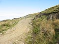 Bends in the farm road - geograph.org.uk - 566957.jpg 640 × 480; 104 KB
-
 Bethel Welsh Independent Chapel (2).jpg 3,872 × 2,592; 4.36 MB
-
 Boggy terrain north of Moel Meirch - geograph.org.uk - 2106113.jpg 2,000 × 899; 1.84 MB
-
 Bracken and birch - geograph.org.uk - 6332257.jpg 800 × 600; 182 KB
-
 Bridge Street Dolwyddelan - geograph.org.uk - 4119427.jpg 640 × 480; 95 KB
-
 Bron-Llywelyn - a disused farmhouse - geograph.org.uk - 559020.jpg 640 × 480; 128 KB
-
 Bryn Hafod Fraith - geograph.org.uk - 4068540.jpg 3,264 × 2,448; 3.77 MB
-
 Butterfly on Moel Siabod - geograph.org.uk - 4050726.jpg 640 × 360; 96 KB
-
 Bwlch y Cwm - geograph.org.uk - 2531811.jpg 2,560 × 1,920; 560 KB
-
 Bwlch y Gorddinan from A470 - geograph.org.uk - 4720489.jpg 640 × 509; 53 KB
-
 Bwlch y Gorddinan in 2002 - geograph.org.uk - 3030024.jpg 1,024 × 763; 135 KB
-

-
 By Llyn Dyrnogydd - geograph.org.uk - 2533424.jpg 2,560 × 1,920; 1.98 MB
-
 By the A470 - geograph.org.uk - 2949448.jpg 640 × 480; 78 KB
-
 Cadwaladr Owen's old house, Dolwyddelan NLW3361385.jpg 585 × 457; 48 KB
-
 Cadwaladr Owen's old house, Dolwyddelan NLW3361386.jpg 573 × 460; 69 KB
-
 Cae uwchben Dolwyddelan - Field above Dolwyddelan - geograph.org.uk - 4068990.jpg 3,264 × 2,448; 3.74 MB
-
 Can't see the sheepfold shown on the map - geograph.org.uk - 4800448.jpg 1,024 × 768; 185 KB
-
 Capel Bethel - geograph.org.uk - 4119810.jpg 640 × 480; 61 KB
-
 Capel Bethel, Dolwyddelan - geograph.org.uk - 1568526.jpg 640 × 476; 69 KB
-
 Capel Bethel, Dolwyddelan - geograph.org.uk - 6293061.jpg 1,280 × 839; 661 KB
-
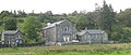 Capel Moreia, Dolwyddelan - geograph.org.uk - 568120.jpg 640 × 273; 59 KB
-
 Car park for Dolwyddelan Castle - geograph.org.uk - 4054600.jpg 1,024 × 768; 213 KB
-
 Car park near the top of the Crimea Pass - geograph.org.uk - 4054614.jpg 1,024 × 768; 267 KB
-
 Carnedd y Cribau - geograph.org.uk - 4037774.jpg 3,600 × 2,400; 3.74 MB
-
 Carnedd y Cribau - geograph.org.uk - 4037786.jpg 3,600 × 2,400; 3.99 MB
-
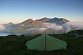 Carnedd y Cribau - geograph.org.uk - 4037839.jpg 3,600 × 2,400; 3.97 MB
-
 Carreg Alltrem - geograph.org.uk - 2693420.jpg 5,888 × 3,925; 2.82 MB
-
 Carreg Filltir - Milestone - geograph.org.uk - 5122957.jpg 640 × 628; 127 KB
-
 Cascade, below Llyn y Foel - geograph.org.uk - 4119914.jpg 768 × 1,024; 298 KB
-
 Castell Dolwyddelan1.jpg 4,032 × 3,024; 1.57 MB
-
 Castell Dolwyddelan2.jpg 4,032 × 3,024; 2.44 MB
-

-

-
 Causeway across the Lledr - geograph.org.uk - 3438971.jpg 5,184 × 3,456; 5.81 MB
-

-

-
 Clear felled forest, below Moel Siabod - geograph.org.uk - 4119918.jpg 1,024 × 768; 290 KB
-
 Climbers at Craig y Tonnau - geograph.org.uk - 4958355.jpg 1,836 × 3,264; 3.6 MB
-
 Climbing the Style - geograph.org.uk - 2389262.jpg 2,816 × 1,880; 1.97 MB
-
 Climbing up to Bwlch Rhiw'r Ychen - geograph.org.uk - 6480698.jpg 4,092 × 3,609; 1.71 MB
-
 Clogwyn y Groes - geograph.org.uk - 5062882.jpg 1,600 × 1,200; 605 KB
-
 Cloud over Moel Siabod - geograph.org.uk - 1092816.jpg 640 × 427; 46 KB
-

-
 Colourful shed - geograph.org.uk - 4427108.jpg 640 × 480; 90 KB
-

-
 Cottage - geograph.org.uk - 4299995.jpg 1,024 × 768; 297 KB
-
 Cottage at Mur Coch - geograph.org.uk - 5071159.jpg 4,896 × 3,672; 6.61 MB
-
 Cottages in the centre of Dolwyddelan - geograph.org.uk - 1996549.jpg 640 × 427; 103 KB
-
 Cottages in the Lledr valley - geograph.org.uk - 2317302.jpg 640 × 480; 104 KB
-
 Cottages near Pont-y-pant station - geograph.org.uk - 5071136.jpg 4,896 × 3,672; 7.12 MB
-
 Country lane near Pwll-y-gâth - geograph.org.uk - 5071918.jpg 4,896 × 3,672; 6.82 MB
-
 Crag and tail rock outcrop - geograph.org.uk - 6332336.jpg 800 × 600; 119 KB
-
 Crag on north side of Llyn Iwerddon - geograph.org.uk - 6595552.jpg 1,999 × 1,300; 2.66 MB
-
 Craig Blaen-y-cwm - geograph.org.uk - 4068508.jpg 3,264 × 2,448; 3.66 MB
-
 Craig y Tonnau - geograph.org.uk - 4958354.jpg 3,264 × 1,836; 3.58 MB
-
 Crimea Pass - geograph.org.uk - 134929.jpg 640 × 480; 77 KB
-
 Crimea Pass - geograph.org.uk - 134933.jpg 640 × 480; 92 KB
-
 Crimea Pass - geograph.org.uk - 2531801.jpg 2,560 × 1,920; 2.03 MB
-
 Cropped image of Capel Moreia, Dolwyddelan 568120 1662f890.jpg 328 × 268; 56 KB
-
 Crossing the bridge - geograph.org.uk - 2195389.jpg 2,816 × 1,880; 1.97 MB
-
 Culvert over forest ride - geograph.org.uk - 3800053.jpg 2,977 × 2,127; 2.31 MB
-
 Cut-off pool - geograph.org.uk - 6332205.jpg 800 × 600; 100 KB
-
 Cwm Clorad - geograph.org.uk - 2878506.jpg 1,024 × 768; 196 KB
-
 Cwm holding Llyn y Foel - geograph.org.uk - 2170630.jpg 2,000 × 1,306; 2.23 MB
-
 Cwm Lledr - geograph.org.uk - 2533363.jpg 2,560 × 1,920; 2.08 MB
-
 Cwm Lledr - geograph.org.uk - 2533369.jpg 1,920 × 2,560; 834 KB
-
 Cwm Penmaen - geograph.org.uk - 4063874.jpg 3,264 × 2,448; 3.58 MB
-
 Cwm Penmaen - geograph.org.uk - 4063881.jpg 3,264 × 2,448; 3.74 MB
-
 Cyfyng - geograph.org.uk - 5480433.jpg 4,608 × 3,456; 4.61 MB
-
 Cyfyng house - geograph.org.uk - 5071947.jpg 4,896 × 3,672; 7.02 MB
-
 Daear Ddu - geograph.org.uk - 2321868.jpg 1,391 × 1,024; 534 KB
-
 Daear Ddu - geograph.org.uk - 2321886.jpg 1,024 × 1,365; 459 KB
-
 Daear Ddu - geograph.org.uk - 4119672.jpg 1,024 × 768; 276 KB
-
 Damaged milestone by the A470 at Bwlch-Cynnud - geograph.org.uk - 6295750.jpg 3,648 × 5,472; 5.95 MB
-

-
 Derelict Pavilion, Lledr House - geograph.org.uk - 3801369.jpg 3,102 × 2,216; 2.2 MB
-

-
 Disused petrol station on the A470 - geograph.org.uk - 3015892.jpg 2,849 × 2,254; 2.81 MB
-
 Disused Quarry - geograph.org.uk - 240581.jpg 640 × 480; 76 KB
-
 Disused sports field near Dolwyddelan - geograph.org.uk - 2255745.jpg 3,296 × 2,472; 1.94 MB
-
 Dolerite crags - geograph.org.uk - 6612837.jpg 800 × 600; 120 KB
-
 Cenotaph at Dolwyddelan - geograph.org.uk - 1568437.jpg 640 × 480; 79 KB
-
 Dolwyddelan - geograph.org.uk - 4068952 (edited).jpg 1,024 × 768; 516 KB
-
 Dolwyddelan - geograph.org.uk - 4068952.jpg 3,264 × 2,448; 3.85 MB
-
 Dolwyddelan - geograph.org.uk - 4068974.jpg 3,264 × 2,448; 3.85 MB
-
 Dolwyddelan - The Gwydyr - geograph.org.uk - 134950.jpg 640 × 480; 62 KB
-
 Dolwyddelan and late morning sun - geograph.org.uk - 1092837.jpg 640 × 427; 38 KB
-
 Dolwyddelan and Moel Siabod (2,866 ft.), 1992 - geograph.org.uk - 4436993.jpg 2,438 × 1,549; 3.3 MB
-
 Dolwyddelan and Moel Siabod - geograph.org.uk - 1742065.jpg 2,816 × 1,880; 2.75 MB
-
 Dolwyddelan and Moel Siabod - geograph.org.uk - 2195373.jpg 2,816 × 1,880; 2.42 MB
-
 Dolwyddelan and snowy mountain - geograph.org.uk - 1032941.jpg 640 × 427; 68 KB
-
 Dolwyddelan Castle - geograph.org.uk - 5744351.jpg 1,024 × 681; 139 KB
-
 Dolwyddelan Castle - geograph.org.uk - 6293148.jpg 1,280 × 960; 922 KB
-
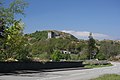 Dolwyddelan Castle ^ Road - geograph.org.uk - 1874216.jpg 2,816 × 1,880; 2.25 MB
-
 Dolwyddelan church - geograph.org.uk - 134959.jpg 640 × 480; 71 KB
-
 Dolwyddelan cottages - geograph.org.uk - 134960.jpg 640 × 480; 86 KB
-
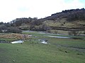 Dolwyddelan farmland - geograph.org.uk - 134968.jpg 640 × 480; 60 KB
-
 Dolwyddelan from above - geograph.org.uk - 2389235.jpg 2,816 × 1,880; 1.63 MB
-

-
 Dolwyddelan Junior School - geograph.org.uk - 1568467.jpg 640 × 421; 79 KB
-
 Dolwyddelan map board.JPG 2,848 × 2,136; 1.41 MB
-
 Dolwyddelan NLW3361372.jpg 586 × 462; 79 KB
-
 Dolwyddelan NLW3361433.jpg 604 × 452; 56 KB
-
 Dolwyddelan railway station signage - geograph.org.uk - 6291969.jpg 1,280 × 1,180; 1.13 MB
-
 Dolwyddelan school - geograph.org.uk - 4130328.jpg 640 × 480; 88 KB
-
 Dolwyddelan School field - geograph.org.uk - 2195384.jpg 2,816 × 1,880; 1.88 MB
-
 Dolwyddelan Station - geograph.org.uk - 2260443.jpg 3,296 × 2,472; 1.96 MB
-
 Dolwyddelan village - geograph.org.uk - 134953.jpg 640 × 480; 66 KB
-
 Dolwyddelan War Memorial - geograph.org.uk - 4119439.jpg 640 × 480; 77 KB
-
 Dolwyddelan war memorial - geograph.org.uk - 6086079.jpg 2,816 × 1,880; 2.51 MB
-
 Dolwyddelan War Memorial. - geograph.org.uk - 798862.jpg 426 × 640; 61 KB
-

-
 Dolwyddelan, Y Gwydyr - geograph.org.uk - 1334392.jpg 600 × 450; 167 KB
-
 Dry Stone Fencing at Dolwyddelan - panoramio.jpg 4,320 × 3,240; 4.35 MB
-
 East of Dolwyddelan - geograph.org.uk - 1568538.jpg 640 × 480; 107 KB
-
 Elen's Castle Hotel - geograph.org.uk - 4119883.jpg 640 × 480; 112 KB


_-_geograph.org.uk_-_240588.jpg)


.jpg)


.jpg)


,_1992_-_geograph.org.uk_-_4436993.jpg)


