Category:Doodenbastion (Oudeschans)
Jump to navigation
Jump to search
| Object location | | View all coordinates using: OpenStreetMap |
|---|
 | |||||
| Upload media | |||||
| Instance of | |||||
|---|---|---|---|---|---|
| Location | Oudeschans, Westerwolde, Groningen, Netherlands | ||||
| Street address |
| ||||
| Heritage designation |
| ||||
 | |||||
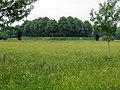
Nederlands: Doodenbastion, Kerkhof bastion. Aan de oostzijde verhoogde rest van het bastion waarop kerkhof.
|
This is a category about rijksmonument number 8918
|
| Address |
|
Media in category "Doodenbastion (Oudeschans)"
The following 5 files are in this category, out of 5 total.
-
 Kerkhof bastion vanaf Oude schansweg - Oudeschans - 20179297 - RCE.jpg 1,198 × 1,200; 324 KB
-
 Kerkhof, aanzicht - Oudeschans - 20179377 - RCE.jpg 1,200 × 808; 188 KB
-
 Kerkhof, overzicht - Oudeschans - 20179376 - RCE.jpg 1,200 × 810; 226 KB
-
 Oudeschans Doodenbastion.jpg 4,000 × 3,000; 1.73 MB
-
 Schanspad naar Kerkhof-bastion - Oudeschans - 20179308 - RCE.jpg 1,190 × 1,200; 387 KB


