Category:Dorfkirche Diedersdorf (Großbeeren)
Jump to navigation
Jump to search
| Object location | | View all coordinates using: OpenStreetMap |
|---|
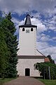
church building in Großbeeren, Brandenburg state, Germany  | |||||
| Upload media | |||||
| Instance of | |||||
|---|---|---|---|---|---|
| Location | Diedersdorf, Großbeeren, Teltow-Fläming District, Brandenburg, Germany | ||||
| Heritage designation | |||||
 | |||||
This is the category of the Brandenburger Baudenkmal (cultural heritage monument) with the ID 09105675 (Wikidata)
|
Media in category "Dorfkirche Diedersdorf (Großbeeren)"
The following 15 files are in this category, out of 15 total.
-
 Der Dorfbackofen - panoramio.jpg 4,592 × 3,056; 7.71 MB
-
 Dorfkirche Diedersdorf Gedenkstein Opfer Gewalt.jpg 4,608 × 3,456; 6.4 MB
-
 Dorfkirche Diedersdorf Grabwangen südwestlicher Friedhof.jpg 4,608 × 3,456; 6.63 MB
-
 Dorfkirche Diedersdorf Nordansicht.jpg 4,608 × 3,456; 4.56 MB
-
 Dorfkirche Diedersdorf Nordostansicht.jpg 4,608 × 3,456; 4.17 MB
-
 Dorfkirche Diedersdorf Ostansicht.jpg 4,608 × 3,456; 5.84 MB
-
 Dorfkirche Diedersdorf Südostansicht.jpg 4,608 × 3,456; 5.34 MB
-
 Dorfkirche Diedersdorf Westansicht.jpg 3,456 × 4,608; 2.51 MB
-
 Dorfkirche Diedersdorf Westportal.jpg 4,608 × 3,456; 5.73 MB
-
 Dorfkirche Diedersdorf Westturm Südansicht.jpg 3,456 × 4,608; 4.37 MB
-
 DorfkircheDiedersdorfSO.JPG 4,000 × 3,000; 3.89 MB
-
 DorfkircheDiedersdorfSW.JPG 4,000 × 3,000; 2.97 MB
-
 Ev. Kirche Diedersdorf - panoramio.jpg 4,592 × 3,056; 7.35 MB
-
 Grossbeeren Diedersdorf Kirche.jpg 2,592 × 3,872; 1.3 MB
-
 Kirche Diedersdor Grossbeeren.jpg 6,192 × 4,128; 11.33 MB


