Category:Dorfkirche Rangsdorf
Jump to navigation
Jump to search
| Object location | | View all coordinates using: OpenStreetMap |
|---|
church building in Brandenburg state, Germany    | |||||
| Upload media | |||||
| Instance of | |||||
|---|---|---|---|---|---|
| Location | Rangsdorf, Teltow-Fläming District, Brandenburg, Germany | ||||
| Heritage designation | |||||
 | |||||
This is the category of the Brandenburger Baudenkmal (cultural heritage monument) with the ID 09105475 (Wikidata)
|
Subcategories
This category has only the following subcategory.
I
Media in category "Dorfkirche Rangsdorf"
The following 17 files are in this category, out of 17 total.
-
 Dorfkirche Rangsdorf - Deutschland - panoramio.jpg 2,592 × 1,944; 2.03 MB
-
 Dorfkirche Rangsdorf - Germany - panoramio.jpg 3,264 × 2,448; 3.1 MB
-
 Dorfkirche Rangsdorf Kirchenschiff Nordansicht Mittelfenster.jpg 3,456 × 4,608; 3.71 MB
-
 Dorfkirche Rangsdorf Kirchenschiff Nordansicht.jpg 4,608 × 3,456; 4.62 MB
-
 Dorfkirche Rangsdorf Kirchenschiff Südansicht.jpg 4,608 × 3,456; 4.24 MB
-
 Dorfkirche Rangsdorf Ostansicht.jpg 4,608 × 3,456; 5.17 MB
-
 Dorfkirche Rangsdorf Südostansicht.jpg 4,608 × 3,456; 4.56 MB
-
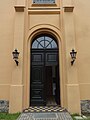
 Dorfkirche Rangsdorf Tür.jpg 3,024 × 4,032; 4.91 MB
-
 Dorfkirche Rangsdorf Westturm Nordansicht.jpg 3,456 × 4,608; 3.46 MB
-
 Dorfkirche Rangsdorf Westturm Portal.jpg 3,456 × 4,608; 3.56 MB
-
 Dorfkirche Rangsdorf Westturm Turmgeschoss.jpg 3,456 × 4,608; 3.28 MB
-
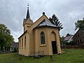 Dorfkirche Rangsdorf.jpg 4,032 × 3,024; 4.13 MB
-
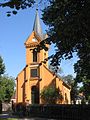
 Evangelische Kirche Rangsdorf in Brandenburg Teltow Fläming.jpg 5,182 × 2,915; 9.27 MB
-
 Evangelische Kirche Rangsdorf.jpg 4,032 × 3,024; 6.53 MB
-
 Kircheweg Kirche Rangsdorf.jpg 4,928 × 3,264; 9.05 MB
-
 Kirche1 Rangsdorf Brandenburg.JPG 480 × 640; 80 KB
-
 Rangsdorf Dorfkirche asv2022-10 img3.jpg 3,238 × 4,857; 10.72 MB


