Category:Dorfkirche Schönermark (Ostprignitz)
Jump to navigation
Jump to search
| Object location | | View all coordinates using: OpenStreetMap |
|---|
_church_2016_S.jpg) | |||||
| Upload media | |||||
| Instance of | |||||
|---|---|---|---|---|---|
| Location | Schönermark, Stüdenitz-Schönermark, Ostprignitz-Ruppin District, Brandenburg, Germany | ||||
| Heritage designation | |||||
 | |||||
This is the category of the Brandenburger Baudenkmal (cultural heritage monument) with the ID 09170687 (Wikidata)
|
English: Church in Schönermark in Eastern Prignitz, Stüdenitz-Schönermark municipality, Ostprignitz-Ruppin district, Brandenburg state, Germany
Deutsch: Dorfkirche in Schönermark in der Ostprignitz, Gemeinde Stüdenitz-Schönermark, Landkreis Ostprignitz-Ruppin, Land Brandenburg, Deutschland.
Français : Église de Schönermark en Prignitz-de-l'Est, commune de Stüdenitz-Schönermark, arrondissement Prignitz-de-l'Est-Ruppin, état fédéral de Brandebourg, Allemagne
Media in category "Dorfkirche Schönermark (Ostprignitz)"
The following 11 files are in this category, out of 11 total.
-
 Lausitz Luftsport- & Techniktage 2013-Hinflug by-RaBoe 0725.jpg 2,600 × 1,727; 966 KB
-
 Lausitz Luftsport- & Techniktage 2013-Hinflug by-RaBoe 0726.jpg 2,600 × 1,727; 922 KB
-
 Schönermark (Ostprignitz) church 2016 E.JPG 4,864 × 3,648; 5.83 MB
-
 Schönermark (Ostprignitz) church 2016 ESE.JPG 3,648 × 4,864; 5.28 MB
-
 Schönermark (Ostprignitz) church 2016 NE.JPG 4,864 × 3,648; 7 MB
-
 Schönermark (Ostprignitz) church 2016 NW.jpg 4,489 × 4,775; 5.59 MB
-
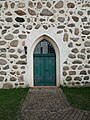 Schönermark (Ostprignitz) church 2016 portal W.JPG 3,648 × 4,864; 5.81 MB
-
 Schönermark (Ostprignitz) church 2016 S.jpg 4,694 × 4,213; 8.67 MB
-
 Schönermark (Ostprignitz) church 2016 SW.jpg 4,724 × 4,145; 6.89 MB
-
 Schönermark (Ostprignitz) church 2016 window.JPG 3,648 × 4,864; 4.97 MB
-
 Schönermark (Ostprignitz) Kirche Denkmal.jpg 2,436 × 3,647; 4.59 MB


_church_2016_E.JPG)
_church_2016_ESE.JPG)
_church_2016_NE.JPG)
_church_2016_NW.jpg)
_church_2016_portal_W.JPG)
_church_2016_SW.jpg)
_church_2016_window.JPG)
_Kirche_Denkmal.jpg)