Category:Dorfkirche Schützberg
Jump to navigation
Jump to search
| Object location | | View all coordinates using: OpenStreetMap |
|---|
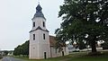
church building in Jessen (Elster), Germany  | |||||
| Upload media | |||||
| Instance of | |||||
|---|---|---|---|---|---|
| Part of |
| ||||
| Location | Schützberg, Jessen (Elster), Wittenberg, Saxony-Anhalt, Germany | ||||
| Heritage designation | |||||
 | |||||
This is the category of the Saxony-Anhalt Kulturdenkmal (cultural heritage monument) with the ID 09435198 (Wikidata)
|
Media in category "Dorfkirche Schützberg"
The following 3 files are in this category, out of 3 total.
-
 Kirche Schützberg.JPG 3,264 × 1,840; 2.55 MB
-
 Kirche von Schützberg 12345.jpg 1,280 × 720; 175 KB
-
 Kirche von Schützberg 123456.jpg 720 × 1,280; 160 KB

