Category:Dorfkirche Schwante
Jump to navigation
Jump to search
| Object location | | View all coordinates using: OpenStreetMap |
|---|
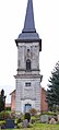
church building in Oberkrämer, Brandenburg state, Germany   | |||||
| Upload media | |||||
| Instance of | |||||
|---|---|---|---|---|---|
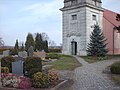
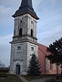
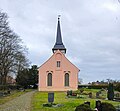
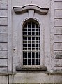
| Location | Schwante, Oberkrämer, Oberhavel District, Brandenburg, Germany | ||||
| Architectural style | |||||
| Heritage designation | |||||
| Inception |
| ||||
 | |||||
This is the category of the Brandenburger Baudenkmal (cultural heritage monument) with the ID 09165123 (Wikidata)
|
English: Pictures of the church in Schwante, Oberkrämer municipality, Oberhavel district, Brandenburg state, Germany.
Deutsch: Ansichten der Kirche in Schwante, Gemeinde Oberkrämer, Landkreis Oberhavel, Land Brandenburg, Deutschland.
Français : Photos de l'église à Schwante, commune de Oberkrämer, arrondissement de Oberhavel, état fédéral de Brandebourg, Allemagne
Español: Vistas de la iglesia en Schwante, municipio de Oberkrämer, distrito de Oberhavel, estado federado de Brandeburgo, Alemania
Address:
Dorfstraße, Schwante, 16727 Oberkrämer
Subcategories
This category has only the following subcategory.
I
- Interior of Dorfkirche Schwante (25 F)
Pages in category "Dorfkirche Schwante"
This category contains only the following page.
Media in category "Dorfkirche Schwante"
The following 30 files are in this category, out of 30 total.
-
 Dorfkirche Schwante 2021 E.jpg 3,648 × 4,864; 7.11 MB
-
 Dorfkirche Schwante 2021 N.jpg 4,608 × 3,456; 3.66 MB
-
 Dorfkirche Schwante 2021 NE.jpg 4,864 × 3,648; 5.37 MB
-
 Dorfkirche Schwante 2021 SW.jpg 3,598 × 4,826; 6.42 MB
-
 Dorfkirche Schwante 2021 W.jpg 2,982 × 4,002; 4.52 MB
-
 Dorfkirche Schwante 2021 Westportal.jpg 3,648 × 4,864; 5.81 MB
-
 Dorfkirche Schwante (1).JPG 3,215 × 3,943; 2.25 MB
-
 Dorfkirche Schwante (2).JPG 2,722 × 4,238; 1.97 MB
-
 Dorfkirche Schwante 2021 Fenster.jpg 3,598 × 4,826; 4.36 MB
-
 Dorfkirche Schwante 2021 SE.jpg 4,864 × 3,648; 7.78 MB
-
 Dorfkirche Schwante 2021 SW Panorama.jpg 4,608 × 3,456; 6.3 MB
-
 Dorfkirche Schwante 2021 Südportal.jpg 3,598 × 4,826; 4.88 MB
-
 Dorfkirche Schwante 2021 Turmhelm.jpg 3,648 × 4,864; 3.83 MB
-
 Schwante 20080309 kirche1.jpg 2,560 × 1,920; 1.45 MB
-
 Schwante 20080309 kirche2.jpg 1,920 × 2,560; 1.18 MB
-
 Schwante 20080309 kirche3.jpg 1,920 × 2,560; 1.19 MB
-
 Schwante 30.10.2016 13-04-56.jpg 3,456 × 4,608; 5.23 MB
-
 Schwante 30.10.2016 13-05-46.jpg 3,912 × 3,354; 8.45 MB
-
 Schwante 30.10.2016 13-05-51.jpg 2,390 × 3,368; 4.37 MB
-
 Schwante, Dorfkirche (16).jpg 6,073 × 5,616; 4.42 MB
-
 Schwante, Dorfkirche (17).jpg 2,422 × 4,017; 1.8 MB
-
 Schwante, Dorfkirche (18).jpg 5,982 × 6,245; 5.41 MB
-
 Schwante, Dorfkirche (19).jpg 2,465 × 4,460; 787 KB
-
 Schwante, Dorfkirche (20).jpg 3,840 × 5,195; 4.85 MB
-
 Schwante, Dorfkirche (21).jpg 5,997 × 5,386; 8.23 MB
-
 Schwante, Dorfkirche (22).jpg 2,440 × 5,381; 1.86 MB
-
 Schwante, Dorfkirche (23).jpg 5,788 × 6,488; 6.01 MB
-
 Schwante, Dorfkirche (24).jpg 5,558 × 7,923; 11.83 MB
-
 Schwante, Dorfkirche (25).jpg 3,479 × 4,429; 3.33 MB
-
 Schwante, Dorfkirche (26).jpg 6,120 × 5,183; 5.7 MB


.JPG)
.JPG)


.jpg)
.jpg)
.jpg)
.jpg)
.jpg)
.jpg)
.jpg)
.jpg)
.jpg)
.jpg)
.jpg)