Category:Dorfkirche Wengern
Jump to navigation
Jump to search
| Object location | | View all coordinates using: OpenStreetMap |
|---|
church in Wetter (Ruhr), North Rhine-Westphalia, Germany   | |||||
| Upload media | |||||
| Instance of | |||||
|---|---|---|---|---|---|
| Part of | |||||
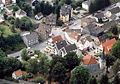
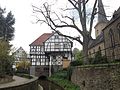
| Location | Wengern, Wetter, Ennepe-Ruhr-Kreis, Arnsberg Government Region, North Rhine-Westphalia, Germany | ||||
| Heritage designation | |||||
 | |||||
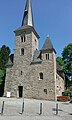
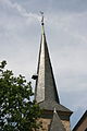
This is the category for an architectural monument.
It is on the list of cultural monuments of Wetter (Ruhr), no. 83.
It is on the list of cultural monuments of Wetter (Ruhr), no. 83.
| Address |
|
Subcategories
This category has only the following subcategory.
I
- Interior of Dorfkirche Wengern (12 F)
Media in category "Dorfkirche Wengern"
The following 21 files are in this category, out of 21 total.
-
 Dorfkirche Wengern IMAG2250.jpg 1,552 × 2,592; 1.86 MB
-
 Kirchstraße 8 - Ev. Kirche (Wengern) (10).jpg 3,279 × 2,698; 2.9 MB
-
 Kirchstraße 8 - Ev. Kirche (Wengern) (11).jpg 2,990 × 2,930; 6.12 MB
-
 Kirchstraße 8 - Ev. Kirche (Wengern) (5).jpg 3,462 × 2,860; 4.74 MB
-
 Kirchstraße 8 - Ev. Kirche (Wengern) (7).jpg 2,181 × 3,017; 1.47 MB
-
 Wengern, Ev. Dorfkirche - Geograph-106948-by-Michael-W.jpg 480 × 640; 102 KB
-
 Wengernortskern fr.jpg 800 × 557; 449 KB
-
 Wengernortskern.jpg 1,072 × 746; 696 KB
-
 Wetter Wengern - Kirchstraße - Dorfkirche ex 01 ies.jpg 3,888 × 2,592; 6.13 MB
-
 Wetter Wengern - Kirchstraße - Dorfkirche ex 02 ies.jpg 2,592 × 3,888; 5.08 MB
-
 Wetter Wengern - Kirchstraße - Dorfkirche ex 03 ies.jpg 2,592 × 3,888; 4.32 MB
-
 Wetter Wengern - Kirchstraße - Dorfkirche ex 04 ies.jpg 2,592 × 3,888; 6.76 MB
-
 Wetter Wengern - Kirchstraße - Dorfkirche ex 05 ies.jpg 2,592 × 3,888; 3.28 MB
-
 Wetter Wengern - Kirchstraße - Dorfkirche ex 06 ies.jpg 3,888 × 2,592; 6.21 MB
-
 Wetter Wengern - Kirchstraße - Dorfkirche ex 07 ies.jpg 2,592 × 3,888; 5.23 MB
-
 Wetter Wengern - Kirchstraße - Dorfkirche ex 08 ies.jpg 3,888 × 2,592; 6.18 MB
-
 Wetter Wengern - Kirchstraße - Dorfkirche ex 09 ies.jpg 2,592 × 3,888; 3.82 MB
-
 Wetter Wengern - Kirchstraße - Dorfkirche ex 10 ies.jpg 2,592 × 3,888; 5.32 MB
-
 Wetter-Wengern, Leimkasten und Dorfkirche an der Elbsche.jpg 3,264 × 2,448; 3.06 MB
-
 WetterKirchstr8DorfkircheWengern.jpg 480 × 640; 135 KB
-
 WetterKirchstr8DorfkircheWengernSchädelnischenSüdwand.jpg 640 × 480; 117 KB
_(10).jpg)
_(11).jpg)
_(5).jpg)
_(7).jpg)


Categories:
- Wetter-Wengern
- Churches in Wetter (Ruhr)
- Churches in Kirchenkreis Hattingen-Witten
- Cultural heritage monuments in Wetter (Ruhr)
- Kirchstraße (Wetter (Ruhr))
- Verlässlich geöffnete Kirchen
- Hall churches in Regierungsbezirk Arnsberg
- 12th-century church towers in Regierungsbezirk Arnsberg
- 13th-century churches in Regierungsbezirk Arnsberg
- Romanesque churches in Regierungsbezirk Arnsberg
- Gothic churches in Regierungsbezirk Arnsberg
- 1890s churches in Regierungsbezirk Arnsberg
- Gothic Revival churches in Regierungsbezirk Arnsberg