Category:Dorking
Jump to navigation
Jump to search
historic market town in Surrey, England .jpg) | |||||
| Upload media | |||||
| Instance of | |||||
|---|---|---|---|---|---|
| Location | Mole Valley, Surrey, South East England, England | ||||
| Area |
| ||||
 | |||||
Subcategories
This category has the following 30 subcategories, out of 30 total.
- Shops and restaurants in Dorking (17 F)
B
- Box Hill, Surrey (village) (12 F)
D
- Deepdene House (22 F)
- Denbies Wine Estate (75 F)
- Dorking Cemetery (28 F)
- Dorking Halls (13 F)
G
- Glory Wood and Devil's Den (5 F)
J
M
- Mole Gap Trail (11 F)
N
P
- Pippbrook House (9 F)
R
- Ruckmans (3 F)
S
- Crispian Steele-Perkins (1 F)
T
- Thomas Cubitt statue, Dorking (11 F)
W
Media in category "Dorking"
The following 200 files are in this category, out of 895 total.
(previous page) (next page)-
 "Let there be light" in terracotta, Dorking High Street - geograph.org.uk - 3059160.jpg 2,133 × 1,316; 2.15 MB
-
 1 Cedar Close - geograph.org.uk - 5126672.jpg 1,000 × 662; 1.03 MB
-
 1 Cotmandene - geograph.org.uk - 5145437.jpg 1,000 × 662; 878 KB
-
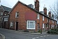
 1 Denfield - geograph.org.uk - 5137577.jpg 1,000 × 662; 961 KB
-
 1-11 and 13-19 High Street - geograph.org.uk - 5538360.jpg 1,000 × 662; 671 KB
-
 1-11 High Street - geograph.org.uk - 5538214.jpg 662 × 1,000; 707 KB
-
 101-105 and 111-117 High Street - geograph.org.uk - 5536419.jpg 1,000 × 662; 608 KB
-
 11 - 12 Rose Hill - geograph.org.uk - 5138387.jpg 1,000 × 662; 678 KB
-
 11 West Street Dorking.jpg 3,264 × 2,448; 2.02 MB
-
 155-161 and 163-171 High Street - geograph.org.uk - 5536364.jpg 1,000 × 662; 744 KB
-
 179-195 High Street - geograph.org.uk - 5535323.jpg 1,000 × 662; 695 KB
-
 188 - 192 High Street - geograph.org.uk - 5146543.jpg 1,000 × 662; 671 KB
-
 199-205 High Street - geograph.org.uk - 5535180.jpg 1,000 × 662; 700 KB
-
 2 - 10 Knoll Road - geograph.org.uk - 5137583.jpg 1,000 × 662; 880 KB
-
 2 K6 Telephone Kiosks - geograph.org.uk - 3373901.jpg 1,600 × 1,200; 469 KB
-
 2 South Street - geograph.org.uk - 5543896.jpg 662 × 1,000; 683 KB
-
 2-6 South Street - geograph.org.uk - 5543341.jpg 1,000 × 662; 676 KB
-
 22 Rose Hill Dorking.jpg 2,448 × 3,264; 2.51 MB
-
 23 and 24 Rose Hill Dorking.jpg 3,264 × 2,448; 2.35 MB
-
 285-293 High Street - geograph.org.uk - 5535168.jpg 1,000 × 662; 579 KB
-
 29-31 High Street - geograph.org.uk - 5537430.jpg 662 × 1,000; 552 KB
-
 3 & 4 West Street Dorking.jpg 3,264 × 2,448; 1.85 MB
-
 3 - 4 and 5 - 6 Rose Hill - geograph.org.uk - 5124727.jpg 1,000 × 662; 766 KB
-
 3 - 4 Rose Hill - geograph.org.uk - 5138508.jpg 1,000 × 662; 954 KB
-
 3 - 4 Rose Hill - geograph.org.uk - 5138512.jpg 662 × 1,000; 936 KB
-
 3 and 4 Rose Hill Dorking.jpg 3,264 × 2,448; 3.24 MB
-
 34 and 35 Dene Street - geograph.org.uk - 5132634.jpg 1,000 × 662; 662 KB
-
 35 - 38 Dene Street - geograph.org.uk - 5132644.jpg 1,000 × 662; 740 KB
-
 35 - 38 Dene Street Dorking.jpg 3,264 × 2,448; 2.16 MB
-
 37-39 High Street - geograph.org.uk - 5537424.jpg 1,000 × 662; 579 KB
-
 38-40 South Street - geograph.org.uk - 5545009.jpg 1,000 × 662; 651 KB
-
 41 and 42 Dene Street - geograph.org.uk - 5132653.jpg 1,000 × 662; 620 KB
-
 41 Dene Street Easter Cottage Dorking.jpg 3,264 × 2,448; 1.56 MB
-
 41-47, 51-53 and 55 High Street - geograph.org.uk - 5537267.jpg 1,000 × 662; 657 KB
-
 5 - 6 Rose Hill - geograph.org.uk - 5138409.jpg 1,000 × 662; 1.06 MB
-
 5&6 West Street Dorking.jpg 3,264 × 2,448; 2.36 MB
-
 553 of '(Our own country. Descriptive, historical, pictorial.)' (11296637554).jpg 1,470 × 1,017; 441 KB
-
 62-64 and 66-70 South Street - geograph.org.uk - 5545338.jpg 1,000 × 662; 660 KB
-
 63 Dene Street Dorking.jpg 3,264 × 2,448; 1.4 MB
-
 67-68 West Street - geograph.org.uk - 5551211.jpg 662 × 1,000; 582 KB
-
 69-79 High Street - geograph.org.uk - 5536425.jpg 662 × 1,000; 751 KB
-
 7 West Street Dorking.jpg 3,264 × 2,448; 1.67 MB
-
 70 and 71 Dene Street Dorking.jpg 3,264 × 2,448; 1.84 MB
-
 8 - 10 Cotmandene - geograph.org.uk - 5145433.jpg 1,000 × 662; 704 KB
-
 87-99 High Street - geograph.org.uk - 5536393.jpg 1,000 × 662; 700 KB
-
 89 - 93 South Street - geograph.org.uk - 5138370.jpg 1,000 × 662; 578 KB
-
 9 - 31 Lincoln Road - geograph.org.uk - 5161041.jpg 1,000 × 662; 674 KB
-
 9 Rose Hill - geograph.org.uk - 5126677.jpg 1,000 × 662; 858 KB
-
 97 South Street - geograph.org.uk - 5138382.jpg 1,000 × 662; 638 KB
-

-

-
 A2003 - geograph.org.uk - 4875153.jpg 640 × 426; 62 KB
-
 A2003 - geograph.org.uk - 4875165.jpg 640 × 426; 68 KB
-
 A24 - geograph.org.uk - 3373733.jpg 640 × 320; 36 KB
-
 A24 - geograph.org.uk - 4799606.jpg 640 × 426; 55 KB
-
 A24 - geograph.org.uk - 5141526.jpg 640 × 426; 56 KB
-
 A24 - geograph.org.uk - 5345243.jpg 640 × 426; 62 KB
-
 A24 approaching Deepdene Roundabout - geograph.org.uk - 4861851.jpg 640 × 360; 43 KB
-
 A24 from the North Downs Line - geograph.org.uk - 2271666.jpg 640 × 384; 52 KB
-
 A24 in Dorking - geograph.org.uk - 2271669.jpg 640 × 326; 50 KB
-
 A24, Dorking - geograph.org.uk - 3033077.jpg 640 × 430; 46 KB
-
 A24, Dorking - geograph.org.uk - 3953204.jpg 640 × 362; 63 KB
-
 A24, northbound - geograph.org.uk - 4892896.jpg 640 × 296; 56 KB
-
 A24, southbound - geograph.org.uk - 4861826.jpg 640 × 314; 50 KB
-
 A25, Reigate Rd - geograph.org.uk - 4865905.jpg 640 × 426; 68 KB
-
 Active Learning House - geograph.org.uk - 5146549.jpg 1,000 × 662; 676 KB
-
 After the road race - geograph.org.uk - 3060636.jpg 2,000 × 2,863; 1,002 KB
-
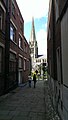 Alleyway to St Martin's Church, Dorking - geograph.org.uk - 6154788.jpg 579 × 1,024; 134 KB
-
 Allotments - geograph.org.uk - 5345254.jpg 640 × 426; 84 KB
-
 Allotments by the railway - geograph.org.uk - 2271692.jpg 640 × 309; 42 KB
-
 Allotments by Tower Hill - geograph.org.uk - 1193605.jpg 640 × 480; 98 KB
-
 Allotments on the edge of Dorking - geograph.org.uk - 2271696.jpg 640 × 312; 32 KB
-
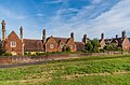
 Almshouses - geograph.org.uk - 5132900.jpg 1,000 × 662; 827 KB
-
 Almshouses - geograph.org.uk - 5132903.jpg 1,000 × 662; 722 KB
-
 Almshouses - geograph.org.uk - 5132905.jpg 1,000 × 662; 810 KB
-
 Almshouses - geograph.org.uk - 5134043.jpg 1,000 × 662; 723 KB
-
 Almshouses, Cotmandene, Dorking 1.jpg 2,448 × 3,264; 1.99 MB
-
 Almshouses, Cotmandene, Dorking 2.jpg 3,264 × 2,448; 1.97 MB
-
 Almshouses, Cotmandene, Dorking 3.jpg 3,264 × 2,448; 2.03 MB
-
 Almshouses, Cotmandene, Dorking 4.jpg 2,448 × 3,264; 2.12 MB
-
 An ex-corner shop - geograph.org.uk - 4875128.jpg 640 × 426; 79 KB
-
 Ansell Road, Dorking - geograph.org.uk - 3338986.jpg 1,600 × 1,134; 322 KB
-
 Antiques Quarter, Dorking - geograph.org.uk - 2377727.jpg 2,560 × 1,920; 1.81 MB
-
 Antiques Road Show - geograph.org.uk - 2378638.jpg 2,560 × 1,920; 1.82 MB
-

-

-
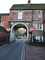 Arch Leading to Rose Hill - geograph.org.uk - 108529.jpg 480 × 640; 173 KB
-
 Arch, Rose Hill House - geograph.org.uk - 5135070.jpg 662 × 1,000; 856 KB
-
 Arched entrance to Victorian Housing Estate, Dorking - geograph.org.uk - 2115727.jpg 2,304 × 3,072; 3.36 MB
-
 Archway Place - geograph.org.uk - 5532900.jpg 1,000 × 662; 831 KB
-
 Arundel Road - geograph.org.uk - 5138306.jpg 1,000 × 662; 651 KB
-
 Ashcombe - geograph.org.uk - 3028923.jpg 425 × 640; 297 KB
-
 Ashcombe Road - geograph.org.uk - 1849021.jpg 640 × 426; 157 KB
-
 Ashcombe Road - geograph.org.uk - 5158885.jpg 1,000 × 662; 797 KB
-
 Ashcombe Road, Dorking - geograph.org.uk - 2699962.jpg 1,600 × 1,200; 616 KB
-
 Ashcombe Road, Dorking - geograph.org.uk - 5682066.jpg 1,280 × 851; 488 KB
-
 Ashcombe School - geograph.org.uk - 1849013.jpg 640 × 426; 78 KB
-
 Ashcombe School - geograph.org.uk - 2699947.jpg 1,600 × 1,200; 427 KB
-
 Ashcombe School - geograph.org.uk - 2699990.jpg 1,600 × 1,200; 553 KB
-
 Atherstone - geograph.org.uk - 5143963.jpg 1,000 × 662; 866 KB
-
 Barn off Coldharbour Lane - geograph.org.uk - 4889442.jpg 640 × 426; 59 KB
-
 Bartholomew Press - geograph.org.uk - 5137471.jpg 1,000 × 662; 883 KB
-
 Beehive Cottage - geograph.org.uk - 5138586.jpg 1,000 × 662; 804 KB
-
 Bench on The Nower, Dorking - geograph.org.uk - 6240704.jpg 1,024 × 768; 186 KB
-
 Bench with a view over Dorking - geograph.org.uk - 6240523.jpg 1,024 × 768; 289 KB
-
 Bents Brook - geograph.org.uk - 1193683.jpg 480 × 640; 147 KB
-
 Beresford Road - geograph.org.uk - 5125400.jpg 1,000 × 662; 744 KB
-
 Beresford Road - geograph.org.uk - 5125402.jpg 1,000 × 662; 786 KB
-
 Beresford Road - geograph.org.uk - 5138531.jpg 1,000 × 662; 586 KB
-
 Beresford Road - geograph.org.uk - 5138533.jpg 1,000 × 662; 590 KB
-
-
 Blue Plaque, Dorking, Surrey - geograph.org.uk - 1396039.jpg 428 × 640; 49 KB
-
 Bluebells - geograph.org.uk - 5167480.jpg 1,000 × 662; 609 KB
-
 Box Hill viewpoint - geograph.org.uk - 656348.jpg 1,800 × 1,185; 2.17 MB
-
 Box Hill, view over Dorking (1 mile) - geograph.org.uk - 558741.jpg 640 × 480; 74 KB
-
 Bridge over Pipp Brook, Dorking - geograph.org.uk - 6240729.jpg 1,024 × 768; 324 KB
-
 Bridleway at Old Bury Hill Lodge - geograph.org.uk - 1708374.jpg 427 × 640; 102 KB
-
 Bridleway in Bridlegate Copse - geograph.org.uk - 1710492.jpg 640 × 427; 102 KB
-
 Bridleway Near Dorking, Surrey - geograph.org.uk - 1395989.jpg 640 × 428; 112 KB
-
 Bridleway to Chadhurst Farm - geograph.org.uk - 1708897.jpg 640 × 427; 104 KB
-
 British country - panoramio.jpg 5,102 × 1,534; 1.5 MB
-
 Building site, Dorking - geograph.org.uk - 4950225.jpg 3,091 × 2,048; 1.54 MB
-
 Bungalows, South Terrace - geograph.org.uk - 5168741.jpg 1,000 × 662; 725 KB
-
 Bury Hill - Trig Point - geograph.org.uk - 5251489.jpg 1,920 × 2,560; 2.19 MB
-
 Bury Hill Above the Mist - geograph.org.uk - 2705799.jpg 2,560 × 1,920; 1.26 MB
-
 Bus (1302851971).jpg 2,739 × 2,171; 3.27 MB
-
 Butter Hill Dorking.jpg 2,448 × 3,264; 2.35 MB
-
 Cafe Rouge 170 High Street Dorking.jpg 3,264 × 2,448; 1.55 MB
-
 Café Rouge - geograph.org.uk - 4866022.jpg 640 × 426; 65 KB
-
 Café Rouge, Dorking - geograph.org.uk - 4096372.jpg 4,320 × 3,240; 1.86 MB
-
 Café Rouge, Dorking - geograph.org.uk - 6081877.jpg 800 × 600; 98 KB
-
 Calvert Gardens - geograph.org.uk - 5156965.jpg 1,000 × 662; 746 KB
-
 Calvert Road - geograph.org.uk - 5156953.jpg 1,000 × 662; 669 KB
-
 Calvert Road, Dorking - geograph.org.uk - 4185743.jpg 4,000 × 2,728; 2.44 MB
-
 CAMHS and Dene Street Centre, Dene Street - geograph.org.uk - 5132609.jpg 1,000 × 662; 779 KB
-
 Caves (geograph 5398103).jpg 1,000 × 662; 1.02 MB
-
 Chadhurst Farm House, Coldharbour Lane, Dorking.jpg 3,000 × 1,983; 2.08 MB
-
 Chadhurst Farmhouse - geograph.org.uk - 1708927.jpg 640 × 427; 105 KB
-
 Chadhurst Farmhouse, Dorking, Coldharbour Lane.jpg 3,500 × 2,336; 2.39 MB
-
 Chalk Lane - geograph.org.uk - 1003241.jpg 640 × 427; 100 KB
-
 Chalkpit Lane - geograph.org.uk - 5158924.jpg 1,000 × 662; 651 KB
-
 Chalkpit Terrace - geograph.org.uk - 5147353.jpg 1,000 × 662; 638 KB
-
 Chalkpit Terrace - geograph.org.uk - 5157119.jpg 1,000 × 662; 709 KB
-
 Chalkpit Terrace - geograph.org.uk - 5157123.jpg 1,000 × 662; 687 KB
-
 Chalkpit Terrace - geograph.org.uk - 5157128.jpg 1,000 × 662; 723 KB
-
 Chapel Court - geograph.org.uk - 5532894.jpg 1,000 × 662; 829 KB
-
 Charles Allen Figure - geograph.org.uk - 2377640.jpg 640 × 480; 56 KB
-
 Charles Allen Plaque - geograph.org.uk - 2377630.jpg 2,560 × 1,920; 1.88 MB
-
 Chart Lane, Dorking - geograph.org.uk - 2647478.jpg 640 × 353; 135 KB
-
 Chequers Place - geograph.org.uk - 5135051.jpg 1,000 × 662; 921 KB
-
 Chequers Place - geograph.org.uk - 5138530.jpg 1,000 × 662; 513 KB
-
 Chichester Road - geograph.org.uk - 5156940.jpg 1,000 × 662; 829 KB
-
 Chichester Road Pyracanthas - geograph.org.uk - 1502995.jpg 640 × 428; 163 KB
-
 Chicken on a Stick - geograph.org.uk - 1193773.jpg 640 × 480; 130 KB
-
 Christique Antique Centre - geograph.org.uk - 4096337.jpg 4,320 × 3,240; 1.96 MB
-
 Church Court, Church Street - geograph.org.uk - 2259702.jpg 640 × 426; 186 KB
-
 Church of St Martin ^ War Memorial - geograph.org.uk - 4875108.jpg 640 × 424; 65 KB
-
 Church of St Martin ^ War Memorial - geograph.org.uk - 4875110.jpg 426 × 640; 54 KB
-
 Church Square, Dorking - geograph.org.uk - 3126655.jpg 640 × 480; 481 KB
-
 Church Street, Dorking - geograph.org.uk - 4442108.jpg 2,028 × 1,520; 2.58 MB
-
 Clarendon House - geograph.org.uk - 4884680.jpg 640 × 426; 51 KB
-
 Clarendon House West Street Dorking.jpg 3,264 × 2,448; 1.67 MB
-
 Claygate Road - geograph.org.uk - 5167497.jpg 1,000 × 662; 801 KB
-
 Claygate Road - geograph.org.uk - 5167500.jpg 1,000 × 662; 813 KB
-
 Cleardene - geograph.org.uk - 5122110.jpg 1,000 × 662; 730 KB
-
 Cleardene - geograph.org.uk - 5138588.jpg 1,000 × 662; 597 KB
-
 Cleardene - geograph.org.uk - 5145441.jpg 1,000 × 662; 747 KB
-
 Cliftonville - geograph.org.uk - 5137607.jpg 1,000 × 662; 966 KB
-
 Clock face within decorative fanlight, Dorking Post Office - geograph.org.uk - 3060533.jpg 2,890 × 1,650; 1.04 MB
-
 Cobbet's Real Ale - geograph.org.uk - 4885056.jpg 640 × 426; 68 KB
-
 Cobbetts, Dorking - geograph.org.uk - 5683004.jpg 851 × 1,280; 290 KB
-
 Coldharbour Lane - geograph.org.uk - 4889318.jpg 640 × 426; 108 KB
-
 Coldharbour Lane - geograph.org.uk - 4889375.jpg 640 × 426; 134 KB
-
 Coldharbour Lane - geograph.org.uk - 4889378.jpg 640 × 426; 89 KB
-
 Coldharbour Lane - geograph.org.uk - 4889398.jpg 640 × 426; 113 KB
-
 Coldharbour Lane - geograph.org.uk - 4889403.jpg 640 × 426; 108 KB
-
 Coldharbour Lane - geograph.org.uk - 4889415.jpg 640 × 426; 81 KB
-
 Coldharbour Lane - geograph.org.uk - 4889445.jpg 640 × 426; 95 KB
-
 Coldharbour Lane - geograph.org.uk - 4889449.jpg 640 × 426; 96 KB
-
 Coldharbour Lane - geograph.org.uk - 4892861.jpg 640 × 384; 96 KB
-
 Coldharbour Lane - geograph.org.uk - 4946658.jpg 640 × 426; 92 KB
-
 Coldharbour Lane - geograph.org.uk - 4946659.jpg 640 × 426; 80 KB
-
 Coldharbour Lane - geograph.org.uk - 4946660.jpg 640 × 426; 66 KB
-
 Congregational Church - geograph.org.uk - 4875146.jpg 640 × 426; 80 KB
-
 Congregational Church - geograph.org.uk - 4875147.jpg 640 × 426; 96 KB
-
 Converted warehouse, Station Rd - geograph.org.uk - 4875172.jpg 640 × 426; 102 KB
-
 Corner of South Street and Junction Road, Dorking - geograph.org.uk - 4096392.jpg 2,646 × 1,986; 911 KB
-
 Cotmandene - geograph.org.uk - 5125000.jpg 1,000 × 662; 635 KB
-
 Cotmandene - geograph.org.uk - 5125080.jpg 1,000 × 662; 820 KB
-
 Cotmandene - geograph.org.uk - 5143955.jpg 1,000 × 662; 730 KB
-
 Cotmandene - geograph.org.uk - 5144882.jpg 1,000 × 662; 784 KB
-
 Cotmandene - geograph.org.uk - 5144889.jpg 1,000 × 662; 776 KB
-
 Cotmandene - geograph.org.uk - 5146125.jpg 1,000 × 662; 690 KB
-
 Cotmandene - geograph.org.uk - 5146550.jpg 1,000 × 662; 670 KB
-
 Cotmandene - geograph.org.uk - 5146553.jpg 1,000 × 662; 628 KB
-
 Cotmandene - geograph.org.uk - 5146555.jpg 1,000 × 662; 904 KB
-
 Cotmandene House Dene Street Dorking 2.jpg 3,264 × 2,448; 2.62 MB
-
 Cotmandene House Dene Street Dorking.jpg 2,448 × 3,264; 2.52 MB
-
 Cotmandene Lodge - geograph.org.uk - 5126538.jpg 1,000 × 662; 832 KB
-
 Cotmandene Spring - geograph.org.uk - 2377533.jpg 2,560 × 1,920; 1.81 MB


%27_(11296637554).jpg)


_-_geograph.org.uk_-_558741.jpg)


.jpg)


.jpg)


