Category:Dorpskerk, Aagtekerke
Jump to navigation
Jump to search
| Object location | | View all coordinates using: OpenStreetMap |
|---|
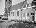
church building in Veere, Netherlands 1.JPG) | |||||
| Upload media | |||||
| Instance of | |||||
|---|---|---|---|---|---|
| Named after | |||||
| Location | Aagtekerke, Veere, Zeeland, Netherlands | ||||
| Street address |
| ||||
| Located on street |
| ||||
| Architectural style | |||||
| Has part(s) | |||||
| Heritage designation |
| ||||
| Inception |
| ||||
| Significant event |
| ||||
 | |||||
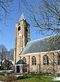
Toren (steeple tower):
|
This is a category about rijksmonument number 28105
|
Kerk (church):
|
This is a category about rijksmonument number 28106
|
| Address |
|
Subcategories
This category has the following 2 subcategories, out of 2 total.
I
T
Media in category "Dorpskerk, Aagtekerke"
The following 16 files are in this category, out of 16 total.
-
 Aflat II.jpg 2,048 × 1,536; 1.35 MB
-
 Detail toegangshek kerk - Aagtekerke - 20003065 - RCE.jpg 802 × 1,200; 154 KB
-
 Exterieur zuid-zijde naar het noord-oosten - Aagtekerke - 20003053 - RCE.jpg 1,200 × 947; 336 KB
-
 Exterieur zuid-zijde naar het noord-westen - Aagtekerke - 20003052 - RCE.jpg 1,200 × 956; 337 KB
-
 Ingangshek Kerk - Aagtekerke - 20003066 - RCE.jpg 1,200 × 801; 253 KB
-
 Kerk, exterieur - Aagtekerke - 20003063 - RCE.jpg 1,200 × 802; 193 KB
-
 Overzicht - Aagtekerke - 20003073 - RCE.jpg 1,200 × 802; 172 KB
-
 Overzicht met Toren - Aagtekerke - 20003050 - RCE.jpg 1,200 × 803; 141 KB
-

-
 Overzicht zuidwestgevel met kerktoren - Aagtekerke - 20352675 - RCE.jpg 941 × 1,200; 310 KB
-
 Protestanste Kerk (Aagtekerke)1.JPG 1,697 × 1,506; 1.17 MB
-
 Protestanste Kerk (Aagtekerke)2.jpg 1,281 × 1,747; 907 KB
-
 Protestanste Kerk (Aagtekerke)3.jpg 1,711 × 1,279; 1.05 MB
-
 Protestanste Kerk (Aagtekerke)4.jpg 1,738 × 1,110; 1,021 KB
-
 Raadhuis en Nederlands Hervormde Kerk - Aagtekerke - 20003051 - RCE.jpg 1,200 × 805; 198 KB
-
 Toegangshek kerkhof Hervormde Kerk - Aagtekerke - 20003064 - RCE.jpg 1,200 × 804; 286 KB


2.jpg)
3.jpg)
4.jpg)

