Category:Dorpskerk, Ruurlo
Jump to navigation
Jump to search
| Object location | | View all coordinates using: OpenStreetMap |
|---|
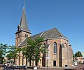
church building in Berkelland, Netherlands  | |||||
| Upload media | |||||
| Instance of | |||||
|---|---|---|---|---|---|
| Location | Ruurlo, Gelderland, Netherlands | ||||
| Street address |
| ||||
| Located on street |
| ||||
| Heritage designation |
| ||||
| Inception |
| ||||
 | |||||
|
This is a category about rijksmonument number 32991
|
| Address |
|
Subcategories
This category has only the following subcategory.
I
- Interior of Dorpskerk, Ruurlo (15 F)
Media in category "Dorpskerk, Ruurlo"
The following 8 files are in this category, out of 8 total.
-
 Dorpskerk Ruurlo gefotografeerd door Rembrandt Kalkhoven.jpg 3,060 × 4,080; 3.11 MB
-
 Exterieur - Ruurlo - 20194024 - RCE.jpg 1,200 × 945; 276 KB
-
 Exterieur - Ruurlo - 20194025 - RCE.jpg 1,200 × 945; 243 KB
-
 Kerk vanuit het zuid-westen - Ruurlo - 20194023 - RCE.jpg 1,200 × 881; 260 KB
-
 Overzicht zuid-oost gevel - Ruurlo - 20194031 - RCE.jpg 1,200 × 1,197; 312 KB
-
 Ruurlo, kerk1 foto4 2010-07-19 10.37.JPG 3,024 × 2,510; 5.38 MB
-
 Ruurlo.JPG 2,304 × 1,728; 1.63 MB
-
 The protestant church of Ruurlo ands its square - panoramio.jpg 4,928 × 3,264; 3.44 MB


