Category:Dorpskerk (Castricum)
Jump to navigation
Jump to search
| Object location | | View all coordinates using: OpenStreetMap |
|---|
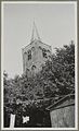
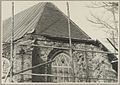
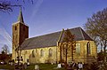
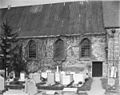
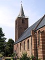
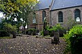
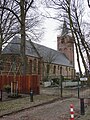
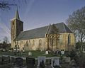
Nederlands: Afbeeldingen van de Dorpskerk, Kerkpad 1, 1901 GV Castricum. Gelegen in Castricum in de provincie Noord-Holland in het noordwesten van Nederland. Het is een Rijksmonument
|
This is a category about rijksmonument number 11478
|
church building in Castricum, Netherlands  | |||||
| Upload media | |||||
| Instance of | |||||
|---|---|---|---|---|---|
| Location | Castricum, North Holland, Netherlands | ||||
| Street address |
| ||||
| Located on street |
| ||||
| Heritage designation |
| ||||
 | |||||
Subcategories
This category has only the following subcategory.
I
Media in category "Dorpskerk (Castricum)"
The following 40 files are in this category, out of 40 total.
-
 Bovenste deel toren - Castricum - 20323283 - RCE.jpg 724 × 1,200; 147 KB
-
 Bovenste deel toren - Castricum - 20323367 - RCE.jpg 729 × 1,200; 164 KB
-
 Bovenste deel toren - Castricum - 20323368 - RCE.jpg 726 × 1,200; 112 KB
-
 Bovenzijde koor tijdens restauratie - Castricum - 20324420 - RCE.jpg 1,200 × 851; 206 KB
-
 Castricum zuidgevel en oostgevel 20396805.jpg 1,199 × 786; 875 KB
-
 Commonwealth War Graves - The Netherlands - Castricum Protestant Churchyard.jpg 3,264 × 2,448; 3.44 MB
-
 Deel gevel met raam - Castricum - 20324422 - RCE.jpg 1,200 × 864; 257 KB
-
 Deel gevel met ramen - Castricum - 20324423 - RCE.jpg 1,200 × 854; 258 KB
-
 Deel gevel schip en begraafplaats - Castricum - 20324418 - RCE.jpg 1,200 × 854; 275 KB
-
 Detail exterieur aan de zuid-zijde - Castricum - 20046663 - RCE.jpg 945 × 1,200; 352 KB
-
 Detail noord gevel van het schip - Castricum - 20046667 - RCE.jpg 1,200 × 935; 387 KB
-
 Detail noord gevel van het schip - Castricum - 20046669 - RCE.jpg 1,200 × 945; 371 KB
-
 Detail noord-gevel van de toren - Castricum - 20046670 - RCE.jpg 1,200 × 939; 384 KB
-
 Detail noord-zijde van de toren - Castricum - 20046668 - RCE.jpg 950 × 1,200; 314 KB
-
 Detail zuid gevel van het schip - Castricum - 20046664 - RCE.jpg 1,200 × 950; 312 KB
-
 Deur - Castricum - 20324419 - RCE.jpg 1,200 × 846; 214 KB
-
 Dorpskerkcastricum.jpg 600 × 800; 197 KB
-
 Exterieur naar het noord-westen - Castricum - 20046650 - RCE.jpg 1,200 × 886; 330 KB
-
 Exterieur naar het noord-westen - Castricum - 20046651 - RCE.jpg 882 × 1,200; 219 KB
-
 Exterieur naar het noord-westen - Castricum - 20046652 - RCE.jpg 1,200 × 889; 238 KB
-
 Exterieur naar het noord-westen - Castricum - 20046662 - RCE.jpg 937 × 1,200; 282 KB
-
 Exterieur naar het oosten - Castricum - 20046646 - RCE.jpg 877 × 1,200; 227 KB
-
 Exterieur naar het zuid-oosten - Castricum - 20046649 - RCE.jpg 889 × 1,200; 165 KB
-
 Exterieur naar het zuid-westen - Castricum - 20046647 - RCE.jpg 1,200 × 888; 270 KB
-
 Exterieur naar het zuid-westen - Castricum - 20046648 - RCE.jpg 1,200 × 883; 266 KB
-
 Exterieur naar het zuid-westen - Castricum - 20046666 - RCE.jpg 1,200 × 941; 321 KB
-
 Gevel met ramen en deur - Castricum - 20324421 - RCE.jpg 1,200 × 852; 253 KB
-
 GM-Kerkepad-1-Castricum-1.JPG 4,928 × 3,264; 3.84 MB
-
 GM-Kerkepad-1-Castricum-2.JPG 4,928 × 3,264; 3.13 MB
-
 Grafzerk in de toren - Castricum - 20323281 - RCE.jpg 889 × 1,200; 235 KB
-
 Interieur naar het oosten - Castricum - 20046674 - RCE.jpg 1,200 × 957; 192 KB
-
 Interieur naar het oosten - Castricum - 20046675 - RCE.jpg 1,200 × 952; 158 KB
-
 Karke castricum.jpg 300 × 400; 139 KB
-
 Noord-gevel - Castricum - 20046676 - RCE.jpg 1,200 × 959; 367 KB
-
 Overzicht zuidgevel - Castricum - 20046672 - RCE.jpg 860 × 1,200; 206 KB
-
 Overzicht zuidgevel en oostgevel - Castricum - 20396805 - RCE.jpg 1,200 × 957; 230 KB
-
 Overzicht zuidgevel en toren - Castricum - 20046673 - RCE.jpg 1,200 × 894; 290 KB
-
 Toren gezien vanuit het zuiden - Castricum - 20324369 - RCE.jpg 849 × 1,200; 155 KB
-
 Zuid-gevel - Castricum - 20046678 - RCE.jpg 1,200 × 956; 275 KB
-
 Zuid-gevel met toren - Castricum - 20046677 - RCE.jpg 961 × 1,200; 221 KB


