Category:Dorpsstraat 45, Cadier en Keer
Jump to navigation
Jump to search
| Object location | | View all coordinates using: OpenStreetMap |
|---|
building in Cadier en Keer, Netherlands .JPG) | |||||
| Upload media | |||||
| Instance of | |||||
|---|---|---|---|---|---|
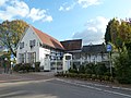
| Location | Cadier en Keer, Eijsden-Margraten, Limburg, Netherlands | ||||
| Street address |
| ||||
| Located on street |
| ||||
| Heritage designation |
| ||||
 | |||||
|
This is a category about rijksmonument number 46785
|
| Address |
|
Subcategories
This category has only the following subcategory.
Media in category "Dorpsstraat 45, Cadier en Keer"
The following 6 files are in this category, out of 6 total.
-
 Cadier en Keer-Dorpsstraat 45 (1).JPG 4,000 × 3,000; 4.73 MB
-
 Cadier en Keer-Dorpsstraat 45 (2).JPG 4,000 × 3,000; 4.97 MB
-
 Overzicht - Cadier en Keer - 20046324 - RCE.jpg 1,200 × 788; 221 KB
-
 Overzicht - Cadier en Keer - 20046330 - RCE.jpg 1,200 × 805; 180 KB
-
 Voor- en linker zijgevel - Cadier en Keer - 20046326 - RCE.jpg 1,200 × 788; 228 KB
-
 Voor- en rechter zijgevel - Cadier en Keer - 20046325 - RCE.jpg 1,200 × 788; 206 KB
.JPG)


