Category:Drayton, Vale of White Horse
Jump to navigation
Jump to search
village and civil parish in Vale of White Horse district, Oxfordshire, England  | |||||
| Upload media | |||||
| Instance of | |||||
|---|---|---|---|---|---|
| Location | Vale of White Horse, Oxfordshire, South East England, England | ||||
| Different from | |||||
| official website | |||||
 | |||||
English: Drayton is a village south of Abingdon. It was part of Berkshire until the 1974 boundary changes.
Subcategories
This category has the following 6 subcategories, out of 6 total.
Media in category "Drayton, Vale of White Horse"
The following 200 files are in this category, out of 333 total.
(previous page) (next page)-
 'The Old School', High Street - geograph.org.uk - 3322591.jpg 1,024 × 683; 156 KB
-
 'Windy Ridge', Milton Road - geograph.org.uk - 3308087.jpg 1,024 × 683; 221 KB
-
 A bridleway crosses a drain - geograph.org.uk - 4883217.jpg 1,500 × 1,125; 334 KB
-
 A drain between fields near Drayton - geograph.org.uk - 4883192.jpg 1,500 × 1,128; 367 KB
-
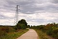
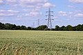
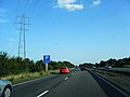 A34 and pylon near Drayton - geograph.org.uk - 3103546.jpg 640 × 480; 48 KB
-
 A34 bridge carrying farm track from Drayton - geograph.org.uk - 2534026.jpg 3,648 × 2,736; 1.57 MB
-
 A34 footbridge carrying path from Drayton - geograph.org.uk - 2534014.jpg 3,126 × 1,984; 778 KB
-
 A34 near Drayton - geograph.org.uk - 2924846.jpg 1,600 × 998; 274 KB
-
 A34 near Drayton - geograph.org.uk - 3294984.jpg 640 × 427; 320 KB
-
 A34 north-west of Drayton - geograph.org.uk - 3103540.jpg 640 × 480; 53 KB
-
 A34 northbound - geograph.org.uk - 3341404.jpg 640 × 480; 48 KB
-
 A34 northbound - geograph.org.uk - 3341411.jpg 640 × 480; 46 KB
-
 A34 northbound - geograph.org.uk - 3341416.jpg 640 × 480; 43 KB
-
 A34 northbound - geograph.org.uk - 3341424.jpg 640 × 480; 37 KB
-
 A34 northbound - geograph.org.uk - 3341434.jpg 640 × 480; 38 KB
-
 A34 northbound - geograph.org.uk - 5637596.jpg 640 × 428; 80 KB
-
 A34 northbound - geograph.org.uk - 5637602.jpg 640 × 428; 81 KB
-
 A34 northbound - geograph.org.uk - 5637606.jpg 640 × 428; 86 KB
-
 A34 northbound - geograph.org.uk - 5637610.jpg 640 × 428; 79 KB
-
 A34 northbound towards Marcham Interchange - geograph.org.uk - 4688620.jpg 1,600 × 1,200; 485 KB
-
 A34 west of Drayton - geograph.org.uk - 2310541.jpg 640 × 425; 77 KB
-
 Abingdon Road (B4017) - geograph.org.uk - 3322443.jpg 1,024 × 683; 205 KB
-
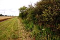
 Along by the hedge - geograph.org.uk - 5679639.jpg 1,024 × 683; 256 KB
-
 Altar back - geograph.org.uk - 5673770.jpg 1,024 × 683; 116 KB
-
 Altar in the chapel - geograph.org.uk - 5673766.jpg 1,024 × 683; 104 KB
-
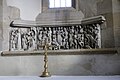
 Altar screen - geograph.org.uk - 5673582.jpg 1,024 × 683; 112 KB
-
 Altar ^ screen - geograph.org.uk - 5673580.jpg 1,024 × 683; 126 KB
-
 An arable field near Landmead Farm - geograph.org.uk - 4883215.jpg 1,500 × 1,121; 191 KB
-
 Arable land near Drayton - geograph.org.uk - 1281605.jpg 640 × 427; 65 KB
-
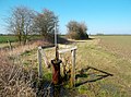 Artesian Borehole - geograph.org.uk - 2904550.jpg 3,552 × 2,624; 2.86 MB
-
 Back in the old park - geograph.org.uk - 5679642.jpg 1,024 × 683; 160 KB
-
 Back of the office - geograph.org.uk - 5680400.jpg 1,024 × 683; 143 KB
-
 Back to the Church - geograph.org.uk - 5680299.jpg 1,024 × 683; 142 KB
-
 Bee on black knapweed - geograph.org.uk - 2584599.jpg 1,500 × 996; 119 KB
-
 Bench by the postbox - geograph.org.uk - 5680413.jpg 1,024 × 683; 208 KB
-
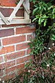
 Benchmark on 'The Old School', ^16 High Street - geograph.org.uk - 3341065.jpg 725 × 1,024; 178 KB
-
 Benchmark on Stonehill Cottage - geograph.org.uk - 3334121.jpg 683 × 1,024; 257 KB
-
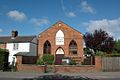
 Benchmark on the front of Drayton Baptist Church - geograph.org.uk - 3322882.jpg 683 × 1,024; 287 KB
-
 Benchmark on tower of St Peter's Church - geograph.org.uk - 3322839.jpg 688 × 1,024; 280 KB
-
 Benchmark on ^1 Milton Road, 'Windy Ridge' - geograph.org.uk - 3308074.jpg 683 × 1,024; 209 KB
-
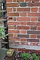
 Benchmark on ^236 Steventon Road - geograph.org.uk - 3308336.jpg 683 × 1,024; 196 KB
-
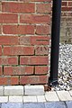
 Benchmark on ^97 Steventon Road - geograph.org.uk - 3308133.jpg 683 × 1,024; 224 KB
-

-
 Bend in path at culverted stream - geograph.org.uk - 5234640.jpg 1,024 × 683; 266 KB
-
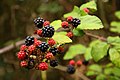 Blackberries by the bridleway - geograph.org.uk - 2584603.jpg 1,500 × 1,000; 114 KB
-
 Blocked gateway - geograph.org.uk - 1900195.jpg 1,024 × 683; 183 KB
-
 Bolton Memorial - geograph.org.uk - 5678713.jpg 1,024 × 683; 48 KB
-
 Bridleway between the hedgerows - geograph.org.uk - 2584610.jpg 1,500 × 1,000; 420 KB
-
 Bridleway by the A34 - geograph.org.uk - 2580980.jpg 1,500 × 1,000; 295 KB
-
 Bridleway by the canal - geograph.org.uk - 2586288.jpg 1,500 × 1,000; 314 KB
-
 Bridleway by the field - geograph.org.uk - 2586290.jpg 1,500 × 1,000; 194 KB
-
 Bridleway by the former canal - geograph.org.uk - 2586298.jpg 1,000 × 1,500; 383 KB
-
 Bridleway junction near Drayton - geograph.org.uk - 2579629.jpg 1,500 × 1,000; 315 KB
-
 Bridleway past the fields - geograph.org.uk - 2580990.jpg 1,500 × 1,000; 229 KB
-
 Bridleway through the gate - geograph.org.uk - 2580976.jpg 1,500 × 1,000; 311 KB
-
 Bridleway through the trees - geograph.org.uk - 2586279.jpg 1,000 × 1,500; 383 KB
-
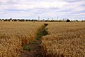 Bridleway through the wheatfield - geograph.org.uk - 2579622.jpg 1,500 × 1,000; 299 KB
-
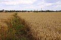
 Bridleway through the wheatfield - geograph.org.uk - 2579634.jpg 1,500 × 1,000; 327 KB
-
 Bridleway to Abingdon - geograph.org.uk - 2576608.jpg 1,500 × 1,000; 187 KB
-
 Bridleway to Abingdon Common - geograph.org.uk - 1355055.jpg 640 × 427; 94 KB
-
 Bridleway to Ardington - geograph.org.uk - 2576589.jpg 1,500 × 1,000; 229 KB
-
 Bridleway to Ardington Wick - geograph.org.uk - 2580982.jpg 1,500 × 1,000; 336 KB
-
 Bridleway to Ardington Wick - geograph.org.uk - 2584616.jpg 1,500 × 1,000; 195 KB
-
 Bridleway to Ardington Wick - geograph.org.uk - 2584622.jpg 1,500 × 1,000; 259 KB
-
 Bridleway to Drayton - geograph.org.uk - 2576534.jpg 1,500 × 1,000; 160 KB
-
 Bridleway to Drayton - geograph.org.uk - 2579632.jpg 1,500 × 1,000; 297 KB
-
 Bridleway to Drayton - geograph.org.uk - 2580974.jpg 1,500 × 1,000; 262 KB
-
 Bridleway to Drayton - geograph.org.uk - 2586282.jpg 1,500 × 1,000; 431 KB
-
 Bridleway to Drayton - geograph.org.uk - 2587278.jpg 1,500 × 1,000; 208 KB
-
 Bridleway to Drayton - geograph.org.uk - 2587281.jpg 1,500 × 1,000; 181 KB
-
 Bridleway to Drayton - geograph.org.uk - 4883194.jpg 1,500 × 1,125; 243 KB
-
 Bridleway to Drayton - geograph.org.uk - 4883210.jpg 1,125 × 1,500; 448 KB
-
 Bridleway to Drayton - geograph.org.uk - 4883211.jpg 1,125 × 1,500; 265 KB
-
 Bridleway to Drayton - geograph.org.uk - 4883212.jpg 1,500 × 1,125; 322 KB
-
 Bridleway to Drayton by the A34 - geograph.org.uk - 2580979.jpg 1,500 × 1,000; 286 KB
-
 Bridleway to Landmead Farm - geograph.org.uk - 2576563.jpg 1,500 × 1,000; 311 KB
-
 Bridleway to Landmead Farm - geograph.org.uk - 2576567.jpg 1,500 × 1,000; 287 KB
-
 Bridleway to Landmead Farm - geograph.org.uk - 4883213.jpg 1,500 × 1,125; 317 KB
-
 Bridleway to Manor Farm - geograph.org.uk - 2576498.jpg 1,500 × 1,000; 153 KB
-
 Bridleway to Manor Farm - geograph.org.uk - 2576522.jpg 1,500 × 1,000; 165 KB
-
 Bridleway to Manor Farm - geograph.org.uk - 2576539.jpg 1,500 × 1,000; 191 KB
-
 Bridleway to Marcham - geograph.org.uk - 2576586.jpg 1,500 × 1,000; 212 KB
-
 Bridleway to Marcham Mill - geograph.org.uk - 2576612.jpg 1,500 × 1,000; 406 KB
-
 Bridleway to Marcham Mill - geograph.org.uk - 2579626.jpg 1,500 × 1,000; 283 KB
-
 Bridleway to Marcham Mill - geograph.org.uk - 2580973.jpg 1,500 × 1,000; 173 KB
-
 Bridleway to Sutton Wick - geograph.org.uk - 1355065.jpg 640 × 427; 96 KB
-
 Bridleway to the A338 - geograph.org.uk - 4883196.jpg 1,500 × 1,092; 315 KB
-
 Bridleway to Willowbrook Farm - geograph.org.uk - 2586292.jpg 1,000 × 1,500; 396 KB
-
 Buildings at New Cut Mill - geograph.org.uk - 3335131.jpg 1,024 × 683; 173 KB
-
 Canal Bed near Drayton Lock - geograph.org.uk - 3061010.jpg 3,968 × 2,232; 2.99 MB
-
 Car boot sale near Drayton - geograph.org.uk - 4623250.jpg 1,500 × 999; 210 KB
-
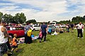 Car boot sale near Drayton - geograph.org.uk - 4623251.jpg 1,500 × 999; 205 KB
-
 Caudwell memorial - geograph.org.uk - 5678405.jpg 533 × 800; 64 KB
-
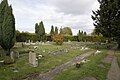
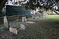
 Cemetery across the road - geograph.org.uk - 5680290.jpg 1,024 × 683; 171 KB
-
 Cemetery near St Peter - geograph.org.uk - 5679637.jpg 1,024 × 683; 252 KB
-
 Chained up box - geograph.org.uk - 5678710.jpg 533 × 800; 83 KB
-
 Chancel in St Peter - geograph.org.uk - 5673574.jpg 1,024 × 683; 113 KB
-
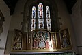
 Chancel ^ chapel - geograph.org.uk - 5673571.jpg 1,024 × 683; 114 KB
-
 Chapel at St Peter - geograph.org.uk - 5679524.jpg 1,024 × 683; 156 KB
-
 Church office - geograph.org.uk - 5680347.jpg 1,024 × 683; 164 KB
-
 Church ^ lychgate - geograph.org.uk - 5679772.jpg 533 × 800; 88 KB
-
 Clarke Headstone - geograph.org.uk - 5680301.jpg 533 × 800; 146 KB
-
 Corner of the cemetery - geograph.org.uk - 5680338.jpg 1,024 × 683; 195 KB
-
 Couple of memorials - geograph.org.uk - 5673763.jpg 1,024 × 683; 66 KB
-

-
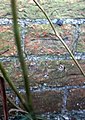
 Culvert in field hedge - geograph.org.uk - 3308191.jpg 1,024 × 683; 285 KB
-

-
 Culvert taking track over former canal - geograph.org.uk - 3340478.jpg 1,024 × 683; 280 KB
-

-
 Dewe memorial - geograph.org.uk - 5678712.jpg 533 × 800; 62 KB
-
 Disused Wilts and Berks canal - geograph.org.uk - 64073.jpg 640 × 480; 112 KB
-
 Ditch beside track towards Sutton Wick - geograph.org.uk - 3349288.jpg 1,024 × 683; 290 KB
-
 Door in the corner - geograph.org.uk - 5673773.jpg 533 × 800; 78 KB
-
 Door in the corner - geograph.org.uk - 5678838.jpg 533 × 800; 71 KB
-
 Drainage ditch by Marcham Mill - geograph.org.uk - 2576610.jpg 1,000 × 1,500; 298 KB
-
 Drainage ditch near Drayton Copse - geograph.org.uk - 2586277.jpg 1,000 × 1,500; 420 KB
-
 Drainage stream by Marcham Mill - geograph.org.uk - 2576614.jpg 1,000 × 1,500; 360 KB
-
 Church Lane, Drayton - geograph.org.uk - 1234061.jpg 640 × 427; 96 KB
-
 Rape field near Drayton - geograph.org.uk - 1281617.jpg 640 × 427; 87 KB
-
 Drayton - geograph.org.uk - 15725.jpg 640 × 479; 77 KB
-
 Drayton Baptist Church viewed across the A4017 - geograph.org.uk - 3322889.jpg 683 × 1,024; 153 KB
-
 Drayton BaptistChurch.jpg 1,024 × 683; 340 KB
-
 Drayton Copse - geograph.org.uk - 2586280.jpg 1,500 × 1,000; 172 KB
-
 Drayton East Way - geograph.org.uk - 3300836.jpg 640 × 480; 56 KB
-
 Drayton Lock - geograph.org.uk - 290071.jpg 640 × 480; 185 KB
-
 Drayton Lock, Wilts ^ Berks Canal - geograph.org.uk - 3020238.jpg 3,968 × 2,232; 2.25 MB
-
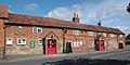
 Drayton Post Office ^ Stores - geograph.org.uk - 6063914.jpg 1,735 × 1,151; 1.09 MB
-
 Drayton RedLion.jpg 1,024 × 512; 291 KB
-
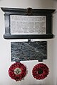 Drayton war memorial - geograph.org.uk - 5678844.jpg 533 × 800; 86 KB
-

-
-
 Mill Brook by Drayton Mill - geograph.org.uk - 1355040.jpg 427 × 640; 126 KB
-
 Stonehill Farm, Drayton - geograph.org.uk - 800810.jpg 640 × 480; 140 KB
-
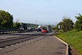 The A34 near Drayton - geograph.org.uk - 1281618.jpg 640 × 427; 58 KB
-
 Village cross in Drayton - geograph.org.uk - 1349054.jpg 640 × 427; 75 KB
-
 Wildflower meadow near Drayton - geograph.org.uk - 1355082.jpg 640 × 427; 81 KB
-
 Pylons, Drayton - geograph.org.uk - 290025.jpg 640 × 480; 87 KB
-
 Dry lock chamber near Drayton - geograph.org.uk - 2586283.jpg 1,000 × 1,500; 323 KB
-
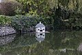 Duck house in the pond - geograph.org.uk - 5680415.jpg 1,024 × 683; 179 KB
-
 East end of the church - geograph.org.uk - 5679534.jpg 1,024 × 683; 156 KB
-
 Elderberries by the bridleway - geograph.org.uk - 2580983.jpg 1,500 × 1,000; 180 KB
-
 Elderberries over the bridleway - geograph.org.uk - 2584619.jpg 1,000 × 1,500; 420 KB
-
 End of the Cemetery - geograph.org.uk - 5680293.jpg 1,024 × 683; 198 KB
-
 Eroded stone - geograph.org.uk - 5680403.jpg 533 × 800; 108 KB
-
 F.E.Robinson - geograph.org.uk - 5680397.jpg 1,024 × 683; 197 KB
-
 Faded memorial - geograph.org.uk - 5679434.jpg 533 × 800; 60 KB
-
 Far end of the churchyard - geograph.org.uk - 5679629.jpg 1,024 × 683; 152 KB
-
 Farm Road Crossing the A34 - geograph.org.uk - 2924837.jpg 3,540 × 2,044; 1.62 MB
-
 Farm track and farmhouse - geograph.org.uk - 2743422.jpg 1,024 × 683; 202 KB
-
 Farmland near the A34 at Drayton - geograph.org.uk - 1281607.jpg 640 × 427; 61 KB
-
 Farmland, Drayton - geograph.org.uk - 6178699.jpg 1,024 × 768; 210 KB
-
 Farmland, Drayton - geograph.org.uk - 6178701.jpg 1,024 × 768; 288 KB
-
 Farmland, Drayton - geograph.org.uk - 6178702.jpg 1,024 × 768; 229 KB
-
 Farmland, Drayton - geograph.org.uk - 6178704.jpg 1,024 × 768; 214 KB
-
 Farmland, Drayton - geograph.org.uk - 6178705.jpg 1,024 × 768; 216 KB
-
 Field by Manor Farm - geograph.org.uk - 2584606.jpg 1,500 × 1,000; 209 KB
-
 Field by the bridleway - geograph.org.uk - 2580989.jpg 1,500 × 1,000; 249 KB
-
 Field by the bridleway - geograph.org.uk - 2586275.jpg 1,000 × 1,500; 229 KB
-
 Field by the hedgerow - geograph.org.uk - 2580986.jpg 1,500 × 1,000; 205 KB
-
 Field of rape by Manor Farm - geograph.org.uk - 2580984.jpg 1,500 × 1,000; 315 KB
-
 Field scabious on the bridleway - geograph.org.uk - 2580988.jpg 1,019 × 1,500; 115 KB
-
 First world war roll of honour - geograph.org.uk - 5679431.jpg 1,024 × 683; 93 KB
-
 Floor of the porch - geograph.org.uk - 5679436.jpg 533 × 800; 77 KB
-
 Font by the screen - geograph.org.uk - 5678701.jpg 533 × 800; 96 KB
-
 Footbridge on the bridleway - geograph.org.uk - 2576605.jpg 1,500 × 1,000; 373 KB
-
 Footpath Gate near Drayton - geograph.org.uk - 3188663.jpg 1,600 × 1,222; 564 KB
-
 Footpath Marker - geograph.org.uk - 3148136.jpg 1,600 × 1,200; 601 KB
-
 Former lock chamber - geograph.org.uk - 2586285.jpg 1,500 × 1,000; 340 KB
-
 Former lock on the canal - geograph.org.uk - 2586287.jpg 1,000 × 1,500; 406 KB
-
 Former Towpath^ - geograph.org.uk - 3020248.jpg 1,024 × 647; 106 KB
-
 From in the pulpit - geograph.org.uk - 5673640.jpg 1,024 × 683; 134 KB
-
 From the arch - geograph.org.uk - 5673636.jpg 533 × 800; 89 KB
-
 Fungi on the bridleway - geograph.org.uk - 2584620.jpg 1,500 × 1,000; 163 KB
-
 Gargoyle one - geograph.org.uk - 5679519.jpg 1,024 × 683; 196 KB
-
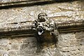 Gargoyle two - geograph.org.uk - 5679521.jpg 1,024 × 683; 195 KB
-
 Gateway into a field - geograph.org.uk - 2584613.jpg 1,500 × 1,000; 217 KB
-
 Gateway on north side of track west of A34 - geograph.org.uk - 3340274.jpg 1,024 × 683; 271 KB
-
 Gateway to a field - geograph.org.uk - 2576543.jpg 1,500 × 981; 217 KB
-
 Graves by the wall - geograph.org.uk - 5680305.jpg 1,024 × 683; 240 KB
-
 Green on Abingdon Road, Drayton - geograph.org.uk - 6065391.jpg 1,872 × 1,202; 1.48 MB
-
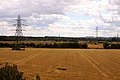 Harvested fields under the wires - geograph.org.uk - 2576487.jpg 1,500 × 1,000; 156 KB
-
 Hawthorn berries by the bridleway - geograph.org.uk - 2576509.jpg 1,500 × 1,000; 274 KB
-
 Hawthorn berries by the bridleway - geograph.org.uk - 2584593.jpg 1,500 × 1,000; 354 KB
-
 Hayward Tomb - geograph.org.uk - 5678397.jpg 533 × 800; 98 KB
-
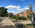 Haywards Road Bus Stop - geograph.org.uk - 4109825.jpg 3,768 × 3,000; 2.78 MB
-
 Head ^ footstone - geograph.org.uk - 5680395.jpg 533 × 800; 141 KB
-
 Headstones by the chapel wall - geograph.org.uk - 5679532.jpg 1,024 × 683; 160 KB
-

-
 Hedgerow by the bridleway - geograph.org.uk - 2576593.jpg 1,500 × 1,000; 357 KB
-
 High Street Drayton - geograph.org.uk - 3300672.jpg 640 × 480; 78 KB
-
 High Street Drayton - geograph.org.uk - 3300690.jpg 640 × 480; 62 KB
-
 High Street, Drayton - geograph.org.uk - 6065382.jpg 1,607 × 1,050; 949 KB
-
 High Street, Drayton - geograph.org.uk - 6065387.jpg 1,864 × 1,190; 1.12 MB
-
 Houses on Steventon Road, Drayton - geograph.org.uk - 6065393.jpg 1,892 × 1,236; 1.93 MB
-
 Houses on Steventon Road, Drayton - geograph.org.uk - 6065395.jpg 1,830 × 1,128; 1.81 MB
-
 Housing at Drayton Mill - geograph.org.uk - 3148092.jpg 2,448 × 1,764; 1.02 MB
-
 Inside the porch - geograph.org.uk - 5679435.jpg 533 × 800; 84 KB
-
 John Tyrrell - geograph.org.uk - 5678401.jpg 533 × 800; 60 KB
-
 Joseph Norrington - geograph.org.uk - 5678709.jpg 533 × 800; 53 KB
-
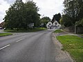
 Junction of High Street and Drayton Road - geograph.org.uk - 3552716.jpg 800 × 600; 136 KB


_-_geograph.org.uk_-_3322443.jpg)


