Category:Drumbeg, Highland
Jump to navigation
Jump to search
village in Highland, Scotland, UK  | |||||
| Upload media | |||||
| Instance of | |||||
|---|---|---|---|---|---|
| Location |
| ||||
 | |||||
English: Drumbeg is a remote crofting village on the north west coast of Scotland in Assynt, Sutherland, Scottish Highlands and is in the Scottish council area of Highland.
Nederlands: Drumbeg ( Schots-Gaelisch: An Druim Beag) is een dorp in het westen van de Schotse Lieutenancy Sutherland in de council Highland met een populatie van ongeveer 60.

Subcategories
This category has the following 2 subcategories, out of 2 total.
A
- Loch Ardbhair (11 F)
L
- Loch Drumbeg (8 F)
Media in category "Drumbeg, Highland"
The following 30 files are in this category, out of 30 total.
-
 2011 Schotland Drumbeg Sutherland 30-05-2011 18-15-57.png 2,914 × 1,821; 8.4 MB
-
 2011 Sutherland Drumbeg Sutherland 30-05-2011 18-15-57.jpg 2,914 × 1,821; 1,012 KB
-
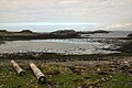
 A pattern of islands - geograph.org.uk - 5904995.jpg 640 × 480; 280 KB
-
 B869 in Drumbeg - geograph.org.uk - 1260819.jpg 640 × 426; 72 KB
-
 Beach at Drumbeg - geograph.org.uk - 450393.jpg 640 × 427; 69 KB
-
 Cattle grid near Drumbeg - geograph.org.uk - 1260851.jpg 640 × 426; 79 KB
-
 Drumbeg - geograph.org.uk - 425020.jpg 600 × 376; 237 KB
-
 Drumbeg Bay and Islands - geograph.org.uk - 3215834.jpg 640 × 439; 59 KB
-
 Drumbeg Stores - geograph.org.uk - 1377445.jpg 640 × 480; 89 KB
-
 Drumbeg Stores and postbox - geograph.org.uk - 1260804.jpg 640 × 426; 77 KB
-
 Drumbeg viewpoint - geograph.org.uk - 2633452.jpg 4,000 × 3,000; 3.27 MB
-
 From Drumbeg Viewpoint - geograph.org.uk - 3041161.jpg 640 × 445; 64 KB
-
 Fruit and Veg. Shop, Drumbeg - geograph.org.uk - 232675.jpg 640 × 384; 78 KB
-
 Information Board, Drumbeg Viewpoint - geograph.org.uk - 232647.jpg 640 × 384; 67 KB
-
 Loch Dhrombaig - 1983 - geograph.org.uk - 2435083.jpg 2,271 × 1,514; 377 KB
-
 Loch Dhrombaig from Drumbeg Viewpoint - geograph.org.uk - 6466468.jpg 1,672 × 1,114; 427 KB
-

-
 Loch Drumbeg - panoramio (3).jpg 2,048 × 1,536; 695 KB
-
 Ordnance Survey One-Inch Sheet 15 Lochinver & Loch Assynt, Published 1947.jpg 12,196 × 9,283; 11.15 MB
-
 Passing place near Drumbeg - geograph.org.uk - 501040.jpg 640 × 407; 75 KB
-
 Port Dhrombaig - geograph.org.uk - 2151936.jpg 640 × 480; 26 KB
-
 Port Drumbeg - geograph.org.uk - 3904119.jpg 1,024 × 768; 213 KB
-
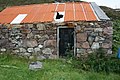 Stone Building - geograph.org.uk - 523760.jpg 640 × 426; 88 KB
-
 Sutherland coast, Scotland, at Drumbeg, 14 April 2011 - Flickr - PhillipC.jpg 4,288 × 2,848; 1.59 MB
-
 Culkein Drumbeg jetty - geograph.org.uk - 450386.jpg 640 × 427; 79 KB
-
 Drumbeg - geograph.org.uk - 243296.jpg 640 × 384; 113 KB
-
 Moorland Near Culkein Drumbeg - geograph.org.uk - 232653.jpg 640 × 384; 92 KB
-
 Port Dhrombaig and Cul Eilean - geograph.org.uk - 248430.jpg 640 × 480; 94 KB
-
 Seaview Cottage - geograph.org.uk - 157074.jpg 640 × 480; 88 KB
-
 Track to Pollachapuill - geograph.org.uk - 232628.jpg 640 × 384; 69 KB


.jpg)


