Category:Drumderg Wind Farm
Jump to navigation
Jump to search
Media in category "Drumderg Wind Farm"
The following 42 files are in this category, out of 42 total.
-
 Access sign, Drumderg Wind Farm - geograph.org.uk - 1424356.jpg 640 × 426; 55 KB
-
 Aerogenerator No 5, Drumderg - geograph.org.uk - 1424342.jpg 426 × 640; 24 KB
-
 Aerogenerator No 5, Drumderg - geograph.org.uk - 1424345.jpg 426 × 640; 15 KB
-
 Aerogenerator No 5, Drumderg - geograph.org.uk - 1438303.jpg 640 × 359; 49 KB
-
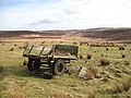 An old trailer - geograph.org.uk - 712727.jpg 640 × 480; 87 KB
-
 Badkeirie - geograph.org.uk - 707779.jpg 640 × 471; 51 KB
-
 Bridge over the Burn of Drimmie - geograph.org.uk - 896157.jpg 640 × 426; 72 KB
-
 Clearing in Blackcraig Forest - geograph.org.uk - 722934.jpg 640 × 480; 121 KB
-
 Craighead Farm - geograph.org.uk - 1087488.jpg 435 × 640; 129 KB
-
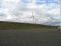
 Drumderg power station - geograph.org.uk - 1428512.jpg 640 × 359; 61 KB
-
 Drumderg power station - geograph.org.uk - 1428529.jpg 640 × 480; 73 KB
-
 Drumderg power station - geograph.org.uk - 1428752.jpg 640 × 480; 73 KB
-
 Drumderg Power Station - geograph.org.uk - 706341.jpg 640 × 480; 34 KB
-
 Drumderg Power Station - geograph.org.uk - 708720.jpg 640 × 480; 48 KB
-
 Drumderg Wind Farm - geograph.org.uk - 1419387.jpg 640 × 426; 33 KB
-
 Drumderg Wind Farm - geograph.org.uk - 1419389.jpg 426 × 640; 31 KB
-
 Drumderg Wind Farm - geograph.org.uk - 1535167.jpg 640 × 481; 40 KB
-
 Drumderg Wind Farm - geograph.org.uk - 1535195.jpg 640 × 480; 73 KB
-
 Drumderg Wind Farm - geograph.org.uk - 684140.jpg 640 × 480; 49 KB
-
 Drumderg Wind Farm from the south - geograph.org.uk - 1419385.jpg 640 × 426; 55 KB
-

-
 Drumderg Wind Farm from the west - geograph.org.uk - 1424357.jpg 640 × 426; 32 KB
-
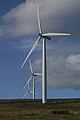
 Drumderg wind generators - geograph.org.uk - 782579.jpg 640 × 327; 37 KB
-
 Drumderg Wind Turbine - geograph.org.uk - 660767.jpg 640 × 480; 58 KB
-
 Drumderg windfarm - geograph.org.uk - 1112163.jpg 426 × 640; 47 KB
-
 Drumderg Windfarm - geograph.org.uk - 896554.jpg 640 × 426; 43 KB
-
 East side of Drumderg - geograph.org.uk - 1428541.jpg 640 × 480; 87 KB
-
 East side of Drumderg Wind Farm - geograph.org.uk - 1424351.jpg 640 × 426; 57 KB
-
 Forest of Alyth moorland - geograph.org.uk - 707631.jpg 640 × 480; 64 KB
-

-

-
 Moonshade - geograph.org.uk - 702779.jpg 640 × 480; 71 KB
-
 Moorland, Forest of Alyth - geograph.org.uk - 1428490.jpg 640 × 480; 65 KB
-
 Pond between Bamff and Drimmie - geograph.org.uk - 896146.jpg 640 × 426; 62 KB
-

-
 Pond near Tullymurdoch - geograph.org.uk - 1540283.jpg 640 × 481; 135 KB
-
 Tracks across the moor, Tullymurdoch - geograph.org.uk - 1540302.jpg 640 × 480; 106 KB
-
 View from Heatheryhaugh - geograph.org.uk - 896155.jpg 640 × 426; 49 KB
-
 View to Drumderg from near Smyrna - geograph.org.uk - 1419106.jpg 640 × 426; 72 KB
-

-
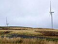
 Windfarm on Drumderg Hill - geograph.org.uk - 889292.jpg 640 × 229; 27 KB
-
 Woodland on Hill of Drimmie - geograph.org.uk - 1009481.jpg 640 × 426; 62 KB


