Category:Dual carriageway
Jump to navigation
Jump to search

type of road with two unidirectional parts  | |||||
| Upload media | |||||
| Instance of |
| ||||
|---|---|---|---|---|---|
| Subclass of | |||||
| Has part(s) |
| ||||
| Partially coincident with | |||||
| |||||
Subcategories
This category has the following 15 subcategories, out of 15 total.
A
C
D
E
G
K
- Kapiti Expressway (3 F)
L
- Local-express lanes (10 F)
N
P
R
- Ring Road (Greater Accra) (10 F)
Media in category "Dual carriageway"
The following 66 files are in this category, out of 66 total.
-

-
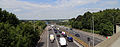
 A view of the M11 from Coopersale Lane Theydon Garnon Essex England 01.JPG 5,144 × 2,268; 6.21 MB
-
 A view of the M11 from Coopersale Lane Theydon Garnon Essex England 02.JPG 5,164 × 2,012; 5.63 MB
-
 A1 southbound near Little Ponton (geograph 3502131).jpg 2,256 × 1,504; 1.89 MB
-
 A299 Dual Carriageway - geograph.org.uk - 1827592.jpg 3,072 × 2,304; 1.56 MB
-
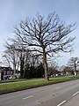 A34 Birmingham tree - 2021-02-12 - Andy Mabbett - 01.jpg 3,000 × 4,000; 5.74 MB
-
 A34 Birmingham tree - 2021-02-12 - Andy Mabbett - 02.jpg 4,000 × 3,000; 5.24 MB
-
 A727 east of Thorntonhall (geograph 3530076).jpg 640 × 480; 65 KB
-
 A739 Flyover (geograph 1784821).jpg 640 × 480; 69 KB
-
 Autoroute française 10 à Saint-Georges-des-Coteaux (17, France).JPG 2,272 × 1,704; 899 KB
-
 B 31a bei Freiburg-Lehen 2.jpg 3,000 × 4,000; 3.59 MB
-
 B 31a bei Freiburg-Lehen 3.jpg 3,000 × 4,000; 2.98 MB
-
 B766 Carmunnock Road at Lainshaw Drive (geograph 3527855).jpg 640 × 479; 58 KB
-
 B768 Carmunnock Road looking north (geograph 3527863).jpg 640 × 480; 47 KB
-
 BNDES libera 10 milhões para obras na saída norte (27388209793).jpg 4,288 × 2,848; 1.67 MB
-
 BNDES libera 10 milhões para obras na saída norte (27924281601).jpg 3,999 × 2,656; 1.7 MB
-
 Carmunnock Road (geograph 4648524).jpg 1,600 × 1,200; 396 KB
-
 Carmunnock Road bus stop at dusk (geograph 6728525).jpg 3,648 × 2,736; 4.44 MB
-
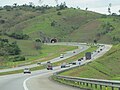 Carvalhopinto.JPG 1,600 × 1,200; 588 KB
-
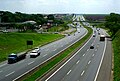 Dom-pedro-km145.jpg 975 × 659; 157 KB
-
 East Bridge Street, Belfast - geograph.org.uk - 576481.jpg 636 × 406; 86 KB
-
 East Kilbride Road - geograph.org.uk - 1230079.jpg 640 × 480; 120 KB
-
 Footbridge over the A555, Manchester..jpg 4,160 × 3,120; 3.24 MB
-
 FR 17 route départementale 733.JPG 2,272 × 1,704; 768 KB
-
 FR 17 Saintes - Route nationale 150 près du Petit Chadignac 01.jpg 4,608 × 3,456; 6.11 MB
-
 FR 17 Saintes - Route nationale 150 près du Petit Chadignac 02.jpg 4,608 × 3,456; 7.27 MB
-
 FR 17 Vergeroux - Route D137 - PMV avec XA24 et XC50.jpg 3,456 × 3,456; 2.9 MB
-
 Gallowflat Roundabout - geograph.org.uk - 2109730.jpg 640 × 480; 56 KB
-
 Glasgow Road (geograph 3407572).jpg 640 × 442; 98 KB
-
 Goteborg Lundbyleden.jpg 5,184 × 3,456; 9.89 MB
-
 Guthrie Port Roundabout, Arbroath - geograph.org.uk - 1152050.jpg 640 × 426; 68 KB
-
 Holiday Traffic on the A31 (1251096288).jpg 3,008 × 2,000; 3.77 MB
-
 Kurt-Schumacher-Brücke 04 Koblenz 2015.jpg 5,000 × 3,333; 8.9 MB
-
 MelvL P1010351 (5603711172).jpg 4,000 × 3,000; 3.52 MB
-
 N11 road south of Newtownmountkennedy.jpg 2,592 × 1,944; 1.32 MB
-
 National Cycle Route 756 near East Kilbride (geograph 7504641).jpg 1,024 × 768; 309 KB
-
 New cycleway in the Bristol Road in June 2019.jpg 4,592 × 3,448; 6.49 MB
-
 New road bridge over railway line at Hoppers Crossing.jpg 1,200 × 800; 327 KB
-
 Pune Urban Highway.jpg 2,250 × 2,310; 1.92 MB
-
 Queensway (road), East Kilbride - geograph.org.uk - 2342182.jpg 1,024 × 683; 194 KB
-
 Rocade Besançon Bouloie.JPG 2,304 × 1,728; 815 KB
-
 Rocade Besançon Montboucons.JPG 2,304 × 1,728; 421 KB
-
 Rocade Besançon Saint-Claude.JPG 2,304 × 1,728; 876 KB
-
 ROCADE DE SAINTES - 08 - N141 Rocade Sud-Est.JPG 2,272 × 1,704; 776 KB
-
-

-
 Route départementale 137 à Yves (17, France).JPG 4,608 × 3,456; 6.08 MB
-
 Route nationale 137 à La Rochelle · Périgny (17, France).JPG 2,720 × 2,448; 1.53 MB
-
 Route nationale 141 (Chérac, 17, France) vers Saintes.JPG 3,456 × 3,456; 2.26 MB
-
 Route nationale 237 à La Rochelle (17, France) vers l'Est.JPG 2,272 × 1,704; 790 KB
-
 Route nationale 237 à La Rochelle (17, France) vers l'Ouest.JPG 3,264 × 2,448; 1.51 MB
-
 Route nationale 237 à La Rochelle (17, France).JPG 4,608 × 2,592; 2.57 MB
-
 Runcorn road Mk2 pic,.png 1,716 × 1,184; 2.31 MB
-
 Runcorn road Mk3 pic,.png 1,713 × 1,179; 1.75 MB
-
 Santa Catarina - BR-101 (geometria).jpg 2,500 × 1,875; 227 KB
-
 Sign-1110845, Wainuiomata, Wellington, New Zealand.jpg 4,896 × 3,672; 9.3 MB
-
 Sign-1120715, Wainuiomata, Wellington, New Zealand.jpg 4,896 × 3,672; 8.8 MB
-
 Single to dual carriageway section of the Hume Highway on the outskirts of Holbrook.jpg 2,000 × 1,275; 2.24 MB
-
 Sion Panvel Highway, Mumbai.jpg 2,250 × 4,000; 6.71 MB
-
 Stamps of Germany (BRD) 1971, MiNr 672.jpg 840 × 720; 441 KB
-
 The Transportation.jpg 2,400 × 1,590; 2.38 MB
-
 Thorntonhall Splash - geograph.org.uk - 1492268.jpg 640 × 480; 116 KB
-
 Turkish state road D 750.JPG 3,118 × 1,417; 875 KB
-
 Uk carriageway guide.png 200 × 470; 3 KB
-
 View Towards Bedfont - panoramio.jpg 3,648 × 2,736; 2.89 MB
-
 Voronezh Road Don.JPG 2,592 × 1,944; 2.21 MB
_mit_Abfahrt_2.jpg)

.jpg)


.jpg)
.jpg)
.JPG)


.jpg)
.jpg)
.jpg)
.jpg)
.jpg)
.jpg)


.jpg)


.jpg)

.jpg)

.jpg)


,_East_Kilbride_-_geograph.org.uk_-_2342182.jpg)


_vue_depuis_la_route_D137EB4_-_orientation_direction_Rochefort.JPG)
_vue_depuis_la_route_D137EB4_-_orientation_direction_Saintes.JPG)
.JPG)
.JPG)
_vers_Saintes.JPG)
_vers_l%27Est.JPG)
_vers_l%27Ouest.JPG)
.JPG)


.jpg)


_1971,_MiNr_672.jpg)


