Category:Dudley, West Midlands
Jump to navigation
Jump to search
town in West Midlands, England  | |||||
| Upload media | |||||
| Instance of | |||||
|---|---|---|---|---|---|
| Location | Dudley, West Midlands, England | ||||
| Population |
| ||||
| Different from | |||||
| official website | |||||
 | |||||
English: Dudley ( measured by Urban Sub-Area, the second largest town in the United Kingdom, behind Reading and the largest settlement in the UK without its own university.
Subcategories
This category has the following 32 subcategories, out of 32 total.
2
- 2012 in Dudley (18 F)
B
- Black Country Boat Festival (18 F)
- Black Country Day 2021 (18 F)
- Buffery Park (1 F)
C
D
- Dudley Borough Police (3 F)
- Duncan Edwards Leisure Centre (31 F)
G
L
N
P
Q
S
- Saltwells Nature Reserve (34 F)
- St. James' School, Dudley (8 F)
- Street name signs in Dudley (1 F)
W
- Wren's Nest (31 F)
Media in category "Dudley, West Midlands"
The following 200 files are in this category, out of 615 total.
(previous page) (next page)-

-
 Abberley Street, Dudley - geograph.org.uk - 1982847.jpg 1,250 × 794; 303 KB
-
 Access road beside Dudley Golf Club - geograph.org.uk - 939334.jpg 640 × 480; 97 KB
-

-
-
 Alma Place, Dudley - geograph.org.uk - 1982859.jpg 1,250 × 864; 472 KB
-
 An entrance to the Country Park - geograph.org.uk - 913935.jpg 640 × 480; 117 KB
-
 Beacon Reservoir Doors - geograph.org.uk - 1065680.jpg 640 × 480; 80 KB
-
 Beacon Side Path - geograph.org.uk - 1065684.jpg 640 × 480; 65 KB
-
 Birdcage Walk - geograph.org.uk - 2538753.jpg 800 × 600; 114 KB
-

-
 Birdcage Walk View - geograph.org.uk - 2538411.jpg 800 × 600; 121 KB
-
 Birdcage Walk, Dudley - geograph.org.uk - 1982875.jpg 1,250 × 819; 380 KB
-
 Birdcage Walk, Dudley - geograph.org.uk - 1982879.jpg 1,250 × 821; 502 KB
-
 Birmingham New Road houses, Dudley - geograph.org.uk - 2957272.jpg 640 × 480; 79 KB
-
 Birmingham Road - geograph.org.uk - 1593590.jpg 640 × 480; 92 KB
-
 Birmingham Road Dudley - geograph.org.uk - 1101854.jpg 640 × 428; 104 KB
-
 Birmingham Street and Dudley Castle - geograph.org.uk - 1917710.jpg 640 × 480; 110 KB
-
 Birmingham Street, Dudley - geograph.org.uk - 1982882.jpg 1,250 × 833; 494 KB
-
 Black Country Combat, Dudley - geograph.org.uk - 2963837.jpg 640 × 420; 54 KB
-
 Blowers Green Bridge - geograph.org.uk - 1122613.jpg 640 × 428; 95 KB
-

-
 Blowers Green Pumphouse - geograph.org.uk - 3167921.jpg 1,024 × 768; 156 KB
-
 Bloye Apollo statue Dudley.jpg 1,137 × 2,256; 478 KB
-
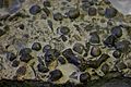 BLW Wenlock limestone (1).jpg 3,888 × 2,592; 2.37 MB
-
 BLW Wenlock limestone (2).jpg 3,749 × 1,851; 1.83 MB
-
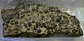
 BLW Wenlock limestone.jpg 3,888 × 2,592; 2.44 MB
-
 Boats 2 (3392974386).jpg 4,062 × 2,226; 5.87 MB
-
 Boats 3 (3392155151).jpg 3,210 × 2,196; 4.43 MB
-
 Bonded Warehouse, Stourbridge - geograph.org.uk - 2350641.jpg 640 × 480; 92 KB
-
 Boss Drive, Dudley - geograph.org.uk - 1982888.jpg 1,250 × 842; 411 KB
-
 Bostin Fittle - geograph.org.uk - 1123800.jpg 640 × 480; 56 KB
-
 Bostin Fittle, Dudley - geograph.org.uk - 2958091.jpg 640 × 422; 59 KB
-
 Bottle and Glass, Black Country Museum - geograph.org.uk - 1760049.jpg 2,007 × 1,602; 820 KB
-

-

-
 Brooke Street, Dudley - geograph.org.uk - 1982944.jpg 1,250 × 831; 512 KB
-
 Buffery Road, Dudley - geograph.org.uk - 1567494.jpg 640 × 464; 97 KB
-
 BULLS HEAD SEDGELEY WEST MIDLANDS JUNE 2013 (9056739234).jpg 4,822 × 3,399; 11.46 MB
-
-
 Buttefield Court, Eve's Hill Dudley - geograph.org.uk - 3558375.jpg 3,648 × 2,736; 2.68 MB
-

-
 Cast Iron House - panoramio.jpg 2,032 × 1,356; 1,021 KB
-
 Castle Hill, Dudley - geograph.org.uk - 1095446.jpg 640 × 428; 90 KB
-
 Christadelphian Hall, Dudley - geograph.org.uk - 2989645.jpg 640 × 397; 52 KB
-
 Christadephain Hall Dudley - geograph.org.uk - 2434200.jpg 800 × 600; 87 KB
-
 Church Street, Dudley - geograph.org.uk - 1986200.jpg 1,250 × 840; 491 KB
-
 Church Street, Dudley - geograph.org.uk - 1986211.jpg 1,250 × 913; 531 KB
-
 Churchfield Street, Dudley - geograph.org.uk - 2989545.jpg 640 × 485; 69 KB
-
 Churchill Shopping Centre, Dudley - geograph.org.uk - 1986228.jpg 1,024 × 685; 157 KB
-
 Coot (3453181068).jpg 2,370 × 1,896; 2.31 MB
-
 Costa Dudley.jpg 4,000 × 2,248; 3.83 MB
-
 Costa, Dudley.JPG 4,000 × 2,248; 3.81 MB
-
 Cradley Heath greyhound track c.1950.png 1,143 × 857; 1.72 MB
-
 Crossotheca nodule.JPG 1,000 × 634; 160 KB
-
 Crossotheca.jpg 959 × 705; 229 KB
-
 Day 159 - Vehicle operation in Dudley (8977377297).jpg 800 × 534; 112 KB
-
 Day 165 - West Midlands Police - All Out Cycle Day (9040051275).jpg 534 × 800; 123 KB
-
 Day 169 - West Midlands Police - Tackling street drinking in Dudley (9077664250).jpg 2,279 × 3,000; 1.85 MB
-
 Day 170 - Dudley Retail radio (9091713875).jpg 800 × 534; 88 KB
-
 Day 333 - West Midlands Police - Crack house closure in Brierley Hill (8228676615).jpg 3,000 × 2,000; 1.3 MB
-

-
 Day 53 - Early morning drugs raid in Dudley (8497719406).jpg 2,626 × 1,547; 363 KB
-
 Derelict house at Gornalwood, Dudley - geograph.org.uk - 1169170.jpg 640 × 470; 147 KB
-
 DMBC roll of freemen 20220316.jpg 3,468 × 4,624; 3.98 MB
-
 Dudley - panoramio.jpg 2,272 × 1,704; 881 KB
-
 Dudley - terrace off The Broadway - geograph.org.uk - 1236053.jpg 640 × 480; 99 KB
-
 Dudley and Oldbury.png 642 × 426; 47 KB
-
 Dudley bridges(3).JPG 3,449 × 2,380; 1.85 MB
-
 Dudley Central Methodist Church - geograph.org.uk - 2390909.jpg 1,024 × 768; 397 KB
-
 Dudley Central Mosque - geograph.org.uk - 2098581.jpg 1,024 × 747; 145 KB
-
 Dudley Central Mosque - geograph.org.uk - 2390935.jpg 1,024 × 768; 416 KB
-
-
 Dudley Cinema - geograph.org.uk - 2551724.jpg 800 × 600; 131 KB
-
 Dudley Citadel - geograph.org.uk - 628348.jpg 640 × 480; 55 KB
-
 Dudley Clay Pits - geograph.org.uk - 457016.jpg 640 × 480; 125 KB
-
 Dudley College - geograph.org.uk - 1507441.jpg 640 × 480; 116 KB
-
 Dudley College View - geograph.org.uk - 1507449.jpg 480 × 640; 103 KB
-
 Dudley County Court - geograph.org.uk - 2098575.jpg 768 × 1,024; 120 KB
-
 Dudley Domesday Book.png 626 × 158; 53 KB
-
 Dudley Double - geograph.org.uk - 2639276.jpg 800 × 600; 139 KB
-
 Dudley Football Pitch - geograph.org.uk - 2434371.jpg 800 × 600; 101 KB
-
 Dudley Footbridge - geograph.org.uk - 2070912.jpg 800 × 600; 98 KB
-
 Dudley Gospel Hall, Hellier Street - geograph.org.uk - 2390923.jpg 1,024 × 768; 492 KB
-
 Dudley Gurdwara Sikh Temple - geograph.org.uk - 3558143.jpg 3,648 × 2,736; 2.94 MB
-
 Dudley Heron - geograph.org.uk - 2441569.jpg 600 × 800; 135 KB
-
 Dudley High Street - geograph.org.uk - 2098402.jpg 1,024 × 776; 165 KB
-
 Dudley High Street - geograph.org.uk - 2993607.jpg 600 × 800; 103 KB
-
 Dudley Hippodrone View - geograph.org.uk - 2551714.jpg 800 × 600; 158 KB
-
 Dudley Housing Services - geograph.org.uk - 3561759.jpg 3,648 × 2,736; 2.57 MB
-
 Dudley Job Centre - geograph.org.uk - 2551991.jpg 800 × 600; 147 KB
-
 Dudley Library - geograph.org.uk - 1920003.jpg 3,648 × 2,736; 2.84 MB
-
 Dudley Lights - geograph.org.uk - 1110377.jpg 640 × 480; 89 KB
-
 Dudley Magistrates Court - geograph.org.uk - 1989101.jpg 1,250 × 896; 378 KB
-
 Dudley Magistrates' Court - geograph.org.uk - 2968307.jpg 640 × 427; 55 KB
-
 Dudley Market - geograph.org.uk - 1110379.jpg 640 × 480; 87 KB
-
 Dudley Market - geograph.org.uk - 1242271.jpg 600 × 450; 226 KB
-
 Dudley MMB 01.jpg 1,728 × 2,304; 1.32 MB
-
 Dudley Montage.jpg 640 × 839; 248 KB
-
 Dudley Mosque - geograph.org.uk - 2551709.jpg 800 × 600; 123 KB
-
 Dudley Motor Company - geograph.org.uk - 2552814.jpg 800 × 600; 107 KB
-
 Dudley Motorcycle Centre - geograph.org.uk - 2968542.jpg 640 × 447; 63 KB
-
 Dudley Museum - geograph.org.uk - 1920027.jpg 3,648 × 2,736; 2.8 MB
-
 Dudley Museum - geograph.org.uk - 2098578.jpg 1,024 × 768; 144 KB
-
 Dudley Museum and Art Gallery - geograph.org.uk - 2966909.jpg 640 × 458; 74 KB
-
 Dudley Museum Scene - geograph.org.uk - 3096780.jpg 800 × 600; 107 KB
-
 Dudley Museum View - geograph.org.uk - 2328825.jpg 800 × 600; 90 KB
-
 Dudley office of Talbots solicitors - geograph.org.uk - 2968271.jpg 640 × 500; 77 KB
-
 Dudley Playing Field - geograph.org.uk - 3183501.jpg 800 × 600; 93 KB
-
 Dudley Police Station - geograph.org.uk - 2098429.jpg 1,024 × 768; 148 KB
-
 Dudley Police Station - geograph.org.uk - 2964880.jpg 640 × 456; 76 KB
-
 Dudley Post Office - geograph.org.uk - 3645808.jpg 800 × 600; 101 KB
-
 Dudley Priory Church.jpg 3,120 × 4,160; 3.98 MB
-
 Dudley Railway Tunnel - geograph.org.uk - 3030704.jpg 1,600 × 1,028; 203 KB
-
 Dudley Railway Tunnel - geograph.org.uk - 3030708.jpg 1,600 × 1,067; 382 KB
-
 Dudley railway tunnel.JPG 720 × 480; 458 KB
-
 Dudley RBS - geograph.org.uk - 2014439.jpg 800 × 600; 143 KB
-
 Dudley Road, Dudley - geograph.org.uk - 2473656.jpg 640 × 480; 79 KB
-
 Dudley Sixth - geograph.org.uk - 3242945.jpg 3,648 × 2,736; 2.59 MB
-
 Dudley Sports FC Ground - geograph.org.uk - 2677495.jpg 3,648 × 2,736; 2.75 MB
-
 Dudley Street View - geograph.org.uk - 1461691.jpg 640 × 480; 74 KB
-
 Dudley TA Centre - geograph.org.uk - 2968409.jpg 640 × 497; 81 KB
-
 Dudley Town Centre (cropped).jpg 640 × 165; 79 KB
-
 Dudley Town Centre - geograph.org.uk - 1101887.jpg 640 × 428; 51 KB
-
 Dudley Town Centre - geograph.org.uk - 1101895.jpg 640 × 428; 38 KB
-
 Dudley Town Centre.jpg 640 × 427; 118 KB
-
 Dudley Town Hall - geograph.org.uk - 1505357.jpg 480 × 640; 98 KB
-
 Dudley Town Hall View - geograph.org.uk - 2328832.jpg 800 × 600; 96 KB
-
 Dudley Town Hall-Concert Hall - geograph.org.uk - 3030714.jpg 1,600 × 1,200; 382 KB
-
 Dudley Town Path - geograph.org.uk - 3456219.jpg 640 × 466; 75 KB
-
 Dudley Tunnel - geograph.org.uk - 2323275.jpg 800 × 531; 116 KB
-
 Dudley United Reformed Church - geograph.org.uk - 2390905.jpg 896 × 672; 346 KB
-
 Dudley view - geograph.org.uk - 2512625.jpg 600 × 800; 101 KB
-
 Dudley View Charlotte Murchison Silurian System p.480.jpg 3,933 × 2,009; 2.25 MB
-
 Dudley Wood Road, Dudley Wood - geograph.org.uk - 1268763.jpg 640 × 439; 93 KB
-
 Dudley Woolworths - geograph.org.uk - 1123792.jpg 640 × 420; 69 KB
-

-
 Dudley, by-pass - geograph.org.uk - 2098394.jpg 1,024 × 768; 141 KB
-
 Dudley, Castle Gate Island - geograph.org.uk - 3135186.jpg 640 × 480; 68 KB
-
 Dudley, Castle Hill Roundabout - geograph.org.uk - 2098593.jpg 1,024 × 768; 103 KB
-
 Dudley, Christadelphian Hall - geograph.org.uk - 2098613.jpg 1,024 × 768; 117 KB
-
 Dudley, fountain - geograph.org.uk - 2098456.jpg 1,024 × 768; 139 KB
-
 Dudley, Lamp Tavern - geograph.org.uk - 2098604.jpg 1,024 × 757; 117 KB
-
 Dudley, Little Barrel - geograph.org.uk - 2098569.jpg 760 × 1,024; 180 KB
-
 Dudley, Mata Da Mandir - geograph.org.uk - 2098622.jpg 1,024 × 785; 113 KB
-
 Dudley, Quality Hotel - geograph.org.uk - 2098589.jpg 1,024 × 768; 156 KB
-
 Dudley, The Court House - geograph.org.uk - 2098453.jpg 1,024 × 768; 134 KB
-
 Dudley, The Full Moon - geograph.org.uk - 2098414.jpg 700 × 1,024; 179 KB
-
 Dudley, The Ward Arms - geograph.org.uk - 2098584.jpg 1,024 × 752; 129 KB
-
 Dudley, West Midlands, UK - panoramio.jpg 1,704 × 2,272; 1.11 MB
-
 Dudleymix Concrete - geograph.org.uk - 3378331.jpg 1,142 × 857; 656 KB
-
 Dudleys monuments - panoramio.jpg 2,272 × 1,704; 838 KB
-
 DudleyTraditionalDetail.jpg 233 × 331; 23 KB
-
 Duncan Edwards - geograph.org.uk - 101348.jpg 480 × 640; 109 KB
-
 Dunns Bridge - geograph.org.uk - 1474863.jpg 640 × 428; 189 KB
-
 East end of St Thomas, Dudley - geograph.org.uk - 3556622.jpg 427 × 640; 77 KB
-
 Ednam House, Dudley - geograph.org.uk - 2966957.jpg 624 × 640; 120 KB
-
 Ednam Road, Dudley - geograph.org.uk - 1987462.jpg 1,250 × 837; 547 KB
-
 Ednam Road, Dudley - geograph.org.uk - 1987476.jpg 1,250 × 837; 511 KB
-
 Ednam Road, Dudley - geograph.org.uk - 1987484.jpg 1,250 × 837; 490 KB
-
 Ednam Road, Dudley - geograph.org.uk - 1987496.jpg 1,250 × 886; 639 KB
-
 Ednam Road, Dudley - geograph.org.uk - 1987518.jpg 1,250 × 753; 403 KB
-
 Eerie trees, Dudley - geograph.org.uk - 2957322.jpg 640 × 480; 72 KB
-
 End of Burnt Tree Island - geograph.org.uk - 1593586.jpg 640 × 480; 60 KB
-
 Entrance to Doosan Babcock, Dudley - geograph.org.uk - 2948912.jpg 640 × 406; 62 KB
-
 Entrance to Dudley Concert Hall - geograph.org.uk - 2967024.jpg 480 × 640; 89 KB
-
 Entrance to the Claughton Centre, Dudley - geograph.org.uk - 2989851.jpg 640 × 547; 116 KB
-
 Flood Street looking south. - geograph.org.uk - 1655369.jpg 640 × 480; 77 KB
-
 Flood Street, Dudley. - geograph.org.uk - 1655347.jpg 640 × 480; 87 KB
-
 Former Albion pub, Dudley - geograph.org.uk - 2966774.jpg 640 × 582; 78 KB
-

-
 Former Derann shop, Dudley - geograph.org.uk - 2989620.jpg 640 × 465; 66 KB
-

-
 Former Hospital, Dudley - geograph.org.uk - 1917725.jpg 640 × 480; 73 KB
-

-
 Former Regent Cinema, Dudley - geograph.org.uk - 2968356.jpg 640 × 559; 60 KB
-

-
 Fountain Arcade - geograph.org.uk - 1110380.jpg 640 × 480; 66 KB
-

-
 Fun House, Bostin Fittle, Dudley - geograph.org.uk - 2958109.jpg 640 × 427; 74 KB
-
 Gables Dental Surgery, Dudley - geograph.org.uk - 2966969.jpg 640 × 480; 72 KB
-
 Gads Green, Netherton - geograph.org.uk - 1494767.jpg 640 × 453; 91 KB
-

-
 Geological Map Dudley Poole 1970.jpg 5,241 × 3,854; 6.74 MB
-
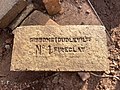 Gibbons (Dudley) Ltd, No. 1 Fireclay Brick.jpg 4,032 × 3,024; 3.57 MB
-
 Gladstone House, Dudley - geograph.org.uk - 2966752.jpg 640 × 523; 79 KB
-
 Globe House - geograph.org.uk - 917573.jpg 640 × 480; 64 KB
-
 Gornal Wood Crematorium - geograph.org.uk - 362802.jpg 640 × 480; 138 KB
-
 Gornal Wood Crematorium, near Dudley - geograph.org.uk - 1168848.jpg 640 × 400; 124 KB
-
 Gornal Wood Crematorium, near Dudley - geograph.org.uk - 1168863.jpg 640 × 407; 156 KB
-
 Gornal Wood Crematorium, near Dudley - geograph.org.uk - 1168871.jpg 640 × 450; 145 KB
-

-

-
 Grade II listed Baylies Hall, Dudley - geograph.org.uk - 2964762.jpg 640 × 480; 84 KB
-

-

-

-

-
-
 Grade II listed The Fellows, Dudley - geograph.org.uk - 2964721.jpg 640 × 485; 54 KB


.jpg)
.jpg)

.jpg)
.jpg)


.jpg)


.jpg)


.jpg)
.jpg)
.jpg)
.jpg)
.jpg)
.jpg)
.jpg)


.JPG)


_-_geograph.org.uk_-_3135182.jpg)


_Ltd,_No._1_Fireclay_Brick.jpg)


_listed_Parish_Church_of_St_Thomas,_Dudley_-_geograph.org.uk_-_2968397.jpg)


.jpg)