Category:Dumyat
Jump to navigation
Jump to search
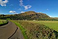
English: Dumyat is a hill at the western extremity of the Ochil Hills in central Scotland. The name is thought to originate from Dun (hill fort) of the Maeatae.
mountain in Stirling, Scotland, UK  | |||||
| Upload media | |||||
| Instance of | |||||
|---|---|---|---|---|---|
| Location | Clackmannanshire, Scotland | ||||
| Mountain range | |||||
| Topographic prominence |
| ||||
| Topographic isolation |
| ||||
| Elevation above sea level |
| ||||
| Parent peak | |||||
 | |||||
Media in category "Dumyat"
The following 35 files are in this category, out of 35 total.
-
 Alloa - geograph.org.uk - 340811.jpg 640 × 424; 53 KB
-
 Countryside - geograph.org.uk - 421252.jpg 640 × 424; 58 KB
-
 Dumyat - Memorial and Beacon Brazier.jpg 5,152 × 3,864; 6.38 MB
-
 Dumyat beacon - geograph.org.uk - 1120156.jpg 640 × 427; 69 KB
-
 Dumyat cairn - geograph.org.uk - 483071.jpg 640 × 480; 83 KB
-
 Dumyat from Castle Law - geograph.org.uk - 1564077.jpg 640 × 428; 98 KB
-
 Dumyat Memorial Plaques - geograph.org.uk - 483074.jpg 640 × 480; 126 KB
-
 Dumyat south elev.jpg 2,272 × 1,704; 2.75 MB
-
 Dumyat Trig Point - geograph.org.uk - 483062.jpg 640 × 480; 87 KB
-
 Dumyat.jpg 640 × 380; 31 KB
-
 Dumyat1.jpg 1,792 × 1,200; 302 KB
-
 Dumyat2.jpg 4,627 × 3,131; 9.76 MB
-
 Farm track - geograph.org.uk - 416406.jpg 640 × 424; 58 KB
-
 Farm track - geograph.org.uk - 419780.jpg 640 × 424; 66 KB
-
 Fields near Glenfoot - geograph.org.uk - 85038.jpg 640 × 480; 54 KB
-
 From Dumyat looking towards Grangemouth (geograph 3766267).jpg 1,920 × 1,080; 1.65 MB
-
 From Dumyat towards the north - geograph.org.uk - 1113709.jpg 640 × 427; 86 KB
-
 Industrial Estate, Alva - geograph.org.uk - 85405.jpg 640 × 480; 64 KB
-

-
 Menstrie war memorial and Foxboy sculpture in Nova Scotia Gardens, July 2011.jpg 2,048 × 1,536; 748 KB
-
 New Year's Day on Dumyat - geograph.org.uk - 242926.jpg 640 × 426; 183 KB
-
 Pylons towards Alloa - geograph.org.uk - 85406.jpg 640 × 480; 57 KB
-

-
 Smiles 1878 robertdickbaker00smil 0047 Dunmyat.jpg 1,962 × 2,122; 499 KB
-
 Sponsored Stretcher Carry up Dumyat - geograph.org.uk - 1555554.jpg 640 × 465; 113 KB
-
 The University of Stirling - geograph.org.uk - 2218.jpg 640 × 422; 74 KB
-

-
 Upper Forth Crossing (3) - geograph.org.uk - 623356.jpg 640 × 424; 40 KB
-
 View to north side of Dumyat - geograph.org.uk - 1221007.jpg 640 × 387; 75 KB
-
 Weavers Wynd, Menstrie - geograph.org.uk - 281408.jpg 640 × 480; 79 KB
-
 Barn, Carse of Lecropt - geograph.org.uk - 187335.jpg 640 × 478; 117 KB
-
 From NW ridge of Dumyat - geograph.org.uk - 373884.jpg 640 × 480; 130 KB
-
 From the Dumyat track - geograph.org.uk - 505268.jpg 640 × 480; 136 KB
-
 البقري موتورز دمياط الجديدة - panoramio.jpg 3,264 × 2,448; 2.26 MB
-
 دمياط الجديدة - panoramio.jpg 3,264 × 2,448; 2.52 MB


.jpg)


_-_geograph.org.uk_-_623356.jpg)


