Category:Dunbar
Jump to navigation
Jump to search
town in East Lothian, Scotland, UK  | |||||
| Upload media | |||||
| Instance of |
| ||||
|---|---|---|---|---|---|
| Location |
| ||||
| Population |
| ||||
| official website | |||||
 | |||||
English: Dunbar, East Lothian, Scotland
Subcategories
This category has the following 18 subcategories, out of 18 total.
B
- Battle of Dunbar (1296) (3 F)
- Battle of Dunbar (1650) (15 F)
- Bayswell Road, Dunbar (17 F)
C
D
- Dunbar Castle (33 F)
- Dunbar Golf Course (9 F)
- Dunbar Priory (1 F)
- Dunbar Town House (15 F)
- Dunbar War Memorial (3 F)
E
- Callum Easter (2 F)
L
- Lauderdale House, Dunbar (27 F)
M
R
- Dunbar railway station (20 F)
S
- Ships registered in Dunbar (10 F)
Media in category "Dunbar"
The following 200 files are in this category, out of 405 total.
(previous page) (next page)-
 'Sea Cubes' by Donald Urquhart - geograph.org.uk - 5814509.jpg 640 × 416; 67 KB
-
 12 Lamer Street Dunbar.jpg 1,920 × 1,280; 886 KB
-
 12 North Street, Belhaven, Dunbar.jpg 1,920 × 1,280; 1.09 MB
-
 2010-08 Scotland - Dumbar.jpg 12,859 × 1,728; 11.16 MB
-
 2016 - East Linton to Dunbar (26926712930).jpg 4,928 × 3,264; 3.03 MB
-
 2016 - East Linton to Dunbar (27167967996).jpg 4,928 × 3,264; 1.73 MB
-
 2016 366 72 A door in Dunbar (25622162432).jpg 3,542 × 4,952; 7.34 MB
-
 A boat at Dunbar - geograph.org.uk - 1199546.jpg 427 × 640; 134 KB
-
 A distant Barns Ness lighthouse - geograph.org.uk - 948200.jpg 640 × 468; 64 KB
-

-
 A pile of Creels at Old Harbour Dunbar - geograph.org.uk - 6248351.jpg 4,592 × 3,448; 3.14 MB
-
 A pond at Dunbar Golf Course - geograph.org.uk - 1199376.jpg 640 × 427; 126 KB
-
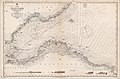 Admiralty Chart No 114a Firth of Forth St Abbs Head to Edinburgh, Published 1860.jpg 12,101 × 7,968; 11.82 MB
-

-
 Andy Scott Giant Bear Sculpture Dunbar .jpg 4,912 × 7,360; 387 KB
-
 Asda, Dunbar, Nov 2007 geograph.org.uk - 613409.jpg 640 × 480; 69 KB
-
 Bass Rock from Dunbar.jpg 5,184 × 3,456; 5.61 MB
-
 Bathe Rock - geograph.org.uk - 5093992.jpg 1,024 × 683; 333 KB
-
 Battle of Dunbar medal.jpg 976 × 1,282; 479 KB
-
 Beach closeups (8665805713).jpg 4,928 × 3,264; 3.16 MB
-
 Beach closeups Barns Ness, 2014 (15264631409).jpg 4,928 × 3,264; 5.43 MB
-
 Beach closeups Barns Ness, 2014 (15264790888).jpg 4,928 × 3,264; 1.73 MB
-
 Beach closeups Barns Ness, 2014 (15428327736).jpg 4,928 × 3,264; 2.82 MB
-
 Beach closeups Barns Ness, 2014 (15428328496).jpg 4,928 × 3,264; 2.9 MB
-
 Beach closeups Barns Ness, 2014 (15451054182).jpg 3,264 × 4,928; 2.61 MB
-
 Beach closeups Barns Ness, 2014 (15451401155).jpg 4,928 × 3,264; 3.19 MB
-
 Beach closeups Barns Ness, 2014 (15451402835).jpg 4,928 × 3,264; 2.96 MB
-
 Beach off Lamer Street, Dunbar - geograph.org.uk - 2695136.jpg 1,600 × 1,200; 293 KB
-
 Below the Battery at Dunbar harbour - geograph.org.uk - 863867.jpg 640 × 480; 87 KB
-
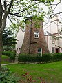 Bielside windmill.jpg 481 × 640; 144 KB
-
 Big fish and little fish (15448239271).jpg 4,928 × 3,264; 3.02 MB
-
 Black Agnes, from a children's history book cropped.jpg 877 × 1,223; 779 KB
-
 Black Agnes, from a children's history book.jpg 878 × 1,224; 365 KB
-
 Bridge at Dunbar Harbour - geograph.org.uk - 3061534.jpg 640 × 480; 87 KB
-
 Bridge in calm water (26595331484).jpg 4,928 × 3,264; 1.76 MB
-
 Bringing home the catch - geograph.org.uk - 2333847.jpg 640 × 480; 49 KB
-
 Britannica Dunbar.jpg 522 × 507; 79 KB
-
 Broad Haven from the Battery - geograph.org.uk - 3080783.jpg 640 × 421; 399 KB
-
 Broadhaven - blocked up former harbour entrance - geograph.org.uk - 2566636.jpg 4,000 × 3,000; 2.17 MB
-
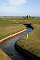
 Brox Burn - geograph.org.uk - 1449500.jpg 640 × 360; 80 KB
-

-
 Centre of Dunbar - geograph.org.uk - 58971.jpg 640 × 480; 117 KB
-
 Channel in the Rocks - geograph.org.uk - 3093451.jpg 420 × 640; 403 KB
-

-

-
 Church Street, Dunbar - geograph.org.uk - 3610378.jpg 1,024 × 768; 93 KB
-
 Circles of Friends.jpg 1,792 × 1,760; 333 KB
-
 Cliff top footpaths - geograph.org.uk - 820501.jpg 640 × 480; 106 KB
-
 Cliff top promenade - geograph.org.uk - 820463.jpg 640 × 480; 69 KB
-
 Coast path, Dunbar - geograph.org.uk - 1276343.jpg 400 × 640; 71 KB
-
 Coastal defences (27105461382).jpg 4,928 × 3,264; 2.8 MB
-
 Coastal defences (27201727805).jpg 4,928 × 3,264; 3.78 MB
-

-
 Coastal East Lothian , A Dreich Day at Dunbar - geograph.org.uk - 2314889.jpg 2,560 × 1,920; 2.4 MB
-

-
 Coastal East Lothian , A Pause For Thought at Dunbar - geograph.org.uk - 2436095.jpg 2,560 × 1,920; 2.78 MB
-

-
 Coastal East Lothian , A View From Meikle Spiker, Dunbar - geograph.org.uk - 3491588.jpg 1,600 × 1,200; 306 KB
-

-

-

-

-
 Coastal East Lothian , An Island Mountain - geograph.org.uk - 3089612.jpg 1,600 × 1,200; 382 KB
-
 Coastal East Lothian , Bandits Coming Out Of The Sun - geograph.org.uk - 3436662.jpg 1,600 × 1,200; 91 KB
-

-

-
 Coastal East Lothian , Blue Kayak At Broad Haven, Dunbar - geograph.org.uk - 3436649.jpg 1,600 × 1,200; 450 KB
-
 Coastal East Lothian , Broad Haven, Dunbar - geograph.org.uk - 3173218.jpg 1,600 × 1,200; 241 KB
-
 Coastal East Lothian , Broad Haven, Dunbar - geograph.org.uk - 3487762.jpg 1,600 × 1,200; 336 KB
-

-
 Coastal East Lothian , Cromwell Harbour, Dunbar - geograph.org.uk - 2267928.jpg 2,560 × 1,920; 2.68 MB
-
 Coastal East Lothian , Cromwell Harbour, Dunbar - geograph.org.uk - 2377364.jpg 2,560 × 1,920; 3.1 MB
-
 Coastal East Lothian , Cromwell Harbour, Dunbar - geograph.org.uk - 3494928.jpg 1,600 × 1,200; 235 KB
-

-
-
 Coastal East Lothian , Early Morning At Pin Cod, Dunbar - geograph.org.uk - 3171751.jpg 1,600 × 1,200; 246 KB
-
 Coastal East Lothian , Early Morning View of Dunbar Castle - geograph.org.uk - 2323124.jpg 2,560 × 1,920; 2.03 MB
-
 Coastal East Lothian , Floating at Cromwell Harbour, Dunbar - geograph.org.uk - 2377396.jpg 2,560 × 1,920; 3.12 MB
-

-

-
 Coastal East Lothian , Incoming Tide at Dunbar - geograph.org.uk - 2093976.jpg 2,560 × 1,920; 3.12 MB
-
 Coastal East Lothian , Injun Country - geograph.org.uk - 3089640.jpg 1,600 × 1,200; 275 KB
-

-

-

-
 Coastal East Lothian , Let Sleeping Gannets Lie - geograph.org.uk - 2084438.jpg 2,560 × 1,920; 3.4 MB
-

-

-

-

-

-
 Coastal East Lothian , Near The Platform Edge at Dunbar - geograph.org.uk - 2093922.jpg 2,560 × 1,920; 3.16 MB
-

-
 Coastal East Lothian , On Meikle Spiker, Dunbar - geograph.org.uk - 3487898.jpg 1,600 × 1,200; 543 KB
-
 Coastal East Lothian , On The Platform at Dunbar - geograph.org.uk - 3101815.jpg 1,600 × 1,200; 494 KB
-
 Coastal East Lothian , On The Way To Meikle Spiker - geograph.org.uk - 3487884.jpg 1,600 × 1,200; 331 KB
-
 Coastal East Lothian , Paint Pots At Broad Haven, Dunbar - geograph.org.uk - 3487773.jpg 1,200 × 1,600; 347 KB
-
 Coastal East Lothian , Parkour at Victoria Harbour, Dunbar - geograph.org.uk - 2425501.jpg 2,560 × 1,920; 3.19 MB
-

-
 Coastal East Lothian , Pin Cod at Daybreak - geograph.org.uk - 3167269.jpg 1,600 × 1,200; 248 KB
-
 Coastal East Lothian , Pin Cod, Dunbar - geograph.org.uk - 3089676.jpg 1,600 × 1,200; 526 KB
-
 Coastal East Lothian , Puffin at Cromwell Harbour, Dunbar - geograph.org.uk - 2280668.jpg 2,560 × 1,920; 3.19 MB
-

-
 Coastal East Lothian , Returning From Fluke Dub - geograph.org.uk - 2084432.jpg 2,560 × 1,920; 3.03 MB
-

-

-

-

-

-

-
 Coastal East Lothian , Sona of Dunbar - geograph.org.uk - 2267790.jpg 2,560 × 1,920; 2.55 MB
-

-

-

-
 Coastal East Lothian , Sunrise at Dunbar - geograph.org.uk - 3180001.jpg 1,600 × 1,200; 131 KB
-
 Coastal East Lothian , Surf and Stacks at Dunbar Clifftop - geograph.org.uk - 2083481.jpg 2,560 × 1,920; 3.15 MB
-
 Coastal East Lothian , Taking You Higher - geograph.org.uk - 3436670.jpg 1,200 × 1,600; 94 KB
-
 Coastal East Lothian , The East Beach, Dunbar - geograph.org.uk - 3471162.jpg 1,600 × 1,200; 415 KB
-
 Coastal East Lothian , The East Shore, Dunbar - geograph.org.uk - 2399116.jpg 2,560 × 1,920; 3.14 MB
-

-

-

-

-
 Coastal East Lothian , The Lower Jawbone, Dunbar - geograph.org.uk - 3436707.jpg 1,600 × 1,200; 352 KB
-

-

-

-

-
 Coastal East Lothian , Time to Retreat at Dunbar - geograph.org.uk - 2093944.jpg 2,560 × 1,920; 3.15 MB
-

-
 Coastal East Lothian , Wee Jock at Victoria Harbour, Dunbar - geograph.org.uk - 2267782.jpg 2,560 × 1,920; 3.06 MB
-
 Coastal East Lothian , Wish You Were Here - geograph.org.uk - 3167282.jpg 1,600 × 1,200; 250 KB
-

-

-

-

-
 Coastal rocks off Dunbar - geograph.org.uk - 2838178.jpg 640 × 480; 81 KB
-
 Coloured Creels at Victoria Harbour Dunbar - geograph.org.uk - 5747103.jpg 2,048 × 1,536; 1.21 MB
-
 Corner of Cromwell Harbour - geograph.org.uk - 968926.jpg 640 × 480; 75 KB
-
 Cottages on the way to Spott - geograph.org.uk - 1220895.jpg 573 × 640; 85 KB
-
 Cove, Dunbar - geograph.org.uk - 1260344.jpg 640 × 480; 102 KB
-

-
 Cromwell Harbour, Dunbar - geograph.org.uk - 25382.jpg 640 × 480; 85 KB
-
 Cromwell Harbour, Dunbar - geograph.org.uk - 2566613.jpg 4,000 × 3,000; 2.18 MB
-
 Dangerous cliffs (27105467492).jpg 4,928 × 3,264; 2.54 MB
-
 Derelict pavillion (26595332444).jpg 4,928 × 3,264; 2.32 MB
-
 Detail of steps, Dunbar Harbour - geograph.org.uk - 1190781.jpg 640 × 480; 143 KB
-
 Dilapidated building - geograph.org.uk - 820551.jpg 640 × 480; 56 KB
-
 Dunbar - 1986 - geograph.org.uk - 2265663.jpg 2,272 × 1,515; 568 KB
-
 Dunbar - geograph.org.uk - 1706858.jpg 640 × 480; 64 KB
-
 Dunbar - geograph.org.uk - 996011.jpg 640 × 347; 59 KB
-
 Dunbar - John Muir's Birthplace 20100919.jpg 535 × 800; 149 KB
-
 Dunbar - panoramio.jpg 1,800 × 1,133; 1.61 MB
-
 Dunbar and East Linton.png 1,084 × 700; 35 KB
-
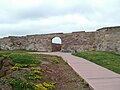 Dunbar Battery entrance.jpg 4,608 × 3,456; 2.87 MB
-
 Dunbar Battery.jpg 4,608 × 3,456; 2.67 MB
-
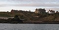
 Dunbar Castle - geograph.org.uk - 1716858.jpg 640 × 480; 63 KB
-
 Dunbar Cathedral - panoramio.jpg 4,320 × 3,240; 3.72 MB
-
 Dunbar Cement Works - geograph.org.uk - 1236873.jpg 640 × 480; 58 KB
-
 Dunbar Cement Works - geograph.org.uk - 1359042.jpg 640 × 480; 63 KB
-
 Dunbar Cement Works - geograph.org.uk - 1777325.jpg 640 × 403; 174 KB
-
 Dunbar Cliffs - geograph.org.uk - 3093456.jpg 640 × 419; 422 KB
-
 Dunbar East FBM - geograph.org.uk - 1449475.jpg 640 × 360; 67 KB
-
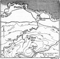
 Dunbar fishing port map.png 4,558 × 3,254; 6.27 MB
-
 Dunbar from Doon Hill - geograph.org.uk - 1344892.jpg 640 × 381; 83 KB
-
 Dunbar from Doon Hill - geograph.org.uk - 1780038.jpg 640 × 325; 149 KB
-
 Dunbar from the sea - geograph.org.uk - 1189313.jpg 640 × 330; 41 KB
-
 Dunbar Golf Club - geograph.org.uk - 1266092.jpg 640 × 360; 53 KB
-
 Dunbar Golf Club - geograph.org.uk - 1449490.jpg 640 × 360; 72 KB
-
 Dunbar Golf Club - geograph.org.uk - 1449526.jpg 640 × 480; 75 KB
-
 Dunbar Golf Course - geograph.org.uk - 1199387.jpg 427 × 640; 121 KB
-
 Dunbar Golf Course - geograph.org.uk - 1201785.jpg 640 × 427; 143 KB
-

-
 Dunbar Grammar School (geograph 4212714).jpg 1,600 × 1,064; 625 KB
-
 Dunbar Harbour - geograph.org.uk - 964627.jpg 640 × 480; 68 KB
-
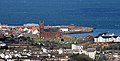
 Dunbar Harbour - panoramio.jpg 1,798 × 1,124; 1.44 MB
-
 Dunbar Harbour and Castle - geograph.org.uk - 1129866.jpg 640 × 455; 80 KB
-
 Dunbar Harbour and Castle, 1987.jpg 1,219 × 922; 957 KB
-
 Dunbar Harbour, East Lothian - entrance and castle.jpg 4,608 × 3,456; 4.34 MB
-
 Dunbar Harbours - geograph.org.uk - 820641.jpg 640 × 480; 79 KB
-
 Dunbar High Street - geograph.org.uk - 1778768.jpg 433 × 640; 147 KB
-
 Dunbar Lifeboat Day 2011 , On The Bridge - geograph.org.uk - 2518652.jpg 1,600 × 1,200; 290 KB
-
 Dunbar Parish Churchyard - geograph.org.uk - 1780045.jpg 640 × 427; 133 KB
-
 Dunbar Quarry - geograph.org.uk - 946945.jpg 640 × 480; 72 KB
-
 Dunbar Really Close-Up - panoramio.jpg 1,798 × 1,121; 1.52 MB
-
 Dunbar Regatta 2013 - geograph.org.uk - 3516688.jpg 640 × 459; 200 KB
-
 Dunbar Regatta 2013 - geograph.org.uk - 3516741.jpg 640 × 407; 219 KB
-
 Dunbar RFC in action.jpg 604 × 421; 64 KB
-
 Dunbar rooftops - geograph.org.uk - 1260364.jpg 640 × 434; 78 KB
-
 Dunbar Sailing Club - geograph.org.uk - 1182209.jpg 640 × 480; 70 KB
-
 Dunbar UK 3.jpg 2,048 × 1,536; 835 KB
-
 Dunbar Victoria Harbour, East Lothian.jpg 4,608 × 2,440; 3.29 MB
-
 Dunbar Weather Station - geograph.org.uk - 1360545.jpg 640 × 455; 65 KB
-
 Dunbar, East Lothian and the Firth of Forth, 1973 - Flickr - PhillipC.jpg 1,737 × 919; 1.18 MB
-
 Dunbar, from Roy Military Survey of Scotland, 1747-1755.png 1,002 × 832; 1.06 MB
-
 Dunbar, Frosty Day For Golf - panoramio.jpg 1,798 × 1,124; 1.78 MB
-
 Dunbar, Looking for my Golf ball - panoramio.jpg 1,798 × 1,124; 1.7 MB
-
 Dunbar, UK - panoramio (1).jpg 3,264 × 2,448; 1.58 MB
-
 Dunbar, UK - panoramio (2).jpg 2,456 × 528; 278 KB
-
 Dunbar, UK - panoramio (3).jpg 3,264 × 2,448; 1.83 MB


.jpg)
.jpg)
.jpg)


.jpg)
.jpg)
.jpg)
.jpg)
.jpg)
.jpg)
.jpg)
.jpg)


.jpg)


.jpg)


.jpg)
.jpg)


.jpg)
.jpg)


_-_geograph.org.uk_-_2377341.jpg)
_-_geograph.org.uk_-_2377352.jpg)


,_Dunbar_-_geograph.org.uk_-_2425491.jpg)


.jpg)
.jpg)


.jpg)


.jpg)
.jpg)
.jpg)