Category:Dunham Town
Jump to navigation
Jump to search
English: Dunham Town is a village in the civil parish of Dunham Massey in the Metropolitan Borough of Trafford, Greater Manchester, England. It was historically a part of Cheshire.
village in Trafford, Greater Manchester, UK  | |||||
| Upload media | |||||
| Instance of | |||||
|---|---|---|---|---|---|
| Location | Trafford, Greater Manchester, North West England, England | ||||
 | |||||
Subcategories
This category has only the following subcategory.
S
- St Mark's Church, Dunham Town (16 F)
Media in category "Dunham Town"
The following 59 files are in this category, out of 59 total.
-
 1, 3 and 4, Big Tree Cottages, Dunham Town 01.jpg 4,000 × 3,000; 2.64 MB
-
 1, 3 and 4, Big Tree Cottages, Dunham Town 02.jpg 4,000 × 3,000; 1.99 MB
-
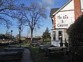
 Axe and Cleaver - geograph.org.uk - 2765578.jpg 640 × 480; 596 KB
-
 Axe and Cleaver public house.jpg 1,024 × 749; 318 KB
-
 Beetles eating Alder - geograph.org.uk - 412978.jpg 640 × 480; 79 KB
-
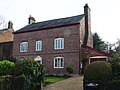
 Big Tree Cottages, Dunham Town.jpg 4,000 × 3,000; 2.09 MB
-
 Big Tree House, Dunham Town.jpg 4,000 × 3,000; 6.52 MB
-
 Bonville Road - geograph.org.uk - 4512630.jpg 6,000 × 4,000; 3.51 MB
-
 Charcoal Road joins School Lane at Dunham Town - geograph.org.uk - 3896132.jpg 1,024 × 754; 222 KB
-
 Diversionary tactics - geograph.org.uk - 146075.jpg 640 × 426; 155 KB
-
 Dog Farmhouse, Dunham Town.jpg 4,000 × 3,000; 6.18 MB
-
 Door and Plaque of Dunham Massey School.jpg 3,264 × 4,928; 11.45 MB
-
 Dunham Massey Brewery - geograph.org.uk - 1311958.jpg 640 × 480; 75 KB
-
 Dunham Massey Brewing Company - geograph.org.uk - 5723495.jpg 640 × 480; 67 KB
-
 Dunham School Plaque - geograph.org.uk - 2765569.jpg 640 × 640; 591 KB
-
 Dunham School, Dunham Town.jpg 4,000 × 3,000; 4.53 MB
-
 Dunham Town - Cow Lane - geograph.org.uk - 1231004.jpg 640 × 480; 213 KB
-
 Dunham Town - the main road - geograph.org.uk - 1231009.jpg 640 × 480; 196 KB
-
 Dunham Woodhouses - geograph.org.uk - 79500.jpg 640 × 480; 123 KB
-
 Farm Cottage and Rose Cottage, Dunham Town 01.jpg 4,000 × 3,000; 3.06 MB
-
 Farm Cottage and Rose Cottage, Dunham Town 02.jpg 4,000 × 3,000; 6.4 MB
-
 Farm Cottage and Rose Cottage, Dunham Town 03.jpg 4,000 × 3,000; 6.2 MB
-
 Farm land near Dunham Town, Trafford - geograph.org.uk - 5401162.jpg 1,280 × 888; 783 KB
-
 Fields Of Dunham Town - geograph.org.uk - 1231023.jpg 640 × 480; 180 KB
-
 Former post office at Dunham Town, Trafford - geograph.org.uk - 5408250.jpg 1,280 × 887; 940 KB
-
 Gardener's Cottage, Dunham Town.jpg 4,000 × 3,000; 6.74 MB
-
 Gardens in School Lane at Dunham Town - geograph.org.uk - 5086366.jpg 1,024 × 768; 220 KB
-
 House Demolition, Charcoal Road - geograph.org.uk - 2765596.jpg 640 × 480; 635 KB
-
 Ivy House, Dunham Town.jpg 4,000 × 3,000; 2.09 MB
-
 Junction on School Lane, Dunham - geograph.org.uk - 4952075.jpg 800 × 642; 159 KB
-
 Kitchen wall north of Dunham Massey 01.jpg 4,000 × 3,000; 6.4 MB
-
 Kitchen wall north of Dunham Massey 03.jpg 4,000 × 3,000; 6.45 MB
-
 Lime Tree Cottage and Yew Tree Cottage, Dunham Town 01.jpg 4,000 × 3,000; 6.28 MB
-
 Lime Tree Cottage and Yew Tree Cottage, Dunham Town 02.jpg 4,000 × 3,000; 6.45 MB
-
 Listed barn at Dunham Town.jpg 4,000 × 3,000; 6.26 MB
-
 Meadows Cottage and Magnolia Cottage, Dunham Town 01.jpg 4,000 × 3,000; 3.01 MB
-
 Meadows Cottage and Magnolia Cottage, Dunham Town 02.jpg 4,000 × 3,000; 6.28 MB
-
 Pasture near Dunham Town, Trafford - geograph.org.uk - 5404585.jpg 1,280 × 791; 890 KB
-
 Pasture near Dunham Town, Trafford - geograph.org.uk - 5404593.jpg 1,280 × 811; 996 KB
-
 Post Office and shop, Dunham Town - geograph.org.uk - 3174057.jpg 1,600 × 1,064; 337 KB
-
 Red Beech Farm - geograph.org.uk - 79126.jpg 640 × 480; 140 KB
-
 Red House Farm, The Maize Maze - geograph.org.uk - 29481.jpg 480 × 640; 104 KB
-
 School Lane at Dunham Massey, Trafford - geograph.org.uk - 5404582.jpg 960 × 1,280; 984 KB
-
 School Lane at Dunham Town, Trafford - geograph.org.uk - 5408241.jpg 1,280 × 911; 1.01 MB
-
 School Lane near Dunham Town, Trafford - geograph.org.uk - 5404588.jpg 1,280 × 823; 865 KB
-
 School Lane near Dunham Town, Trafford - geograph.org.uk - 5408235.jpg 1,280 × 887; 1.1 MB
-
 School Lane, Dunham Massey - geograph.org.uk - 4952056.jpg 800 × 600; 137 KB
-
 Smoking Room at the 'Axe and Cleaver' - geograph.org.uk - 2231661.jpg 640 × 480; 131 KB
-
 The Axe and Cleaver - geograph.org.uk - 4433986.jpg 4,387 × 2,323; 7.8 MB
-
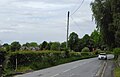
 Trans-Pennine Trail - geograph.org.uk - 1230992.jpg 480 × 640; 238 KB
-

-
 Village shop near Dunham Town, Trafford - geograph.org.uk - 5408160.jpg 1,280 × 960; 839 KB
-
 Field edge footpath near Dunham Town - geograph.org.uk - 447489.jpg 640 × 427; 130 KB
-

-

-
 Pasture - geograph.org.uk - 35737.jpg 640 × 480; 98 KB
-
 Pasture and Cows - geograph.org.uk - 35735.jpg 640 × 480; 71 KB
-

-
 Sinderland Lane - geograph.org.uk - 35742.jpg 640 × 480; 95 KB


