Category:Duntisbourne Rouse
Jump to navigation
Jump to search
English: Duntisbourne Rouse is a village and civil parish in Gloucestershire, England. It lies in the Cotswolds, an Area of Outstanding Natural Beauty.
village and civil parish in Gloucestershire, England, UK  | |||||
| Upload media | |||||
| Instance of | |||||
|---|---|---|---|---|---|
| Location | Cotswold, Gloucestershire, South West England, England | ||||
| Population |
| ||||
 | |||||
Subcategories
This category has the following 4 subcategories, out of 4 total.
Media in category "Duntisbourne Rouse"
The following 76 files are in this category, out of 76 total.
-
 "Stone", bridleway, near Pinbury Park (geograph 6676687).jpg 492 × 1,024; 166 KB
-

-
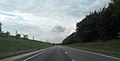
 A417 along Ermin Way - geograph.org.uk - 3676068.jpg 2,226 × 1,473; 1.42 MB
-
 A417 bridge over Welsh Way at Dartley Bottom - geograph.org.uk - 3274891.jpg 1,024 × 768; 473 KB
-

-
 A417 crossing Welsh Way near Dartley - geograph.org.uk - 5526510.jpg 640 × 412; 53 KB
-
 A417 Ermin Way - geograph.org.uk - 3696794.jpg 4,272 × 2,177; 1.88 MB
-

-

-
 A417 southbound at Duntisbourne - geograph.org.uk - 6475228.jpg 1,600 × 900; 571 KB
-
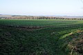 Arable land beside the Welsh Way - geograph.org.uk - 4263650.jpg 800 × 531; 99 KB
-
 Arable land near Duntisbourne - geograph.org.uk - 5089182.jpg 2,592 × 1,276; 661 KB
-
 Arable land west of Daglingworth - geograph.org.uk - 5089160.jpg 2,592 × 1,944; 1.89 MB
-
 Berries of Viburnum opulus, - geograph.org.uk - 3774110.jpg 800 × 800; 293 KB
-
 Bridleway near Parkcorner Farm - geograph.org.uk - 5088859.jpg 2,592 × 1,944; 1.24 MB
-
 Bridleway to Duntisbourne Rouse - geograph.org.uk - 3773658.jpg 800 × 600; 404 KB
-
 Cotswolds dry valley - geograph.org.uk - 3773662.jpg 800 × 600; 322 KB
-
 Dark Ride - geograph.org.uk - 5088871.jpg 2,592 × 1,944; 1.6 MB
-
 Duntisbourne Rous ford, from the footbridge - geograph.org.uk - 2450733.jpg 1,600 × 1,064; 537 KB
-

-
 Duntisbourne Rous, turnoff from main lane - geograph.org.uk - 2437625.jpg 1,024 × 681; 240 KB
-
 Duntisbourne Rouse Ford - geograph.org.uk - 3269477.jpg 3,872 × 2,592; 2.47 MB
-
 Duntisbourne Rouse ford - geograph.org.uk - 462279.jpg 640 × 477; 123 KB
-
 Duntisbourne Rouse Ford.jpg 3,870 × 2,764; 7.23 MB
-
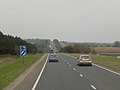
 Empty A417 - geograph.org.uk - 6475237.jpg 1,600 × 900; 537 KB
-
 Ermin Way - geograph.org.uk - 3410738.jpg 640 × 480; 304 KB
-
 Ermine Street, A417, heading south - geograph.org.uk - 5526502.jpg 640 × 440; 65 KB
-
 Farm track off Longhill Road - geograph.org.uk - 3773669.jpg 800 × 450; 215 KB
-
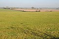
 Farmland above Dartley Farm - geograph.org.uk - 4263647.jpg 800 × 531; 72 KB
-
 Farmland near Duntisbourne Leer - geograph.org.uk - 4262133.jpg 800 × 531; 130 KB
-

-
 Lay-by on A417 near Dartley Bottom - geograph.org.uk - 3274892.jpg 1,024 × 768; 484 KB
-
 Layby on A417 - geograph.org.uk - 3695171.jpg 1,024 × 691; 96 KB
-
 Layby on the A417 Southbound - geograph.org.uk - 3410743.jpg 640 × 480; 381 KB
-
 Longhill Road - geograph.org.uk - 3773629.jpg 800 × 450; 243 KB
-
 Longhill Road - geograph.org.uk - 3773672.jpg 800 × 450; 254 KB
-
 Longhill Road - geograph.org.uk - 4262135.jpg 800 × 531; 187 KB
-
 Looking north-west on the A417 - geograph.org.uk - 2768233.jpg 640 × 480; 36 KB
-
 Looking south-east on the A417 - geograph.org.uk - 2768185.jpg 640 × 480; 49 KB
-
 Macmillan Way approaching Pinbury - geograph.org.uk - 2975505.jpg 5,184 × 3,456; 1.86 MB
-
 Marchants' Downs - geograph.org.uk - 4749473.jpg 800 × 531; 117 KB
-
 Oak tree below Halfpenny Hill - geograph.org.uk - 4264040.jpg 531 × 800; 190 KB
-
 Old Road at Park corner - geograph.org.uk - 1539135.jpg 640 × 480; 71 KB
-
 Overley Ride east of Park Corner - geograph.org.uk - 1109317.jpg 480 × 640; 171 KB
-
 Overley Ride west of Lower End - geograph.org.uk - 1109318.jpg 480 × 640; 164 KB
-
 Overley Ride, Cirencester Park - geograph.org.uk - 2743247.jpg 1,024 × 680; 273 KB
-
 Overley Ride, north - geograph.org.uk - 3774088.jpg 800 × 450; 245 KB
-
 Overley Ride, south - geograph.org.uk - 3774091.jpg 800 × 450; 240 KB
-
 Overley Road - geograph.org.uk - 5088865.jpg 2,592 × 1,944; 1.28 MB
-
 Overley Road climbs Overley Ridge - geograph.org.uk - 2894944.jpg 2,936 × 2,202; 1.54 MB
-

-
 Pasture land west of Overley Wood - geograph.org.uk - 3774116.jpg 800 × 450; 230 KB
-
 Rectory Farm - geograph.org.uk - 1001604.jpg 640 × 481; 224 KB
-
 Rough Plantation - geograph.org.uk - 1001693.jpg 640 × 481; 234 KB
-
 Scissor gate, Duntisbourne Rouse - geograph.org.uk - 1511239.jpg 480 × 640; 134 KB
-

-

-
 The Macmillan Way at Gloucester Lodge - geograph.org.uk - 3780828.jpg 800 × 450; 226 KB
-
 The road to Daglingworth - geograph.org.uk - 1109131.jpg 640 × 480; 100 KB
-
 Track and byway to Woodmancote - geograph.org.uk - 4262153.jpg 1,024 × 680; 347 KB
-
 Track and right of way - geograph.org.uk - 4264039.jpg 531 × 800; 185 KB
-

-
 Track to Park Corner - geograph.org.uk - 2975510.jpg 5,184 × 3,456; 1.78 MB
-
 Trees planted beside the Welsh Way - geograph.org.uk - 4265170.jpg 800 × 531; 133 KB
-
 Un-named lane south of Park Corner - geograph.org.uk - 2896826.jpg 3,648 × 2,736; 2.12 MB
-
 Victorian Letter-box - geograph.org.uk - 1515730.jpg 640 × 480; 125 KB
-
 Western edge of Overley Wood - geograph.org.uk - 3769290.jpg 800 × 450; 220 KB
-
-
 Apple Trees - geograph.org.uk - 1001579.jpg 640 × 481; 225 KB
-
 Bridleway approaching Overley Wood - geograph.org.uk - 462366.jpg 640 × 477; 115 KB
-
 Duntisbourne tip - geograph.org.uk - 462313.jpg 640 × 477; 91 KB
-
 Entering Overley Wood - geograph.org.uk - 462378.jpg 640 × 477; 156 KB
-
 Quiet bridleway - geograph.org.uk - 462356.jpg 640 × 477; 130 KB
-
 Rough Plantation - geograph.org.uk - 462384.jpg 640 × 477; 103 KB
-
 The track in Duntisbourne Grove - geograph.org.uk - 462270.jpg 640 × 477; 158 KB
-
 Towards Duntisbourne Grove - geograph.org.uk - 462268.jpg 640 × 477; 123 KB
.jpg)


,_Gloucestershire_-_geograph.org.uk_-_5904050.jpg)


