Category:Durris
Jump to navigation
Jump to search
Scottish parish in Aberdeenshire, Scotland, UK | |||||
| Upload media | |||||
| Instance of | |||||
|---|---|---|---|---|---|
| Part of |
| ||||
| Location |
| ||||
| Population |
| ||||
| Area |
| ||||
 | |||||
Media in category "Durris"
The following 200 files are in this category, out of 460 total.
(previous page) (next page)-
 A barn at Mains of Blairydrine - geograph.org.uk - 2663303.jpg 2,592 × 1,944; 836 KB
-
 A field drain to the River Dee - geograph.org.uk - 2344886.jpg 1,824 × 1,368; 713 KB
-
 A gated-track into the forest - geograph.org.uk - 891507.jpg 480 × 640; 115 KB
-
 A glimpse of Cairnfauld farm - geograph.org.uk - 6125512.jpg 6,000 × 4,000; 6.57 MB
-
 A grassy knoll near Blairydrine - geograph.org.uk - 2663282.jpg 2,592 × 1,944; 1.06 MB
-
 A lone path marker in the woods - geograph.org.uk - 891264.jpg 640 × 480; 117 KB
-
 A memorial 'shrine' on Mongour - geograph.org.uk - 891212.jpg 640 × 480; 125 KB
-
 A metal Crendon barn - geograph.org.uk - 891017.jpg 640 × 480; 75 KB
-
 A meter on Telecoms Cables - geograph.org.uk - 891478.jpg 480 × 640; 147 KB
-

-
 A minor road climbing up Glen Dhualt - geograph.org.uk - 3957059.jpg 4,608 × 3,456; 3.3 MB
-
 A new barn - geograph.org.uk - 3912829.jpg 2,097 × 1,443; 745 KB
-
 A new build (2017) - geograph.org.uk - 5611764.jpg 3,225 × 1,972; 1.01 MB
-
 A new farm structure - geograph.org.uk - 5609813.jpg 4,896 × 3,672; 4.75 MB
-
 A riverside cottage near Balbridie - geograph.org.uk - 2344882.jpg 640 × 528; 102 KB
-
 A road junction - geograph.org.uk - 891711.jpg 640 × 480; 65 KB
-
 A steading at Mains of Blairydrine - geograph.org.uk - 2663293.jpg 2,592 × 1,944; 554 KB
-
 A track in the forest - geograph.org.uk - 891620.jpg 640 × 480; 94 KB
-
 A tree-lined drain and field boundary - geograph.org.uk - 5609766.jpg 4,786 × 3,589; 3.91 MB
-
 A view over East Mulloch - geograph.org.uk - 3513643.jpg 640 × 480; 89 KB
-
 A view towards Inchloan - geograph.org.uk - 891693.jpg 640 × 480; 73 KB
-
 A957 at Barns junction - geograph.org.uk - 891040.jpg 640 × 469; 61 KB
-
 A957 at Spyhill - geograph.org.uk - 891513.jpg 640 × 480; 78 KB
-
 A957 Slug Road - geograph.org.uk - 5547303.jpg 5,184 × 3,888; 6.59 MB
-
 Access lane to Standingstones Farm - geograph.org.uk - 3513665.jpg 606 × 393; 62 KB
-
 Access to Ardmillan - geograph.org.uk - 1377164.jpg 640 × 520; 91 KB
-
 Access to Brigton Farm - geograph.org.uk - 1919869.jpg 1,024 × 768; 159 KB
-
 Access to Broomhead - geograph.org.uk - 3513615.jpg 640 × 480; 181 KB
-
 Access to Crossroads nursery school. - geograph.org.uk - 891052.jpg 640 × 463; 93 KB
-
 Access to Dhualt Cottages - geograph.org.uk - 5610258.jpg 4,711 × 3,171; 2.89 MB
-
 Access to Dhualt farm - geograph.org.uk - 3513924.jpg 640 × 449; 103 KB
-
 Access to Durris Bridge - geograph.org.uk - 1919816.jpg 1,024 × 768; 133 KB
-
 Access to Durris Forest - geograph.org.uk - 5594734.jpg 640 × 427; 447 KB
-
 Access to Durris Forest - geograph.org.uk - 5594739.jpg 640 × 427; 426 KB
-
 Access to East Molloch - geograph.org.uk - 3513619.jpg 640 × 480; 98 KB
-
 Access to Funach Wood - geograph.org.uk - 1919880.jpg 1,024 × 768; 243 KB
-
 Access to Glenhead farm - geograph.org.uk - 3513903.jpg 640 × 480; 129 KB
-
 Access to Mains of Blairydrine - geograph.org.uk - 2663268.jpg 1,296 × 972; 575 KB
-
 Access to Park Quarry (sandpit) - geograph.org.uk - 1919922.jpg 1,024 × 687; 136 KB
-
 Access to the River Dee - geograph.org.uk - 2344929.jpg 1,753 × 1,168; 1.06 MB
-
 Access to Westerton (March) - geograph.org.uk - 2323660.jpg 3,648 × 2,736; 833 KB
-
 Access Track - geograph.org.uk - 5351091.jpg 4,272 × 2,848; 3.99 MB
-
 Across Fields to Strathie - geograph.org.uk - 5172821.jpg 4,272 × 2,848; 1.89 MB
-
 Across the Dee - geograph.org.uk - 5351174.jpg 4,272 × 2,848; 2.6 MB
-
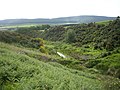
 Across the Dhualt - geograph.org.uk - 1867086.jpg 3,456 × 2,304; 1.3 MB
-
 An access to Durris Wood - geograph.org.uk - 891649.jpg 640 × 480; 93 KB
-
 An anchor point for TV mast - geograph.org.uk - 891298.jpg 640 × 480; 88 KB
-
 An entrance to Craiglug Wood - geograph.org.uk - 1919938.jpg 1,024 × 768; 210 KB
-
 An entrance to Durris Forest - geograph.org.uk - 891554.jpg 640 × 480; 105 KB
-
 An gated entrance to Durris Forest - geograph.org.uk - 5612614.jpg 4,401 × 3,067; 2.39 MB
-
 An' another'orse - geograph.org.uk - 891861.jpg 480 × 640; 65 KB
-
 An'orse - geograph.org.uk - 891857.jpg 480 × 640; 56 KB
-
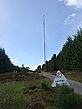
 Anchor array for Durris TV mast - geograph.org.uk - 892171.jpg 640 × 480; 66 KB
-

-
 Approach to A957 junction - geograph.org.uk - 1919804.jpg 1,024 × 768; 147 KB
-
-
 Approach to Crossroads - geograph.org.uk - 891048.jpg 640 × 384; 37 KB
-
 Approach to Durris TV mast grounds - geograph.org.uk - 891288.jpg 640 × 480; 121 KB
-
 Approach to Glenhead Cottages - geograph.org.uk - 3513660.jpg 619 × 385; 74 KB
-
 Ardmillan cottage - geograph.org.uk - 2663235.jpg 1,209 × 909; 481 KB
-
 Ardmillan cottage near Blairydryne - geograph.org.uk - 5610810.jpg 4,462 × 3,347; 3.33 MB
-
 Balbridie Plantation - geograph.org.uk - 1919853.jpg 1,024 × 768; 178 KB
-
 Balfour Tower - geograph.org.uk - 5172955.jpg 4,130 × 2,754; 2.24 MB
-
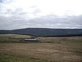
 Balladrum Farm - geograph.org.uk - 2395260.jpg 3,456 × 2,304; 1.28 MB
-
 Balladrum Sheep - geograph.org.uk - 2395239.jpg 3,456 × 2,304; 1.49 MB
-
 Barley field near Bogforran - geograph.org.uk - 6240829.jpg 5,184 × 3,888; 5.97 MB
-
 Barn at Westerton - geograph.org.uk - 2323665.jpg 1,824 × 1,368; 547 KB
-
 Barns Barn - geograph.org.uk - 5151160.jpg 3,756 × 2,504; 1.33 MB
-
 Barns Cottage - geograph.org.uk - 891008.jpg 640 × 480; 95 KB
-
 Barns Farm - geograph.org.uk - 892203.jpg 640 × 540; 62 KB
-
 Bench by the Track - geograph.org.uk - 1921595.jpg 640 × 427; 266 KB
-
 Bend in road near Inchloan - geograph.org.uk - 891676.jpg 640 × 480; 60 KB
-
 Bend left in Slug Road (A957), No Overtaking - geograph.org.uk - 5611721.jpg 4,380 × 3,285; 2.33 MB
-
 Bends on the Slug - geograph.org.uk - 2397483.jpg 3,456 × 2,304; 1.46 MB
-
 Black and white at Quithelhead - geograph.org.uk - 1730342.jpg 1,024 × 768; 99 KB
-
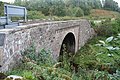
 Blairydryne Bridge - geograph.org.uk - 5129812.jpg 4,272 × 2,848; 4.56 MB
-
 Blairydryne Bridge - geograph.org.uk - 5610952.jpg 4,786 × 3,589; 3.35 MB
-
 Blairydryne Bridge - geograph.org.uk - 960871.jpg 640 × 427; 102 KB
-
 Blairydryne Farmyard - geograph.org.uk - 5610870.jpg 4,895 × 3,272; 4.22 MB
-
 Blairydryne stock yard - geograph.org.uk - 5610929.jpg 4,896 × 3,672; 5.01 MB
-
 Bogforran farm - geograph.org.uk - 5609799.jpg 4,896 × 3,672; 5.14 MB
-
 Bracken by the A957 - geograph.org.uk - 5594733.jpg 640 × 427; 428 KB
-
 Bridge of Blairydryne (the A957) - geograph.org.uk - 5537141.jpg 3,008 × 2,000; 3.08 MB
-
 Bridge of Blairydryne... - geograph.org.uk - 5537145.jpg 3,008 × 2,000; 2.77 MB
-
 Bridge over the Burn of Sheeoch - geograph.org.uk - 2394722.jpg 2,520 × 1,680; 7.33 MB
-
 Bridge over the March Burn - geograph.org.uk - 2344922.jpg 1,771 × 1,211; 1.26 MB
-
 Bridge over the Sheeoch - geograph.org.uk - 2396880.jpg 3,456 × 2,304; 1.71 MB
-
 Broom (Cytisus scoparius) pods - geograph.org.uk - 891494.jpg 640 × 480; 180 KB
-
 Building suspended^ - geograph.org.uk - 2663206.jpg 1,296 × 972; 433 KB
-
 Bull at East Mulloch - geograph.org.uk - 1867106.jpg 3,420 × 2,250; 1.11 MB
-
 Burn by Balbride - geograph.org.uk - 5351163.jpg 4,272 × 2,848; 4.57 MB
-
 Burn of Durris - geograph.org.uk - 4493634.jpg 640 × 427; 475 KB
-
 Burn of Sheeoch - geograph.org.uk - 1921601.jpg 640 × 427; 270 KB
-
 Burn of Sheeoch - geograph.org.uk - 1921607.jpg 640 × 427; 241 KB
-
 Burn of Sheeoch - geograph.org.uk - 5594763.jpg 640 × 427; 401 KB
-
 Butterfly near Red Beard's Well - geograph.org.uk - 891485.jpg 640 × 639; 156 KB
-
 Cairn Mon Earn Track - geograph.org.uk - 5547292.jpg 5,184 × 3,888; 7.39 MB
-
 Cairn Mon Earn Trig Pillar - geograph.org.uk - 5547282.jpg 5,184 × 3,888; 4.03 MB
-
 Cairn Mon Earn.jpg 1,920 × 1,080; 997 KB
-
 Cairn on Mongour - geograph.org.uk - 891191.jpg 480 × 640; 78 KB
-
 Cairn on Mongour - geograph.org.uk - 891197.jpg 640 × 480; 122 KB
-
 Cairn-mon-earn - geograph.org.uk - 1219084.jpg 640 × 428; 44 KB
-
 Cairn-mon-earn communications towers - geograph.org.uk - 3105409.jpg 800 × 600; 65 KB
-
 Cairnfauld Path - geograph.org.uk - 5157342.jpg 4,217 × 2,811; 5.3 MB
-
 Cairns Park, Woodlands of Durris - geograph.org.uk - 3912780.jpg 1,896 × 1,443; 717 KB
-
 Cairnshee Cairn - geograph.org.uk - 895266.jpg 640 × 480; 141 KB
-
 Calladrum Cattle - geograph.org.uk - 5172787.jpg 3,967 × 2,645; 1.81 MB
-
 Calladrum Farmhouse - geograph.org.uk - 5172785.jpg 4,261 × 2,841; 1.57 MB
-
 Castle Hill Motte - geograph.org.uk - 1262051.jpg 640 × 480; 152 KB
-
 Cattle at Wardend - geograph.org.uk - 5157324.jpg 4,228 × 2,818; 1.37 MB
-
 Cattle by a Pool - geograph.org.uk - 5164487.jpg 3,451 × 2,300; 1,020 KB
-
 Cattle by Lochton - geograph.org.uk - 5157182.jpg 3,948 × 2,632; 1.09 MB
-
 Cattle in the morning mist - geograph.org.uk - 896998.jpg 640 × 480; 90 KB
-
 Cattle resting on pasture beside B9077 - geograph.org.uk - 1919915.jpg 1,024 × 768; 184 KB
-
 Cleared Forest - geograph.org.uk - 5547345.jpg 5,184 × 3,888; 6.89 MB
-
 Clearing and Forest - geograph.org.uk - 5309414.jpg 4,272 × 2,848; 1.74 MB
-
 Climb to the Durris summit - geograph.org.uk - 1382967.jpg 640 × 480; 77 KB
-
 Clune Wood recumbent stone and flankers - geograph.org.uk - 5489208.jpg 2,474 × 1,517; 2.39 MB
-
 Clune Wood Recumbent Stone Circle (1) - geograph.org.uk - 4492680.jpg 640 × 427; 437 KB
-
 Clune Wood Recumbent Stone Circle (3) - geograph.org.uk - 4492698.jpg 640 × 427; 371 KB
-
 Clune Wood Recumbent Stone Circle (4) - geograph.org.uk - 4492703.jpg 640 × 427; 472 KB
-
 Clune Wood Recumbent Stone Circle (5) - geograph.org.uk - 4492705.jpg 640 × 427; 393 KB
-
 Clune Wood Recumbent Stone Circle (6) - geograph.org.uk - 4492707.jpg 427 × 640; 457 KB
-
 Clune Wood Recumbent Stone Circle (7) - geograph.org.uk - 4492711.jpg 640 × 427; 474 KB
-
 Clune Wood Recumbent Stone Circle (8) - geograph.org.uk - 4492715.jpg 640 × 427; 436 KB
-
 Clune Wood Recumbent Stone Circle (9) - geograph.org.uk - 4492718.jpg 640 × 427; 427 KB
-
 Clune Wood stone circle - geograph.org.uk - 5489215.jpg 3,008 × 2,000; 3.01 MB
-
 Clune Wood stone circle - geograph.org.uk - 5489236.jpg 2,000 × 2,608; 2.61 MB
-
 Clune Wood stone circle, recumbent and flankers - geograph.org.uk - 5489204.jpg 3,008 × 2,000; 2.99 MB
-
 Cock pheasant herding sheep - geograph.org.uk - 5609944.jpg 4,893 × 3,669; 2.9 MB
-
 Conjoined 'Standingstones Cottages' - geograph.org.uk - 5601138.jpg 4,359 × 3,269; 1.93 MB
-
 Corsehill Farm - geograph.org.uk - 3912846.jpg 2,295 × 1,383; 995 KB
-
 Cottage name sign - geograph.org.uk - 5610248.jpg 4,896 × 3,179; 3.77 MB
-
 Cows and sheep in the Aberdeenshire countryside - geograph.org.uk - 6124466.jpg 5,410 × 3,410; 4.61 MB
-
 Craiglug along the South Deeside Road - geograph.org.uk - 3544050.jpg 615 × 461; 129 KB
-
 Craigs of the Slugs - geograph.org.uk - 1370228.jpg 640 × 480; 150 KB
-
 Crossing the Dhualt Burn - geograph.org.uk - 3513943.jpg 640 × 480; 155 KB
-
 Crossing the Sheeoch - geograph.org.uk - 5157314.jpg 4,212 × 2,808; 1.7 MB
-
 Crossroads Ahead - geograph.org.uk - 5868339.jpg 5,184 × 3,888; 4.33 MB
-
 Crossroads nursery... - geograph.org.uk - 6125523.jpg 4,905 × 3,681; 5.32 MB
-
 Cut Forest - geograph.org.uk - 5307739.jpg 4,272 × 2,848; 4.85 MB
-
 Darnford - geograph.org.uk - 5594745.jpg 640 × 427; 293 KB
-
 Darnford Cottage - geograph.org.uk - 5612545.jpg 4,567 × 2,934; 1.95 MB
-
 Derelict Shed - geograph.org.uk - 1921680.jpg 427 × 640; 292 KB
-
 Descent from Glenhead - geograph.org.uk - 3513912.jpg 605 × 419; 85 KB
-
 Descent of minor road to Blairydryne - geograph.org.uk - 5610237.jpg 4,896 × 3,672; 4.93 MB
-
 Dhualt Burn below Glenhead - geograph.org.uk - 1370156.jpg 640 × 480; 169 KB
-
 Dhualt Cottage and Dhualt Hall - geograph.org.uk - 891836.jpg 640 × 458; 71 KB
-
 Dhualt Cottage in Glen Dhualt - geograph.org.uk - 5610210.jpg 4,440 × 3,331; 4.1 MB
-
 Dhualt Glen - geograph.org.uk - 3513934.jpg 640 × 480; 123 KB
-
 Direction post for Darnford Farm - geograph.org.uk - 5611838.jpg 4,896 × 3,672; 2.87 MB
-
 Distant view from near Culpercy Cottage - geograph.org.uk - 847939.jpg 640 × 421; 121 KB
-
 Double white lines - geograph.org.uk - 1919864.jpg 640 × 373; 56 KB
-
 Downhill Bends - geograph.org.uk - 2397486.jpg 3,456 × 2,304; 1.34 MB
-
 Downstream face of Blackburn Bridge - geograph.org.uk - 3956471.jpg 3,456 × 4,608; 3.16 MB
-
 Downstream face of the single arch Blairydryne Bridge - geograph.org.uk - 5610987.jpg 4,786 × 3,589; 3.62 MB
-
 Downstream parapet of the Blackburn Bridge - geograph.org.uk - 3956449.jpg 4,608 × 3,456; 2.98 MB
-
 Drainage Ditch - geograph.org.uk - 2397024.jpg 3,456 × 2,304; 1.72 MB
-
 Drive sweep and hedge at Wester Durris - geograph.org.uk - 3545570.jpg 615 × 461; 107 KB
-
 Driveway to Durris House - geograph.org.uk - 1919907.jpg 1,024 × 768; 220 KB
-
 Dual pole power lines - geograph.org.uk - 5609922.jpg 4,597 × 3,447; 2.36 MB
-
 Dull Day in Fetteresso Forest - geograph.org.uk - 1921573.jpg 427 × 640; 259 KB
-
 Durris Bridge - geograph.org.uk - 2344869.jpg 3,648 × 2,736; 2.23 MB
-
 Durris Bridge - geograph.org.uk - 5351084.jpg 4,272 × 2,848; 2.62 MB
-
 Durris Church - geograph.org.uk - 5172967.jpg 4,251 × 2,835; 2.5 MB
-
 Durris Forest - geograph.org.uk - 2397450.jpg 3,456 × 2,304; 1.13 MB
-
 Durris Forest - geograph.org.uk - 5172804.jpg 3,967 × 2,645; 2.01 MB
-
 Durris Forest Track - geograph.org.uk - 5547296.jpg 5,184 × 3,888; 6.05 MB
-
 Durris junction - geograph.org.uk - 891531.jpg 640 × 480; 106 KB
-
 Durris Memorial - geograph.org.uk - 1750052.jpg 2,304 × 3,456; 1.99 MB
-
 Durris Parish Kirk - geograph.org.uk - 4493648.jpg 640 × 427; 397 KB
-
 Durris parish kirk... - geograph.org.uk - 6122049.jpg 4,480 × 3,365; 4.34 MB
-
 Durris School - geograph.org.uk - 5489245.jpg 3,008 × 2,000; 2.67 MB
-
 Durris Signpost - geograph.org.uk - 2395224.jpg 2,304 × 3,456; 1.4 MB
-

-
 Durris TV Mast - geograph.org.uk - 3957022.jpg 4,608 × 3,456; 3.34 MB
-
 Durris TV Mast Road - geograph.org.uk - 5547359.jpg 5,184 × 3,888; 5.88 MB
-

-
 East Funach - geograph.org.uk - 2396912.jpg 2,304 × 3,456; 1.6 MB
-
 East Funach - geograph.org.uk - 5164500.jpg 3,417 × 2,276; 1.11 MB
-
 East Lodge, Durris House - geograph.org.uk - 1919925.jpg 1,024 × 656; 196 KB
-
 East Mulloch - geograph.org.uk - 1867109.jpg 3,340 × 2,118; 963 KB
-

-
 Entering Denside - geograph.org.uk - 3912750.jpg 2,205 × 1,515; 933 KB
-
 Entering Kirkton of Durris - geograph.org.uk - 6104447.jpg 4,748 × 3,110; 2.22 MB
-
 Entrance to Durris Forest - geograph.org.uk - 1370242.jpg 640 × 480; 170 KB
-
 Entrance to Free Church Wood, Durris - geograph.org.uk - 2405751.jpg 2,640 × 1,760; 6.16 MB
-
 Entrance to Leiths' Lochton Precast Works - geograph.org.uk - 5611704.jpg 4,302 × 2,758; 1.45 MB
-
 Entry to Spyhill forest - geograph.org.uk - 891111.jpg 640 × 480; 96 KB
-
 Exit from Durris Forest - geograph.org.uk - 5612628.jpg 4,550 × 3,411; 3.33 MB
-
 Fallen Tree - geograph.org.uk - 1921576.jpg 640 × 427; 278 KB
-
 Farm buildings at Standingstones - geograph.org.uk - 5601152.jpg 4,896 × 3,672; 6.71 MB
-
 Fetteresso Forest - geograph.org.uk - 1921582.jpg 427 × 640; 260 KB
-
 Field boundaries - geograph.org.uk - 810299.jpg 640 × 480; 120 KB
-
 Field boundaries south of Cairnshee Wood - geograph.org.uk - 5609749.jpg 4,896 × 3,672; 2.52 MB
-
 Field boundary near Bogforran - geograph.org.uk - 1370145.jpg 480 × 640; 164 KB
-
 Field Drain - geograph.org.uk - 5594749.jpg 640 × 427; 459 KB
-
 Field Dyke - geograph.org.uk - 5594754.jpg 480 × 640; 378 KB
-
 Field near Darnford - geograph.org.uk - 5594757.jpg 640 × 427; 426 KB
-
 Field near Standingstones - geograph.org.uk - 6240824.jpg 5,184 × 3,888; 6.99 MB


_-_geograph.org.uk_-_5611764.jpg)


_-_geograph.org.uk_-_1919922.jpg)

_-_geograph.org.uk_-_2323660.jpg)


,_No_Overtaking_-_geograph.org.uk_-_5611721.jpg)


_-_geograph.org.uk_-_5537141.jpg)


_pods_-_geograph.org.uk_-_891494.jpg)


_-_geograph.org.uk_-_4492680.jpg)
_-_geograph.org.uk_-_4492698.jpg)
_-_geograph.org.uk_-_4492703.jpg)
_-_geograph.org.uk_-_4492705.jpg)
_-_geograph.org.uk_-_4492707.jpg)
_-_geograph.org.uk_-_4492711.jpg)
_-_geograph.org.uk_-_4492715.jpg)
_-_geograph.org.uk_-_4492718.jpg)


