Category:Duxford
Jump to navigation
Jump to search

village and civil parish in Cambridgeshire, England  | |||||
| Upload media | |||||
| Instance of | |||||
|---|---|---|---|---|---|
| Location | South Cambridgeshire, Cambridgeshire, East of England, England | ||||
| Population |
| ||||
| Different from | |||||
| official website | |||||
 | |||||
Subcategories
This category has the following 10 subcategories, out of 10 total.
2
D
- Duxford level crossing (13 F)
J
- Duxford Chapel (9 F)
- John Barleycorn, Duxford (3 F)
P
- St Peter's Church, Duxford (24 F)
- The Plough, Duxford (6 F)
R
- Red Lion, Duxford (6 F)
Media in category "Duxford"
The following 200 files are in this category, out of 350 total.
(previous page) (next page)-
 1 mile to J10, M11 - geograph.org.uk - 4841224.jpg 640 × 426; 34 KB
-
 170 519 Duxford.jpg 3,024 × 1,848; 1.37 MB
-
 28 Green Street - geograph.org.uk - 2234713.jpg 640 × 425; 119 KB
-
 30, Abbey Street.jpg 4,000 × 2,992; 4.24 MB
-
 317 units at Duxford.jpg 3,464 × 1,480; 703 KB
-
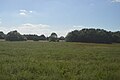
 A field of crops - geograph.org.uk - 5576744.jpg 640 × 426; 69 KB
-
 A lot of water in the Cam - geograph.org.uk - 4257685.jpg 1,024 × 768; 1.26 MB
-
 A Plaque - geograph.org.uk - 6074779.jpg 3,719 × 1,821; 1.84 MB
-
 A505 - geograph.org.uk - 1935326.jpg 640 × 426; 78 KB
-
 A505 - geograph.org.uk - 4778723.jpg 640 × 426; 44 KB
-
 A505 - geograph.org.uk - 4779280.jpg 640 × 426; 47 KB
-
 A505 approaching the M11 - geograph.org.uk - 4778725.jpg 640 × 426; 38 KB
-
 A505 heading east - geograph.org.uk - 5683548.jpg 640 × 428; 91 KB
-
 A505 heading east - geograph.org.uk - 5683553.jpg 640 × 428; 122 KB
-
 A505 near the Imperial War Museum - geograph.org.uk - 4778734.jpg 640 × 426; 76 KB
-
 A505, Duxford Camp - geograph.org.uk - 4779271.jpg 640 × 426; 69 KB
-
 A505, Duxford Camp - geograph.org.uk - 4779273.jpg 640 × 426; 40 KB
-
 Across the A505 - geograph.org.uk - 2651435.jpg 2,592 × 1,944; 2.4 MB
-
 Airspeed Ambassador at IWM Duxford - geograph.org.uk - 6307051.jpg 1,024 × 683; 928 KB
-
 Allotments, Duxford - geograph.org.uk - 5478991.jpg 1,600 × 1,150; 283 KB
-
 Along Grange Road - geograph.org.uk - 4256562.jpg 819 × 1,024; 1.14 MB
-
 American Air Museum - geograph.org.uk - 6308055.jpg 1,024 × 504; 425 KB
-
 American Air Museum - geograph.org.uk - 6308056.jpg 1,024 × 441; 419 KB
-
 American Air Museum - Tomahawk Cruise Missile - geograph.org.uk - 6331443.jpg 1,024 × 768; 697 KB
-
 Arriva XC Class 170 near Duxford.jpg 2,556 × 1,024; 336 KB
-

-
 Bedford CF with side windows July 1973 Duxford.JPG 2,825 × 1,800; 1.08 MB
-
 Birmingham train passing Duxford - geograph.org.uk - 758923.jpg 640 × 480; 87 KB
-
 Bridge over M11 at Duxford - geograph.org.uk - 5989917.jpg 1,024 × 768; 89 KB
-
 Building 61 - geograph.org.uk - 6308102.jpg 1,024 × 678; 618 KB
-
 Building 61 - geograph.org.uk - 6308167.jpg 1,024 × 678; 741 KB
-
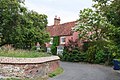
 Bustler's Cottage - geograph.org.uk - 2236981.jpg 640 × 425; 60 KB
-
 Chapel Street - geograph.org.uk - 2235907.jpg 640 × 425; 82 KB
-
 Chapel Street, Duxford - geograph.org.uk - 5781518.jpg 5,202 × 3,465; 3.48 MB
-
 Churchyard wall - geograph.org.uk - 6074898.jpg 6,032 × 4,014; 5.21 MB
-
 Civil Airliners at Duxford - geograph.org.uk - 6307038.jpg 1,024 × 768; 1,020 KB
-
 Close with trees - geograph.org.uk - 6078073.jpg 6,032 × 4,014; 5.75 MB
-
 College Farm Cottages - geograph.org.uk - 4256977.jpg 1,024 × 731; 229 KB
-
 Control Tower-Watch Office - geograph.org.uk - 6308068.jpg 1,024 × 521; 448 KB
-
 Control Tower-Watch Office - geograph.org.uk - 6308073.jpg 1,024 × 463; 332 KB
-
 Cottages, Chrishall Grange - geograph.org.uk - 3778384.jpg 4,320 × 3,240; 4.06 MB
-
 Crossing M11 at junction 10 - geograph.org.uk - 2076214.jpg 640 × 480; 65 KB
-
 Cutting, M11 - geograph.org.uk - 4841228.jpg 640 × 426; 35 KB
-
 Dedication plaque - geograph.org.uk - 6074773.jpg 5,595 × 3,623; 3.95 MB
-
 Delivery van on Grange Road - geograph.org.uk - 4256974.jpg 1,024 × 731; 1.01 MB
-
 Details on gas pipeline marker post - geograph.org.uk - 6310695.jpg 640 × 480; 137 KB
-
 Dragon Rapide Landing at Duxford - geograph.org.uk - 6307104.jpg 1,024 × 683; 733 KB
-
 Driveway leading to Duxford Mill - geograph.org.uk - 403976.jpg 640 × 480; 99 KB
-
 Duxford Aerodrome - geograph.org.uk - 4841236.jpg 640 × 426; 28 KB
-
 Duxford Aerodrome Control Tower - geograph.org.uk - 6305769.jpg 1,024 × 768; 1.01 MB
-
 Duxford Airfield - geograph.org.uk - 6305763.jpg 1,024 × 768; 934 KB
-
 Duxford Airfield - geograph.org.uk - 6307073.jpg 1,024 × 768; 881 KB
-
 Duxford Airfield, de Havilland DH82A Tiger Moth - geograph.org.uk - 6307800.jpg 1,024 × 768; 904 KB
-
 Duxford Airfield, Replica Spitfire - geograph.org.uk - 6305951.jpg 1,024 × 768; 1.36 MB
-
 Duxford Bailey Bridge - geograph.org.uk - 4642436.jpg 1,600 × 1,200; 656 KB
-
 Duxford chemicals factory - geograph.org.uk - 3229811.jpg 1,024 × 728; 219 KB
-
 Duxford from the air - geograph.org.uk - 5136376.jpg 640 × 480; 179 KB
-
 Duxford level crossing - geograph.org.uk - 5781499.jpg 5,202 × 3,465; 3.33 MB
-
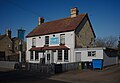
 Duxford Lodge Hotel - geograph.org.uk - 898365.jpg 640 × 480; 77 KB
-
 Duxford Motor Group on the corner of the A505 - geograph.org.uk - 3054713.jpg 1,600 × 1,200; 564 KB
-
 Duxford Post Office - geograph.org.uk - 757985.jpg 640 × 468; 57 KB
-
 Duxford Service Station - geograph.org.uk - 802489.jpg 640 × 480; 70 KB
-
 Duxford United Reformed Church - geograph.org.uk - 758257.jpg 640 × 480; 59 KB
-
 Duxford village sign.JPG 3,456 × 4,023; 2.53 MB
-
 Duxford, abandoned railway - geograph.org.uk - 4689602.jpg 1,024 × 791; 1.05 MB
-
 Duxford, across The Green - geograph.org.uk - 6155713.jpg 1,024 × 768; 1.17 MB
-
 Duxford, bare branches, Temple Close - geograph.org.uk - 5990590.jpg 1,024 × 819; 1.13 MB
-
 Duxford, Chapel Street - geograph.org.uk - 3857109.jpg 1,200 × 834; 1.18 MB
-
 Duxford, colourful creeper - geograph.org.uk - 4689619.jpg 1,024 × 695; 937 KB
-
 Duxford, cottages on the corner - geograph.org.uk - 3857528.jpg 1,200 × 730; 1.03 MB
-
 Duxford, cottages on The Green - geograph.org.uk - 3858340.jpg 932 × 1,024; 1.02 MB
-
 Duxford, disused level crossing - geograph.org.uk - 3229829.jpg 1,024 × 735; 229 KB
-
 Duxford, Fisher Close - geograph.org.uk - 5990573.jpg 1,024 × 683; 878 KB
-
 Duxford, gateway to The Old Rectory - geograph.org.uk - 3858366.jpg 800 × 800; 274 KB
-
 Duxford, Grade II listed houses on St Peter's Street - geograph.org.uk - 3857369.jpg 1,200 × 807; 1.07 MB
-
 Duxford, Green Street - geograph.org.uk - 3857102.jpg 1,200 × 981; 1.3 MB
-
 Duxford, King's Head House - geograph.org.uk - 3857380.jpg 1,200 × 959; 1.15 MB
-
 Duxford, Milkwood and Chapel Street - geograph.org.uk - 3857521.jpg 1,200 × 998; 1.35 MB
-
 Duxford, on Moorfield Road - geograph.org.uk - 5990604.jpg 1,024 × 768; 806 KB
-
 Duxford, overgrown siding - geograph.org.uk - 3229920.jpg 1,024 × 768; 417 KB
-
 Duxford, St Peter's Street - geograph.org.uk - 3857353.jpg 1,024 × 1,024; 1.22 MB
-
 Duxford, sunshine and shadows in November - geograph.org.uk - 3229939.jpg 1,024 × 994; 429 KB
-
 Duxford, The Biggen - geograph.org.uk - 5990582.jpg 819 × 1,024; 1.72 MB
-
 Duxford, the Cam passing The Biggen - geograph.org.uk - 5990576.jpg 819 × 1,024; 1.42 MB
-
 Duxford, the corner of Green Street - geograph.org.uk - 5990587.jpg 819 × 1,024; 1.09 MB
-
 Duxford, The Green - geograph.org.uk - 3229973.jpg 1,024 × 776; 354 KB
-
 Duxford, The Green and The Corner House - geograph.org.uk - 3858350.jpg 1,200 × 879; 1.5 MB
-
 Duxford, United Reformed Church - geograph.org.uk - 3857535.jpg 1,024 × 1,024; 1.08 MB
-
 Duxford, weatherboarding on Mangers Lane - geograph.org.uk - 3857540.jpg 1,024 × 901; 1.03 MB
-
 Duxford1graff.jpg 2,000 × 1,786; 386 KB
-

-
 Entrance to Duxford Airfield - geograph.org.uk - 6308109.jpg 1,024 × 678; 680 KB
-
 Entrance to Duxford Airfield - geograph.org.uk - 6308113.jpg 1,024 × 678; 697 KB
-
 Entrance to Duxford Farm - geograph.org.uk - 6310674.jpg 640 × 480; 69 KB
-
 Eurocopter Helicopter M-XHEC at Duxford Airfield - geograph.org.uk - 6307081.jpg 1,024 × 768; 825 KB
-
 Farm track near Duxford Airfield - geograph.org.uk - 757991.jpg 640 × 480; 49 KB
-
 Farmland and woodland near Duxford - geograph.org.uk - 5399114.jpg 640 × 403; 52 KB
-

-
 Farmland, Hinxton - geograph.org.uk - 5400483.jpg 640 × 378; 52 KB
-
 Fibre optic broadband - geograph.org.uk - 6075757.jpg 6,032 × 4,014; 6.3 MB
-
 Field boundary and copse - geograph.org.uk - 837572.jpg 640 × 480; 60 KB
-
 Field gate opposite Duxford Farm - geograph.org.uk - 6310677.jpg 640 × 480; 77 KB
-
 Field near Chrishall Grange - geograph.org.uk - 3264247.jpg 1,024 × 768; 168 KB
-
 Field near Hinxton - geograph.org.uk - 5576761.jpg 640 × 426; 62 KB
-

-
-
 Field with view of Duxford Aerodrome - geograph.org.uk - 837560.jpg 640 × 480; 80 KB
-
 Fields by the A505, Duxford - geograph.org.uk - 5416391.jpg 2,048 × 1,536; 1.48 MB
-
 Firemark, St Peter's Street - geograph.org.uk - 758974.jpg 640 × 640; 71 KB
-
 Flooded fields near Duxford - geograph.org.uk - 5781504.jpg 5,202 × 3,465; 4.8 MB
-
 Floodplain of the River Cam - geograph.org.uk - 5570797.jpg 640 × 426; 73 KB
-
 Ford - geograph.org.uk - 2237043.jpg 640 × 425; 94 KB
-
 Ford and footbridge across the River Cam or Granta, Hinxton - geograph.org.uk - 5978209.jpg 2,000 × 1,500; 1.16 MB
-
 Ford on Hinxton Road - geograph.org.uk - 5781489.jpg 5,202 × 3,465; 4 MB
-
 Former Workshop Building - Duxford Airfield - geograph.org.uk - 5561542.jpg 1,600 × 1,200; 520 KB
-
 Four-house terrace - geograph.org.uk - 6077369.jpg 6,032 × 4,014; 5.32 MB
-
 From Grange Road to the A505 - geograph.org.uk - 4256491.jpg 1,024 × 732; 951 KB
-
 Garden at the cafe - geograph.org.uk - 6074208.jpg 6,032 × 4,014; 6.7 MB
-

-
 Grange Farm Cottages - geograph.org.uk - 802184.jpg 640 × 480; 79 KB
-
 Grange Farm, Duxford - geograph.org.uk - 4256965.jpg 1,024 × 683; 942 KB
-
 Grange Road - geograph.org.uk - 6310685.jpg 640 × 480; 95 KB
-
 Grange Road Bridge, M11 - geograph.org.uk - 4841013.jpg 640 × 426; 42 KB
-
 Grange Road Bridge, M11 - geograph.org.uk - 4841230.jpg 640 × 426; 37 KB
-
 Grasses - geograph.org.uk - 5586536.jpg 640 × 426; 52 KB
-
 Grasses - geograph.org.uk - 5586538.jpg 640 × 426; 45 KB
-
 Grasses in the Cam Valley - geograph.org.uk - 5586540.jpg 640 × 426; 47 KB
-
 Grassland - geograph.org.uk - 5576766.jpg 640 × 426; 52 KB
-
 Graystones Cafe - geograph.org.uk - 6074207.jpg 5,830 × 4,010; 4.18 MB
-
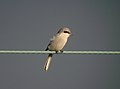 Great Grey Shrike (Lanius excubitor) - geograph.org.uk - 3745465.jpg 1,544 × 1,150; 357 KB
-
 Green Street - geograph.org.uk - 2234663.jpg 640 × 430; 62 KB
-
 Green Street, Duxford - geograph.org.uk - 2528558.jpg 1,000 × 667; 179 KB
-
 Green Street, Duxford - geograph.org.uk - 2528561.jpg 1,000 × 667; 233 KB
-
 Hall, Chapel Street - geograph.org.uk - 2235939.jpg 640 × 425; 102 KB
-
 Hangar 1 - geograph.org.uk - 6307981.jpg 1,024 × 419; 307 KB
-
 Hangar 2 - geograph.org.uk - 6307959.jpg 1,024 × 528; 430 KB
-
 Hangar 2 - geograph.org.uk - 6307962.jpg 1,024 × 507; 382 KB
-
 Hangar 3 - geograph.org.uk - 6307999.jpg 1,024 × 508; 392 KB
-
 Hangar 5 - geograph.org.uk - 6308009.jpg 1,024 × 472; 422 KB
-
 Hangar 5 - geograph.org.uk - 6308035.jpg 1,024 × 678; 534 KB
-
 Hangar 5 - geograph.org.uk - 6308039.jpg 1,024 × 704; 581 KB
-
 Hangar 5 - geograph.org.uk - 6308042.jpg 1,024 × 678; 566 KB
-
 Hangar 5 - geograph.org.uk - 6308184.jpg 1,024 × 537; 474 KB
-
 Harvesting near Chrishall Grange - geograph.org.uk - 3264239.jpg 1,024 × 768; 155 KB
-
 Hinxton Ford - geograph.org.uk - 2987836.jpg 3,264 × 2,448; 3.65 MB
-
 Hinxton Ford - geograph.org.uk - 82295.jpg 640 × 480; 162 KB
-
 Hinxton Ford in autumn - geograph.org.uk - 3229327.jpg 1,024 × 744; 355 KB
-
 Hinxton Rd - geograph.org.uk - 5576757.jpg 573 × 640; 93 KB
-
 Historical remains behind the church - geograph.org.uk - 6077684.jpg 6,032 × 4,014; 7.1 MB
-
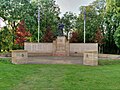
 Honor Guard (detail) - geograph.org.uk - 6306308.jpg 1,024 × 768; 989 KB
-
 Horse in a field - geograph.org.uk - 6075758.jpg 6,032 × 4,014; 4.86 MB
-
 Horsekeeper's Cottage, Chapel Street - geograph.org.uk - 758252.jpg 640 × 480; 91 KB
-
 Houses in Green Street Duxford - geograph.org.uk - 6310733.jpg 640 × 480; 97 KB
-
 Hoverfly - Duxford July 2009 (3712834216).jpg 2,048 × 1,365; 343 KB
-
 How to attack the Imperial War Museum - geograph.org.uk - 802432.jpg 640 × 480; 59 KB
-
 Howitzer Field Gun, IWM Duxford - geograph.org.uk - 6305880.jpg 1,024 × 683; 1,003 KB
-
 Ickleton Road, Duxford - geograph.org.uk - 3584360.jpg 640 × 360; 68 KB
-
-

-
 In the valley of the Cam - geograph.org.uk - 5576753.jpg 640 × 315; 52 KB
-
 Industrial area, Duxford - geograph.org.uk - 5436988.jpg 1,600 × 1,203; 301 KB
-
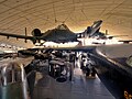 Inside the American Air Museum, IWM Duxford - geograph.org.uk - 6305851.jpg 1,024 × 767; 879 KB
-
 Inside the long thin wood (1) - geograph.org.uk - 837579.jpg 640 × 480; 161 KB
-
 Inside the long thin wood (2) - geograph.org.uk - 837581.jpg 640 × 480; 142 KB
-
 IWM Duxford - geograph.org.uk - 6308235.jpg 1,024 × 492; 434 KB
-
 IWM Duxford - geograph.org.uk - 6308238.jpg 1,024 × 465; 418 KB
-
 IWM Duxford - geograph.org.uk - 6308253.jpg 1,024 × 568; 480 KB
-
 IWM Duxford - geograph.org.uk - 6308255.jpg 1,024 × 445; 367 KB
-
 IWM Duxford ATC - geograph.org.uk - 5061003.jpg 640 × 424; 55 KB
-
-
 IWM Duxford, Coastal Defence Gun - geograph.org.uk - 6306111.jpg 1,024 × 768; 999 KB
-
 IWM Duxford, Morris Cargo Vehicle R Type 4x2 - geograph.org.uk - 6305893.jpg 1,024 × 768; 1.16 MB
-
 IWM Duxford, Pre-Production Concorde Cockpit - geograph.org.uk - 6305919.jpg 1,024 × 768; 842 KB
-
 IWM Duxford, The American Air Museum - geograph.org.uk - 6305836.jpg 1,024 × 767; 865 KB
-
 J10 Overbridge, M11 - geograph.org.uk - 4841242.jpg 640 × 426; 43 KB
-
 J10 overbridges, M11 - geograph.org.uk - 4841239.jpg 640 × 426; 50 KB
-
 J10, M11 - geograph.org.uk - 4841237.jpg 640 × 426; 36 KB
-
 John Deere model 6520 tractor - geograph.org.uk - 802521.jpg 640 × 480; 117 KB
-
 Kings Head House - geograph.org.uk - 2236934.jpg 640 × 425; 64 KB
-
 Land Warfare Hall - geograph.org.uk - 6308086.jpg 1,024 × 537; 423 KB
-
 Land Warfare Hall - geograph.org.uk - 6308093.jpg 1,024 × 539; 439 KB
-
 Looking south from Duxford level crossing - geograph.org.uk - 5781501.jpg 5,202 × 3,465; 3.16 MB
-
 M11 - 1 mile sign for junction 10 - geograph.org.uk - 2640858.jpg 640 × 428; 80 KB
-
 M11 - junction 10 1-2 mile sign - geograph.org.uk - 2640874.jpg 640 × 428; 70 KB
-
 M11 junction 10 - geograph.org.uk - 2640902.jpg 640 × 428; 79 KB
-
 M11 Junction 10 - geograph.org.uk - 3365521.jpg 640 × 438; 41 KB
-
 M11 junction 10 - geograph.org.uk - 759057.jpg 640 × 475; 43 KB
-
 M11 junction 10 for Duxford - geograph.org.uk - 3456925.jpg 1,659 × 988; 699 KB
-
 M11 northbound near Duxford - geograph.org.uk - 3455771.jpg 1,566 × 823; 606 KB
-
 M11 south of Duxford - geograph.org.uk - 3455762.jpg 1,695 × 1,012; 790 KB
-
 M11 southbound at J10 - geograph.org.uk - 3806266.jpg 640 × 354; 29 KB
-
 M11, Grange Road Bridge - geograph.org.uk - 3806269.jpg 640 × 341; 30 KB
-
 M11, southbound - geograph.org.uk - 4841011.jpg 640 × 426; 42 KB
-

-
 Markby Close, Duxford - geograph.org.uk - 2287837.jpg 640 × 480; 80 KB
-
 Memorial Window, American Air Museum at Duxford - geograph.org.uk - 6305861.jpg 800 × 1,067; 969 KB
-
 Memphis Belle - geograph.org.uk - 6305748.jpg 1,024 × 768; 741 KB
-
 Milkwood - geograph.org.uk - 2235926.jpg 640 × 425; 80 KB
-
 Mill Lane - geograph.org.uk - 2236885.jpg 640 × 425; 68 KB
-
 Mill Lane, Duxford - geograph.org.uk - 5781533.jpg 5,202 × 3,465; 2.58 MB


_-_geograph.org.uk_-_3745465.jpg)


_-_geograph.org.uk_-_6306308.jpg)


.jpg)


_-_geograph.org.uk_-_837579.jpg)
_-_geograph.org.uk_-_837581.jpg)


