Category:Easington Colliery
Jump to navigation
Jump to search
village in County Durham, England, UK  | |||||
| Upload media | |||||
| Instance of | |||||
|---|---|---|---|---|---|
| Location | County Durham, North East England, England | ||||
| Said to be the same as | Easington Colliery (Wikimedia duplicated page, civil parish) | ||||
 | |||||
Places in Easington Colliery.
Subcategories
This category has the following 2 subcategories, out of 2 total.
E
- Easington railway station (3 F)
H
- Hawthorn Dene, County Durham (9 F)
Media in category "Easington Colliery"
The following 165 files are in this category, out of 165 total.
-
 Abandoned limekiln - geograph.org.uk - 1358191.jpg 640 × 480; 116 KB
-
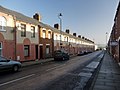
 Allan Street, Easington Colliery - geograph.org.uk - 1578512.jpg 1,024 × 576; 480 KB
-
 Allotments, Easington Colliery.jpg 640 × 480; 72 KB
-
 Angus Street in Easington Colliery - geograph.org.uk - 3190834.jpg 1,500 × 955; 199 KB
-

-
 Avon Street, Easington Colliery.jpg 640 × 480; 46 KB
-
 B1283 Sunderland Road at Grants Houses - geograph.org.uk - 5667265.jpg 800 × 599; 148 KB
-
 B1283, Easington Colliery.jpg 640 × 480; 64 KB
-
 Beach and cliffs at Busiers Holes - geograph.org.uk - 4823006.jpg 640 × 480; 272 KB
-

-
 Beach at Easington Colliery - geograph.org.uk - 4845952.jpg 640 × 384; 139 KB
-
 Beach east of Easington Colliery - geograph.org.uk - 1581973.jpg 1,024 × 576; 552 KB
-
 Beach east of Easington Colliery - geograph.org.uk - 1581996.jpg 640 × 480; 85 KB
-
 Beacon hill from 1100 feet asl - geograph.org.uk - 884603.jpg 640 × 480; 49 KB
-
 Beacon Point - geograph.org.uk - 4823855.jpg 640 × 480; 266 KB
-
 Breach in the cliffs north of Fox Holes - geograph.org.uk - 1582017.jpg 640 × 480; 102 KB
-
 Brick Ruin - geograph.org.uk - 4846029.jpg 640 × 480; 161 KB
-
 Brick, on Easington Colliery Beach - geograph.org.uk - 4845975.jpg 640 × 480; 211 KB
-
 Brick, on Easington Colliery Beach - geograph.org.uk - 4845988.jpg 640 × 384; 164 KB
-
 Bridge on the Durham Coast Line near Easington Colliery. 24 02 2021.jpg 4,032 × 1,960; 3.63 MB
-
 Bridge under Durham Coastal Railway.jpg 640 × 480; 83 KB
-
 Bridge Under Railway. Horden Dene - geograph.org.uk - 3744959.jpg 640 × 427; 305 KB
-
 Byron Street, Easington Colliery - geograph.org.uk - 1578448.jpg 640 × 480; 76 KB
-
 Byron Street, Easington Colliery.jpg 640 × 480; 85 KB
-
 Capped shaft of Easington Colliery - geograph.org.uk - 1578557.jpg 640 × 480; 98 KB
-
 Castle Street, Easington Colliery - geograph.org.uk - 2827675.jpg 640 × 480; 74 KB
-
 Cave in Hawthorn Dene - geograph.org.uk - 4823831.jpg 640 × 480; 358 KB
-
 Cinderella Rock seen from Easington Beach - geograph.org.uk - 2013772.jpg 2,048 × 1,536; 801 KB
-
 Cliff in Hawthorn Dene - geograph.org.uk - 4823826.jpg 480 × 640; 364 KB
-
 Cliffs and beach at Fox Holes - geograph.org.uk - 4822997.jpg 640 × 480; 276 KB
-
 Coast near Easington Colliery - geograph.org.uk - 3744966.jpg 640 × 427; 244 KB
-

-
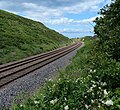
 Coastal Railway - geograph.org.uk - 1359678.jpg 640 × 480; 62 KB
-
 Coastal woodland, Fox Holes Dene - geograph.org.uk - 2703589.jpg 640 × 480; 174 KB
-
 Crawlaw Lane, Easington Colliery - geograph.org.uk - 2703614.jpg 640 × 480; 70 KB
-
 Ditch at Busiers Holes - geograph.org.uk - 4822970.jpg 640 × 480; 303 KB
-
 Drainage Channel - geograph.org.uk - 3262715.jpg 640 × 427; 226 KB
-
 Durham Coast Line near Shippersea Bay - geograph.org.uk - 5636915.jpg 800 × 733; 224 KB
-
 Durham Coast Path near the Loom - geograph.org.uk - 4823641.jpg 640 × 480; 308 KB
-
 Durham Coast Path south of Hawthorn Dene - geograph.org.uk - 2152516.jpg 1,024 × 768; 201 KB
-
 Durham Coast Path south of Hawthorn Dene - geograph.org.uk - 4823843.jpg 640 × 480; 317 KB
-
 Durham Coastal footpath at Fox Holes Dene - geograph.org.uk - 4335258.jpg 3,264 × 2,448; 4 MB
-
 Easington Cliffs and Beach from the Loom - geograph.org.uk - 4340051.jpg 3,264 × 2,448; 3.21 MB
-
 Easington Colliery Cemetery - geograph.org.uk - 2703605.jpg 640 × 480; 161 KB
-

-
 Easington Colliery, Pit Cage Monument - geograph.org.uk - 5636491.jpg 800 × 600; 187 KB
-
 Easington Colliery.jpg 896 × 599; 134 KB
-
 Easington Infants School - geograph.org.uk - 3262702.jpg 405 × 539; 164 KB
-
 Easington Junior School - geograph.org.uk - 3262696.jpg 640 × 427; 224 KB
-
 Easington Street Easington Colliery County Durham - geograph.org.uk - 2175997.jpg 2,048 × 1,536; 644 KB
-

-

-
 Entering Grants Houses - geograph.org.uk - 3329332.jpg 800 × 600; 124 KB
-
 Entrance park to Fox Holes Dene - geograph.org.uk - 4822273.jpg 640 × 480; 284 KB
-
 Fields above Shot Rock - geograph.org.uk - 2098485.jpg 640 × 480; 68 KB
-
 Footbridge in Hawthorn Dene - geograph.org.uk - 4823838.jpg 640 × 480; 376 KB
-
 Footpath Crossing the Railway Line - geograph.org.uk - 3262719.jpg 640 × 427; 210 KB
-
 Footpath near Easington Lea Farm - geograph.org.uk - 1541182.jpg 640 × 480; 111 KB
-
 Footpath off Paradise Crescent - geograph.org.uk - 3191702.jpg 640 × 480; 40 KB
-
 Footpath on north side of Fox holes Dene - geograph.org.uk - 4335623.jpg 3,264 × 2,448; 4.07 MB
-
 Footpath to the Pit Cage Monument - geograph.org.uk - 3190832.jpg 1,500 × 1,000; 172 KB
-
 Footpath towards the sea - geograph.org.uk - 2703583.jpg 640 × 480; 153 KB
-
 Footpath up Beacon Hill from Hawthorn Dene - geograph.org.uk - 2524082.jpg 3,648 × 2,736; 3.22 MB
-

-
 Fox Holes Dene - geograph.org.uk - 1582194.jpg 640 × 480; 104 KB
-
 Fox Holes Dene - geograph.org.uk - 849073.jpg 640 × 480; 85 KB
-
 Grazing land, Easington Colliery - geograph.org.uk - 2703612.jpg 640 × 480; 93 KB
-
 Grey sands north of Fox Holes - geograph.org.uk - 1582011.jpg 640 × 480; 86 KB
-
 Hawthorn Burn Viaduct - geograph.org.uk - 3262724.jpg 640 × 427; 234 KB
-
 Hawthorn Dene - geograph.org.uk - 4822284.jpg 640 × 480; 376 KB
-
 Hawthorn Dene - geograph.org.uk - 4823815.jpg 640 × 480; 404 KB
-
 Hawthorn Dene Viaduct - geograph.org.uk - 4823835.jpg 480 × 640; 294 KB
-
 Hawthorn Dene Viaduct - geograph.org.uk - 4823841.jpg 640 × 480; 349 KB
-
 Hawthorn Dene Viaduct - geograph.org.uk - 5637051.jpg 800 × 642; 240 KB
-

-
 Holmehill Lane Allotments - geograph.org.uk - 322882.jpg 640 × 480; 94 KB
-
 Horden Burn at Fox Holes Dene - geograph.org.uk - 1582166.jpg 480 × 640; 120 KB
-
 Houses on Seaside Lane - geograph.org.uk - 2703618.jpg 640 × 480; 77 KB
-
 Icy path past Pill Box to Easington Beach - geograph.org.uk - 4337060.jpg 3,264 × 2,448; 3.13 MB
-
 Level crossing on the Durham Coast Line - geograph.org.uk - 5636893.jpg 642 × 800; 237 KB
-
 Looking down Ashton Street - geograph.org.uk - 3190835.jpg 1,500 × 994; 117 KB
-
 Looking down on the Loom - geograph.org.uk - 4341570.jpg 3,264 × 2,448; 3.67 MB
-
 Looking North near Foxholes Dene - geograph.org.uk - 4335296.jpg 3,264 × 2,448; 3.03 MB
-
 Looking North near Foxholes Dene - geograph.org.uk - 4335632.jpg 3,264 × 2,448; 2.58 MB
-
 Main Shopping Area, Easington Colliery.jpg 640 × 480; 104 KB
-
 Memorial Avenue, Easington Colliery - geograph.org.uk - 2703607.jpg 640 × 480; 80 KB
-
 Memorial Garden, Easington Colliery - geograph.org.uk - 1578485.jpg 640 × 480; 101 KB
-
 Milton Lane - geograph.org.uk - 4196175.jpg 640 × 480; 57 KB
-

-
 National Trust sign at Shippersea Bay - geograph.org.uk - 5636880.jpg 670 × 800; 180 KB
-
 Newcastle to Middlesbrough line - geograph.org.uk - 831407.jpg 640 × 480; 124 KB
-
 North end of Shippersea Bay - geograph.org.uk - 5443667.jpg 800 × 700; 151 KB
-
 Off Memorial Avenue, Easington Colliery.jpg 640 × 480; 62 KB
-
 Old brickwork in Hawthorn Dene - geograph.org.uk - 4823819.jpg 640 × 480; 431 KB
-
 Path above Fox Holes Dene - geograph.org.uk - 4822962.jpg 640 × 480; 313 KB
-
 Path above Fox Holes Dene - geograph.org.uk - 4822989.jpg 480 × 640; 447 KB
-
 Path above Shippersea Bay - geograph.org.uk - 5636872.jpg 800 × 647; 161 KB
-

-

-
 Path junction at Busiers Holes - geograph.org.uk - 4822979.jpg 640 × 480; 316 KB
-
-
 Path through the Blue House Plantation - geograph.org.uk - 5637194.jpg 800 × 610; 245 KB
-

-
 Path under the Durham Coast Line - geograph.org.uk - 5667263.jpg 800 × 600; 174 KB
-
 Path under the railway - geograph.org.uk - 5518683.jpg 800 × 568; 104 KB
-
 Pillbox on path to Easington Beach - geograph.org.uk - 1582026.jpg 640 × 480; 88 KB
-
 Pipeline,Fox Holes - geograph.org.uk - 849077.jpg 640 × 480; 90 KB
-

-

-

-
 Play area on site of former Easington Colliery - geograph.org.uk - 2013734.jpg 2,048 × 1,536; 949 KB
-

-
 Pond on Site of Old Colliery - geograph.org.uk - 3262707.jpg 640 × 427; 248 KB
-
 Public Footpath - geograph.org.uk - 5028879.jpg 640 × 427; 631 KB
-
 Railway arch at Fox Holes Dene - geograph.org.uk - 4822278.jpg 640 × 480; 286 KB
-
 Railway Bridge - geograph.org.uk - 3262711.jpg 640 × 427; 235 KB
-
 Railway bridge over footpath - geograph.org.uk - 2703592.jpg 640 × 480; 106 KB
-

-
 Railway line between Sunderland and Hartlepool - geograph.org.uk - 4340065.jpg 3,264 × 2,448; 3.27 MB
-

-
 Sea cliffs north-west of Loom - geograph.org.uk - 1581907.jpg 640 × 480; 84 KB
-

-
 Seaside Lane in Easington Colliery - geograph.org.uk - 5640621.jpg 800 × 516; 139 KB
-
 Shippersea Bay - geograph.org.uk - 320072.jpg 640 × 480; 90 KB
-
 Shippersea Bay - geograph.org.uk - 4823857.jpg 640 × 480; 260 KB
-

-
 Shippersea Bay near Easington Colliery - geograph.org.uk - 2152530.jpg 1,024 × 768; 232 KB
-
 Shot Rock - geograph.org.uk - 2098295.jpg 640 × 480; 59 KB
-

-
 Shot Rock from cliff tops - geograph.org.uk - 2098284.jpg 640 × 480; 84 KB
-
 Site of former Easington Colliery - geograph.org.uk - 1578586.jpg 1,024 × 576; 407 KB
-
 Site of the sidings serving Easington Colliery. 24 02 2021.jpg 4,032 × 1,960; 2.06 MB
-

-
 Steps down to the beach at Bed Slide - geograph.org.uk - 4823012.jpg 640 × 480; 265 KB
-
 Steps to beach on County Durham Coast - geograph.org.uk - 2013755.jpg 2,048 × 1,536; 1.47 MB
-
 The bridge to Busiers Holes - geograph.org.uk - 3190828.jpg 1,500 × 986; 154 KB
-

-
 The Loom - geograph.org.uk - 4823639.jpg 640 × 480; 299 KB
-
 The Mineworkers Memorial, Easington - geograph.org.uk - 3329331.jpg 800 × 600; 138 KB
-

-
 The railway near Easington Colliery - geograph.org.uk - 3190826.jpg 1,500 × 984; 178 KB
-

-
 Thorpe Lea West - geograph.org.uk - 1541194.jpg 640 × 480; 87 KB
-
 Three fulmars at Shippersea Bay - geograph.org.uk - 5443373.jpg 800 × 689; 162 KB
-

-
 Track to Beacon House - geograph.org.uk - 5028924.jpg 640 × 427; 482 KB
-
 Track to Thorpe Lea East Farm - geograph.org.uk - 1541031.jpg 640 × 480; 112 KB
-
 Track west of Beacon Hill - geograph.org.uk - 1541026.jpg 640 × 480; 93 KB
-
 Train on the Durham Coast Line - geograph.org.uk - 5443357.jpg 800 × 600; 81 KB
-
 View South along Coast - geograph.org.uk - 2098486.jpg 640 × 480; 87 KB
-
 View south along Horden Beach - geograph.org.uk - 5518657.jpg 800 × 600; 146 KB
-

-
 Walkers on the Durham Coast Path - geograph.org.uk - 4823852.jpg 640 × 480; 299 KB
-
 Washing day in Anthony Street - geograph.org.uk - 3190836.jpg 1,500 × 1,000; 182 KB
-
 WW2 Bunker at Fox Holes - geograph.org.uk - 4846080.jpg 640 × 384; 82 KB
-
 Beach at Hive Point - geograph.org.uk - 1424346.jpg 640 × 480; 73 KB
-

-
 Beacon Hill Trig Point - geograph.org.uk - 831404.jpg 640 × 477; 42 KB
-
 Chourdon Point - geograph.org.uk - 41396.jpg 640 × 480; 68 KB
-
 Coastal Path near Easington Colliery - geograph.org.uk - 320066.jpg 640 × 480; 70 KB
-
 Footpath by County Durham Coastal Railway - geograph.org.uk - 323344.jpg 640 × 480; 101 KB
-
 Holme Hill Farm - geograph.org.uk - 320044.jpg 640 × 480; 61 KB
-
 Horden Hall - geograph.org.uk - 488193.jpg 640 × 480; 86 KB
-
 Spring Bank - geograph.org.uk - 488199.jpg 640 × 480; 84 KB
-
 Woods above Hawthorn Burn - geograph.org.uk - 320077.jpg 640 × 480; 99 KB


_towards_Easington_-_geograph.org.uk_-_2703623.jpg)


