Category:East Calder
Jump to navigation
Jump to search
town in West Lothian, Scotland, UK  | |||||
| Upload media | |||||
| Instance of | |||||
|---|---|---|---|---|---|
| Location |
| ||||
| Population |
| ||||
 | |||||
English: East Calder is a small town located in West Lothian, Scotland. It is located about a mile east of Mid Calder and about a mile west of Wilkieston.
Gàidhlig: Tha Caladar an Ear (Beurla: East Calder) ann an Lodainn an Iar. Tha e ri taobh Caladar Meadhanach.'S e seo na co-chomharran aige: 55° 54′ 0″ Tuath agus 3° 28′ 0″ Iar.
Subcategories
This category has the following 5 subcategories, out of 5 total.
Media in category "East Calder"
The following 27 files are in this category, out of 27 total.
-
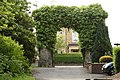 Arch in East Calder. - panoramio.jpg 1,936 × 1,288; 938 KB
-
 Broompark Plant Centre - geograph.org.uk - 90303.jpg 640 × 480; 72 KB
-
 Convenience Store - geograph.org.uk - 90299.jpg 640 × 480; 103 KB
-
 Cycle Path onto A71 near Milrig - geograph.org.uk - 788508.jpg 640 × 480; 83 KB
-
 Farmland and wood from Overshiel - geograph.org.uk - 1307629.jpg 640 × 480; 84 KB
-

-
 Health Centre, East Calder - geograph.org.uk - 788526.jpg 640 × 480; 82 KB
-
 Horseyculture, Burnhouse. - geograph.org.uk - 45300.jpg 636 × 436; 76 KB
-
 Mowing - geograph.org.uk - 893089.jpg 640 × 480; 81 KB
-
 Nasmyth Bridge NE view.jpg 4,032 × 3,024; 2.67 MB
-
 NCN75 - geograph.org.uk - 893250.jpg 640 × 480; 99 KB
-
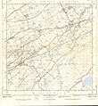 Ordnance Survey Sheet NT 06 The Calders, Published 1956.jpg 7,198 × 7,819; 7.68 MB
-
 Ploughing, Raw Camp. - geograph.org.uk - 45314.jpg 640 × 480; 64 KB
-
 Raw Cottage near East Calder now stands empty. - panoramio - tormentor4555.jpg 3,888 × 2,592; 4.79 MB
-
 Raw Cottage near East Calder now stands empty. - panoramio.jpg 3,888 × 2,592; 3.89 MB
-
 Raw Farm Nurseries - geograph.org.uk - 1323081.jpg 640 × 480; 67 KB
-
 Redcraig Road - geograph.org.uk - 893319.jpg 640 × 359; 48 KB
-
 Redcraig Road - geograph.org.uk - 893324.jpg 640 × 359; 52 KB
-
 Ribbon development, Raw Camps. - geograph.org.uk - 45311.jpg 640 × 442; 65 KB
-
 Ripening barley - geograph.org.uk - 1396654.jpg 640 × 480; 103 KB
-
 Sign at entrance to Latch Farm - geograph.org.uk - 48545.jpg 480 × 640; 188 KB
-
 Soldier beetles - geograph.org.uk - 503017.jpg 640 × 480; 112 KB
-
 Sycamore tree - geograph.org.uk - 1396641.jpg 480 × 640; 69 KB
-
 The slow train to Edinburgh^ - geograph.org.uk - 43097.jpg 640 × 480; 107 KB
-
 The slow train to Glasgow^ - geograph.org.uk - 43095.jpg 640 × 480; 129 KB
-
 Track near East Calder - geograph.org.uk - 788515.jpg 640 × 480; 114 KB
-
 Water Channel near Shiel Mill - geograph.org.uk - 788842.jpg 640 × 480; 103 KB


