Category:East Dean, West Sussex
Jump to navigation
Jump to search
village and civil parish in West Sussex, UK  | |||||
| Upload media | |||||
| Instance of | |||||
|---|---|---|---|---|---|
| Location | Chichester, West Sussex, South East England, England | ||||
| Area |
| ||||
| Said to be the same as | East Dean (Wikimedia duplicated page, civil parish) | ||||
 | |||||
Subcategories
This category has the following 4 subcategories, out of 4 total.
E
F
- East Dean Free Church (15 F)
Media in category "East Dean, West Sussex"
The following 200 files are in this category, out of 396 total.
(previous page) (next page)-
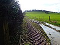
 A bit of a problem on the Monarch's Way - geograph.org.uk - 3842823.jpg 800 × 600; 231 KB
-
 A Corner of East Dean - geograph.org.uk - 2087041.jpg 2,560 × 1,920; 1.77 MB
-
 A little way down then a long way up - geograph.org.uk - 2399465.jpg 600 × 800; 165 KB
-

-
 Approaching East Dean - geograph.org.uk - 5599938.jpg 4,608 × 3,456; 5.59 MB
-
 Autumn colours in Droke Lane - geograph.org.uk - 2685511.jpg 480 × 640; 129 KB
-
 Autumn on the South Downs Way - geograph.org.uk - 2142206.jpg 2,592 × 1,944; 2.19 MB
-
 Autumn woodland - geograph.org.uk - 2115548.jpg 640 × 428; 108 KB
-
 Barn at Newhouse Farm - geograph.org.uk - 2498699.jpg 800 × 600; 144 KB
-
 Barn Conversion, East Dean - geograph.org.uk - 2087162.jpg 2,560 × 1,920; 1.72 MB
-
 Barn conversions at Manor Farm, East Dean - geograph.org.uk - 1960069.jpg 1,600 × 1,200; 444 KB
-
 Bridle gate between woodland and field - geograph.org.uk - 2498783.jpg 800 × 600; 111 KB
-
 Bridlegate on Oxen Down - geograph.org.uk - 3841995.jpg 800 × 600; 244 KB
-
 Bridleway 429 - geograph.org.uk - 6440707.jpg 1,375 × 1,600; 1.03 MB
-
 Bridleway 482 - geograph.org.uk - 3236258.jpg 640 × 480; 172 KB
-
 Bridleway 482 through Charlton Forest - geograph.org.uk - 2262172.jpg 640 × 480; 177 KB
-

-
 Bridleway at the top end of Oxen Down - geograph.org.uk - 2144897.jpg 2,592 × 1,944; 2.38 MB
-
 Bridleway between Forest Hanger and Eastdean Wood - geograph.org.uk - 2142029.jpg 2,592 × 1,944; 1.95 MB
-

-

-
 Bridleway emerges onto Newhouse Lane - geograph.org.uk - 2498669.jpg 800 × 600; 151 KB
-
 Bridleway enters woodland near Pond Barn - geograph.org.uk - 2498718.jpg 800 × 600; 209 KB
-

-

-

-
 Bridleway in Bubholts - geograph.org.uk - 5596802.jpg 4,608 × 3,456; 7.3 MB
-
 Bridleway in East Dean - geograph.org.uk - 2498665.jpg 800 × 600; 177 KB
-
 Bridleway in Little Copse - geograph.org.uk - 2543644.jpg 4,000 × 3,000; 3.48 MB
-
 Bridleway in Open Winkins - geograph.org.uk - 2103670.jpg 2,560 × 1,920; 1.86 MB
-
 Bridleway in Selhurst Park - geograph.org.uk - 3236200.jpg 640 × 480; 193 KB
-
 Bridleway joins track on Oxen Down - geograph.org.uk - 3841996.jpg 800 × 600; 212 KB
-
 Bridleway junction near North Side - geograph.org.uk - 2144629.jpg 2,592 × 1,944; 2.35 MB
-

-
 Bridleway junction, Charlton Forest - geograph.org.uk - 2262295.jpg 640 × 480; 155 KB
-
-
 Bridleway parallel to Selhurstpark Road - geograph.org.uk - 1958845.jpg 1,600 × 1,200; 615 KB
-
 Bridleway parallel to Selhurstpark Road - geograph.org.uk - 2545477.jpg 4,000 × 3,000; 3.61 MB
-
 Bridleway starting next to car park on Droke Lane - geograph.org.uk - 2136940.jpg 2,592 × 1,944; 2.25 MB
-
 Bridleway SW into The Scrubs from Graffham Down - geograph.org.uk - 2142235.jpg 2,592 × 1,944; 2.62 MB
-
 Bridleway Through Open Winkins - geograph.org.uk - 2104638.jpg 2,560 × 1,920; 1.82 MB
-
 Bridleway to Boxgrove - geograph.org.uk - 5604886.jpg 4,608 × 3,456; 6.42 MB
-
 Bridleway to Bubholts - geograph.org.uk - 5601951.jpg 4,608 × 3,456; 5.07 MB
-
 Bridleway to Chiseldown Clump - geograph.org.uk - 5598240.jpg 4,608 × 3,456; 7.6 MB
-
 Bridleway to Droke Lane - geograph.org.uk - 2711206.jpg 1,024 × 768; 289 KB
-
 Bridleway to East Dean - geograph.org.uk - 5596800.jpg 4,608 × 3,456; 6.69 MB
-
 Bridleway to Selhurstpark Road - geograph.org.uk - 5574546.jpg 4,608 × 3,456; 6.96 MB
-
 Bridleway to Selhurstpark Road - geograph.org.uk - 5587350.jpg 4,608 × 3,456; 6.74 MB
-

-
 Broad Walk - geograph.org.uk - 2837885.jpg 4,000 × 3,000; 3.49 MB
-
 Buildings at Droke Farm in East Dean - geograph.org.uk - 2498922.jpg 800 × 600; 93 KB
-

-
 Butcher's Lane - geograph.org.uk - 5601935.jpg 4,608 × 3,456; 4.48 MB
-
 Cattle in field with a hillside view - geograph.org.uk - 2543375.jpg 4,000 × 3,000; 3.49 MB
-
 Chalky descent to Droke - geograph.org.uk - 2144944.jpg 2,592 × 1,944; 2.2 MB
-
 Charlton Forest - geograph.org.uk - 2498899.jpg 800 × 600; 230 KB
-
 Charlton Forest - geograph.org.uk - 6440725.jpg 1,600 × 1,078; 756 KB
-
 Charlton Forest track - geograph.org.uk - 2498908.jpg 600 × 800; 166 KB
-
 Charlton Road - geograph.org.uk - 6441133.jpg 1,024 × 649; 186 KB
-

-
 Charlton Road nearing East Dean - geograph.org.uk - 2137913.jpg 2,592 × 1,944; 1.34 MB
-
 Chichester Challenge charity runners on Monarch's Way - geograph.org.uk - 1958905.jpg 1,600 × 1,200; 619 KB
-
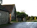
 Church at East Dean - geograph.org.uk - 6404106.jpg 1,802 × 1,201; 638 KB
-
 Cottage in East Dean - geograph.org.uk - 2498658.jpg 600 × 800; 184 KB
-
 Counter's Gate car park on Goodwood Country Park - geograph.org.uk - 2545481.jpg 4,000 × 3,000; 3.37 MB
-
 Counter's Gate entrance to Goodwood Country Park - geograph.org.uk - 1958853.jpg 1,600 × 1,200; 610 KB
-
 Counter’s Gate - geograph.org.uk - 6259854.jpg 1,024 × 768; 375 KB
-
 Crops on south slope of High Down - geograph.org.uk - 5596070.jpg 4,608 × 3,456; 4.43 MB
-
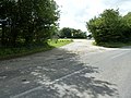
 Crossroads at Pilleygreen Lodges - geograph.org.uk - 1958816.jpg 1,600 × 1,200; 628 KB
-
 Crossroads at Pilleygreen Lodges - geograph.org.uk - 2711220.jpg 1,024 × 768; 204 KB
-
 Crosstracks in Eastdean Wood - geograph.org.uk - 2498740.jpg 800 × 600; 173 KB
-
 Cut through Open Winkins - geograph.org.uk - 1958796.jpg 1,600 × 1,200; 684 KB
-
 Cyclists approaching Pilleygreen Lodges - geograph.org.uk - 1958830.jpg 1,600 × 1,200; 664 KB
-
 Dead and Alive - geograph.org.uk - 2399489.jpg 800 × 600; 217 KB
-
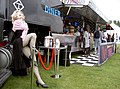 Diner on wheels - Vintage at Goodwood - geograph.org.uk - 2029366.jpg 2,304 × 1,704; 1.59 MB
-
 Discarded tank traps on High Down - geograph.org.uk - 2143510.jpg 2,592 × 1,944; 2.39 MB
-
 Downland North of East Dean - geograph.org.uk - 2086971.jpg 2,560 × 1,920; 1.74 MB
-
 Droke Hanger, Selhurst Park - geograph.org.uk - 5582640.jpg 4,608 × 3,456; 6.39 MB
-
 Droke Lane entering East Dean from the east - geograph.org.uk - 2136969.jpg 2,592 × 1,944; 1.94 MB
-
 Droke Lane looking east at Ide's Barn - geograph.org.uk - 3841959.jpg 800 × 600; 160 KB
-
 Droke Lane, PO18 0JH - geograph.org.uk - 5576216.jpg 4,608 × 3,456; 4.09 MB
-

-

-
 Dwellings by flooded field at Droke - geograph.org.uk - 3841982.jpg 800 × 600; 143 KB
-
 Earthworks behind church, East Dean.JPG 2,048 × 1,536; 655 KB
-
 East along Selhurstpark Road - geograph.org.uk - 1958806.jpg 1,600 × 1,200; 737 KB
-

-

-
 East Dean - geograph.org.uk - 2087172.jpg 2,560 × 1,920; 1.7 MB
-
 East Dean - geograph.org.uk - 2686053.jpg 3,968 × 2,976; 2.86 MB
-
 East Dean - geograph.org.uk - 6441090.jpg 1,600 × 1,001; 373 KB
-
 East Dean - geograph.org.uk - 6441128.jpg 1,600 × 986; 398 KB
-
 East Dean Church - geograph.org.uk - 6441111.jpg 3,867 × 2,550; 3 MB
-
 East Dean Football Club, PO18 0JH - geograph.org.uk - 5601522.jpg 4,608 × 3,456; 4.38 MB
-
 East Dean pond - geograph.org.uk - 952564.jpg 640 × 480; 125 KB
-
 East Dean pond.JPG 1,280 × 960; 510 KB
-
 East Dean village - geograph.org.uk - 1960460.jpg 1,600 × 1,200; 490 KB
-
 East Dean Village Pub - geograph.org.uk - 2087133.jpg 2,560 × 1,920; 1.8 MB
-
 East Dean, village pond.JPG 2,048 × 1,536; 745 KB
-
 East Dean, West Sussex - geograph.org.uk - 2686050.jpg 3,968 × 2,976; 2.6 MB
-
 Eastdean Hill south out of East Dean - geograph.org.uk - 1959123.jpg 1,600 × 1,200; 743 KB
-
 Eastdean Wood - geograph.org.uk - 2143246.jpg 2,592 × 1,944; 2.28 MB
-
 Entrance to Charlton Forest - geograph.org.uk - 3236325.jpg 640 × 480; 191 KB
-
 Entrance to Droke Farm East Dean - geograph.org.uk - 2136974.jpg 2,592 × 1,944; 1.09 MB
-
 Entrance to Vintage At Goodwood - geograph.org.uk - 2013946.jpg 2,304 × 1,704; 1.39 MB
-
 Fallow deer stag - geograph.org.uk - 2143254.jpg 2,592 × 1,944; 1.69 MB
-
 Farm tack on High Down - geograph.org.uk - 5576413.jpg 4,608 × 3,456; 4.49 MB
-
 Farm track from Droke Lane - geograph.org.uk - 5594006.jpg 4,608 × 3,456; 4.95 MB
-
 Farm track parallel with Droke Lane - geograph.org.uk - 5593983.jpg 4,608 × 3,456; 4.75 MB
-
 Farm track to Ide's Barn - geograph.org.uk - 5576594.jpg 4,608 × 3,456; 4.44 MB
-
 Farm track to Wallerdean Hill - geograph.org.uk - 5591625.jpg 4,608 × 3,456; 4.35 MB
-
 Farm track west of East Dean - geograph.org.uk - 3842059.jpg 800 × 600; 147 KB
-
 Farmyard at Ide's Barn - geograph.org.uk - 3841962.jpg 800 × 600; 113 KB
-
 Field crossed by bridleway - geograph.org.uk - 3236227.jpg 640 × 480; 129 KB
-
 Field edge on Halnaker Hill - geograph.org.uk - 3842115.jpg 800 × 600; 153 KB
-
 Field footpath goes west from Eastdean Hill - geograph.org.uk - 2861621.jpg 1,024 × 768; 329 KB
-
 Field footpath leaves road called Eastdean Hill - geograph.org.uk - 2859087.jpg 1,024 × 768; 171 KB
-
 Field north of East Dean - geograph.org.uk - 5363097.jpg 4,000 × 3,000; 7.55 MB
-
 Field north of East Dean - geograph.org.uk - 5363108.jpg 4,000 × 3,000; 6.87 MB
-
 Field north of East Dean - geograph.org.uk - 5363115.jpg 4,000 × 3,000; 4.54 MB
-
 Field on Court Hill - geograph.org.uk - 5891800.jpg 3,456 × 2,592; 3.61 MB
-
 Field with footpath near Postles Barn - geograph.org.uk - 2498877.jpg 800 × 600; 138 KB
-
 Fields near Ide's Barn - geograph.org.uk - 2685521.jpg 640 × 480; 45 KB
-
 Fields on the South Downs near East Dean - geograph.org.uk - 2498824.jpg 768 × 1,024; 190 KB
-
 Fingerpost in Droke Lane - geograph.org.uk - 5584903.jpg 4,608 × 3,456; 7.07 MB
-
 Fire break on Oxen Down - geograph.org.uk - 3842000.jpg 600 × 800; 250 KB
-
 Fire break on Selhurstpark Hill - geograph.org.uk - 2711181.jpg 1,024 × 768; 258 KB
-
 Flint Cottage, East Dean - geograph.org.uk - 2087026.jpg 2,560 × 1,920; 1.84 MB
-
 Flint walled barn at Pond Barn - geograph.org.uk - 1962368.jpg 1,600 × 1,200; 537 KB
-
 Flint-Walled Cottage, East Dean - geograph.org.uk - 2087052.jpg 1,920 × 2,560; 1.8 MB
-
 Flooded bend on Droke Lane - geograph.org.uk - 3841968.jpg 800 × 600; 186 KB
-

-
 Footpath by Wood Lea - geograph.org.uk - 2086943.jpg 2,560 × 1,920; 1.73 MB
-
 Footpath climbing High Down - geograph.org.uk - 2143444.jpg 2,592 × 1,944; 2.37 MB
-
 Footpath crossing of bridleway - geograph.org.uk - 2115476.jpg 640 × 428; 150 KB
-
 Footpath entering woodland on Eastdean Hill - geograph.org.uk - 5891812.jpg 3,456 × 2,592; 4.15 MB
-
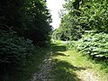
 Footpath in Charlton Forest - geograph.org.uk - 1962430.jpg 1,600 × 1,200; 791 KB
-
 Footpath in Droke Hanger - geograph.org.uk - 1963340.jpg 1,600 × 1,200; 750 KB
-
 Footpath in Droke Hanger - geograph.org.uk - 5582662.jpg 4,608 × 3,456; 6.23 MB
-
 Footpath in Shepherd's Croft wood - geograph.org.uk - 2143275.jpg 2,592 × 1,944; 2.4 MB
-
 Footpath leaves new Road north of East Dean - geograph.org.uk - 2498911.jpg 768 × 1,024; 322 KB
-
 Footpath leaving Butcher's Lane, East Dean - geograph.org.uk - 5891822.jpg 3,456 × 2,592; 4.31 MB
-
 Footpath on Court Hill - geograph.org.uk - 2086960.jpg 2,560 × 1,920; 1.72 MB
-
 Footpath on Eastdean Hill - geograph.org.uk - 5891809.jpg 3,456 × 2,592; 4.59 MB
-

-
 Footpath sign and stile in East Dean - geograph.org.uk - 2498596.jpg 800 × 600; 116 KB
-
 Footpath sign at the crest of High Down - geograph.org.uk - 2143523.jpg 2,592 × 1,944; 2.22 MB
-
 Footpath through Stonehill Clump at Goodwood Country Park - geograph.org.uk - 2543365.jpg 4,000 × 3,000; 3.52 MB
-
 Footpath through the woods to Ripshook - geograph.org.uk - 2498881.jpg 800 × 600; 197 KB
-
 Footpath to Droke Lane - geograph.org.uk - 5601498.jpg 4,608 × 3,456; 4.9 MB
-
 Footpath to Eastdean Hill - geograph.org.uk - 5575590.jpg 4,608 × 3,456; 5.71 MB
-
 Forest on Graffham Down looking East - geograph.org.uk - 2416797.jpg 4,320 × 3,240; 5.56 MB
-
 Forest road and bridleway junction in Charlton Forest - geograph.org.uk - 1962494.jpg 1,600 × 1,200; 657 KB
-
 Forest track - geograph.org.uk - 5573433.jpg 4,608 × 3,351; 4.2 MB
-
 Forest track - geograph.org.uk - 6440699.jpg 1,600 × 1,029; 717 KB
-
 Forest track in Red Copse - geograph.org.uk - 5605405.jpg 4,608 × 3,456; 4.92 MB
-
 Forest track north to North Side - geograph.org.uk - 2144637.jpg 2,592 × 1,944; 1.99 MB
-
 Forest track on Park Hill - geograph.org.uk - 5888911.jpg 3,456 × 2,592; 4.72 MB
-
 Forest track on Park Hill Goodwood - geograph.org.uk - 5888904.jpg 3,456 × 2,592; 4.29 MB
-
 Forest Track to Red Copse - geograph.org.uk - 2103654.jpg 1,920 × 2,560; 1.73 MB
-
 Forestry Commission - Selhurst - geograph.org.uk - 2103604.jpg 2,560 × 1,920; 1.75 MB
-
 Forestry Commission board on High Down - geograph.org.uk - 2143298.jpg 2,592 × 1,944; 2.32 MB
-
 Forestry track looking towards Shepherds Croft - geograph.org.uk - 2498890.jpg 1,024 × 768; 269 KB
-
 Forestry track NW to the South Downs Way - geograph.org.uk - 2837935.jpg 4,000 × 3,000; 3.5 MB
-
 Game shoot near Stonepit Bottom - geograph.org.uk - 2143250.jpg 2,592 × 1,944; 1.78 MB
-
 Gate across track, Goodwood Estate - geograph.org.uk - 5584921.jpg 4,608 × 3,456; 6.74 MB
-
 Gate and wood stack - geograph.org.uk - 5604911.jpg 4,608 × 3,456; 5.97 MB
-
 Gate at southern end of woodland on Oxen Down - geograph.org.uk - 2144927.jpg 2,592 × 1,944; 2.5 MB
-
 Gate on bridleway - geograph.org.uk - 5603105.jpg 4,608 × 3,456; 5.66 MB
-
 Gate on footpath approach to Pond Barn - geograph.org.uk - 1962366.jpg 1,600 × 1,200; 448 KB
-
 Grass pathway to East Dean church - geograph.org.uk - 2498603.jpg 800 × 600; 157 KB
-
 Green pastures north of Droke - geograph.org.uk - 2144936.jpg 2,592 × 1,944; 1.01 MB
-
 Halfmoon Piece, a small wood on Court Hill - geograph.org.uk - 1960477.jpg 1,600 × 1,200; 509 KB
-
 Haredown mountain boarding centre - geograph.org.uk - 952546.jpg 640 × 480; 81 KB
-
 Height restriction warning posts - geograph.org.uk - 5582029.jpg 4,608 × 3,456; 6.42 MB
-
 High Lane - geograph.org.uk - 5576199.jpg 4,608 × 3,456; 6.57 MB
-
 Hillside view across the River Lavant valley - geograph.org.uk - 1959069.jpg 1,600 × 1,200; 340 KB
-
 Hilltop bridleway in Charlton Forest - geograph.org.uk - 2143538.jpg 2,592 × 1,944; 1.93 MB
-
 Hilltop clearing between Charlton Park and Eastdean Park - geograph.org.uk - 1959042.jpg 1,600 × 1,200; 495 KB
-
 House at the southern end of East Dean - geograph.org.uk - 2498580.jpg 800 × 600; 167 KB
-
 Ide's Barn on Droke Lane - geograph.org.uk - 2136946.jpg 2,592 × 1,944; 1.08 MB
-
 In Open Winkins - geograph.org.uk - 2115636.jpg 640 × 428; 131 KB
-
 In the garden of the Star and Garter - geograph.org.uk - 5363046.jpg 3,000 × 4,000; 4.35 MB
-
 Incised Track, East Dean - geograph.org.uk - 2087002.jpg 640 × 480; 79 KB
-
 Joining New Road - geograph.org.uk - 6354998.jpg 1,600 × 1,034; 682 KB
-

-
 Junction of White Road and Droke Lane - geograph.org.uk - 3841980.jpg 800 × 600; 145 KB
-
 Junction, Wood Lea - geograph.org.uk - 225625.jpg 640 × 479; 190 KB
-
 Land awaiting cultivation - geograph.org.uk - 5599955.jpg 4,608 × 3,456; 4.19 MB
-
 Large field at Droke - geograph.org.uk - 3841986.jpg 800 × 600; 145 KB
-

-
 Large house in East Dean - geograph.org.uk - 2498586.jpg 800 × 600; 141 KB
-
 Leaving Bubholts - geograph.org.uk - 5599924.jpg 4,608 × 3,456; 3.94 MB
-
 Linda Lewis performing on the main stage - geograph.org.uk - 2030009.jpg 2,304 × 1,704; 1.46 MB
-
 Log pile on forest road in Charlton forest - geograph.org.uk - 1962466.jpg 1,600 × 1,200; 664 KB
-
 Logs on trailers awaiting collection on the Goodwood Estate - geograph.org.uk - 2545150.jpg 4,000 × 3,000; 3.77 MB
-

-
 Long straight bridleway north of Droke - geograph.org.uk - 3842015.jpg 800 × 600; 207 KB
-

-


