Category:East Prussia
Jump to navigation
Jump to search
English: East Prussia — the main part of the region of Prussia in northern Europe.
- Located along the southeastern Baltic Sea Coast, between Lithuania and Pomerania.
- A kingdom and historic state from the Late Middle Ages-13th century to the mid 20th century — with dominions of varying size and rule, including:
The State of the Teutonic Order 1224 -1525; The Germanic Protestant Duchy of Prussia 1525–1701; the Province of East Prussia in the German Kingdom of Prussia 1772–1918; and post-WW I Province of East Prussia, an exclave separated from mainland Weimar Germany by Poland until 1939; when reconnected via Polish areas annexed by Nazi Germany until the end of World War II, in May 1945. - The expulsion of Germans (1946-1950) brought the collapse of East Prussia as a political entity. East Prussia was divided into 3 sections: the USSR—Kaliningrad Oblast (Soviet Russia 1946-1991); People's Republic of Poland—Warmian-Masurian Voivodeship (present day name); and Lithuanian Soviet Socialist Republic—Klaipėda Region.
Deutsch: Ostpreußen
Polski: Prusy Wschodnie
Русский: Восточная Пруссия
province of Prussia   .svg)  | |||||
| Upload media | |||||
| Instance of | |||||
|---|---|---|---|---|---|
| Location | |||||
| Capital | |||||
| Official language | |||||
| Anthem |
| ||||
| Headquarters location | |||||
| Inception |
| ||||
| Dissolved, abolished or demolished date |
| ||||
| Population |
| ||||
| Area |
| ||||
| Replaces | |||||
| Replaced by | |||||
 | |||||
Subcategories
This category has the following 49 subcategories, out of 49 total.
A
- Agriculture in East Prussia (33 F)
- Aus ostpreussischer Vorzeit (1935) (155 F)
B
C
D
- Das schöne Ostpreussen (1916) (161 F)
E
F
- Fishing in East Prussia (24 F)
- Flags of East Prussia (7 F)
G
- Georgenswalde (4 F)
- Grünheide (Kreis Insterburg) (19 F)
H
- High Prussian (8 F)
L
- Landsmannschaft Ostpreußen (4 F)
- Lisettenfeld (2 F)
M
N
O
- Ostpreußisches Landesmuseum (33 F)
P
R
- Rautenberg (publisher) (2 F)
S
T
°
†
Pages in category "East Prussia"
The following 2 pages are in this category, out of 2 total.
Media in category "East Prussia"
The following 47 files are in this category, out of 47 total.
-

-
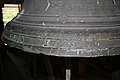 20110615 037 Friedland Detail-Kirchenglocke.jpg 3,888 × 2,592; 3.4 MB
-
 20110615 039 Friedland Detail-Kirchenglocke.jpg 3,888 × 2,592; 3.48 MB
-
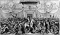 743 Auswerfung der Koenigl Preussischen Kroenungsmuenzen.jpeg 581 × 346; 44 KB
-
 Befestigte Vordüne (Kurische Nehrung).JPG 1,814 × 983; 1.22 MB
-
 Beiträge zur Naturkunde Preussens 06, 1890 - Die Brachiopoden (IA beitrgezurnatu61890kn).pdf 1,206 × 1,587, 104 pages; 6.68 MB
-

-
 Beiträge zur Naturkunde Preussens 09, 1903 - Die Schmetterlingsfauna der Provinzen Ost- und Westpreussen (IA beitrgezurnatu91903kn).pdf 1,281 × 1,677, 164 pages; 15.79 MB
-
-
 Bundesarchiv Bild 102-09887, Neuhöfen, Deutsch-polnische Grenze.jpg 800 × 579; 59 KB
-
 Bundesarchiv Bild 102-14203, Berlin, Ostpreußen-Ausstellung.jpg 800 × 596; 75 KB
-
 Charte vom Königlich Preussischen Regierungsbezirk Gumbinnen.jpg 6,007 × 7,660; 15.71 MB
-
De-Ostpreußen2.ogg 2.1 s; 20 KB
-

-

-
 East Prussian flag.png 4,724 × 2,835; 1.52 MB
-
 Feuerholz (Ostpreußen).jpg 1,831 × 1,042; 1.36 MB
-
 Forstamt Pfeil (Ostpreußen).JPG 853 × 623; 478 KB
-
 Hochwasser und Treibeis (Ostpreußen).JPG 1,521 × 933; 889 KB
-
 Internationale Pelzfachausstellung Leipzig 1930, Elchausstellung.jpg 803 × 592; 76 KB
-
 Kallner Berge.jpg 4,500 × 1,388; 1.23 MB
-
 Kernsdorfer Höhen.jpg 782 × 1,151; 374 KB
-
 Kneiphof CoA.jpg 729 × 876; 104 KB
-
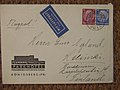
 Letter Pillau 1869 B002.jpg 2,383 × 1,372; 749 KB
-
 Loebenicht CoA.jpg 1,280 × 1,396; 102 KB
-
 Lutherkirche Insterburg Einsegnungsurkunde 1935.jpg 2,430 × 2,001; 2.61 MB
-
 Moose by Horst Siewert.jpg 1,360 × 889; 393 KB
-

-

-
 Ostpreußen-Relief Pyrmont.JPG 3,648 × 2,736; 4.28 MB
-
 Park Hotel Königsberg 1935 (3027206135).jpg 1,152 × 864; 193 KB
-

-

-
 Pillkoppen, Ostpreußen - Stadtansicht (Zeno Ansichtskarten).jpg 2,150 × 1,365; 230 KB
-
 Polski (Narmeln) międzywojnie.jpg 660 × 378; 20 KB
-
 Rathaus Wehlau.jpg 1,160 × 747; 350 KB
-
 Reichspost-Schlitten.jpg 1,613 × 1,063; 896 KB
-
 RSMetgethen1929unbek.jpg 306 × 188; 19 KB
-
 RSMetgethen1929unbII.jpg 1,094 × 667; 102 KB
-
 Schwarzorter Familien bis 1944 (Ostpreußen, heute Litauen).jpg 1,600 × 1,201; 442 KB
-

-
-
 Trakehner Pythagoras.jpg 1,767 × 2,486; 2.64 MB
-
 Wanderdüne bei Pillkoppen.JPG 1,782 × 1,272; 1.31 MB
-
 Wasserkraftwerk Friedland (Königsberg).jpg 1,300 × 832; 586 KB
-
 Wybrzeże Sambijskie w pobliży Warniken.jpg 1,281 × 928; 102 KB
-
 Старинные открытки (52264356827).jpg 1,196 × 1,600; 693 KB


.JPG)
,_Wegweiser.jpg)


.jpg)
.JPG)
.JPG)


.jpg)

_in_Kanoten_(Amtsbezirk_Posegnick_-_Gerdauen)_1926.jpg)
.jpg)
_mi%C4%99dzywojnie.jpg)


.jpg)
_-_DPLA_-_1750bc0f2db7f8b5158b5868e002d32a_(page_19).jpg)
_-_DPLA_-_1750bc0f2db7f8b5158b5868e002d32a_(page_44).jpg)


.jpg)

.jpg)
Categories:
- Provinces of Prussia
- History of Kaliningrad Oblast
- History of Warmian-Masurian Voivodeship
- History of Russia by historical region
- States and territories established in 1773
- 1773 establishments in Europe
- States and territories disestablished in 1829
- 1829 disestablishments in Europe
- 1878 establishments in Germany
- States and territories established in 1878
- States and territories disestablished in 1945
- 1945 disestablishments in Germany
- Former eastern territories of Germany
- Historic exclaves and enclaves