Category:Eastern Canadian Boreal Forests Ecoregion
Jump to navigation
Jump to search
Boreal coniferous forest ecoregion in Eastern Canada   | |||||
| Upload media | |||||
| Instance of | |||||
|---|---|---|---|---|---|
| Location |
| ||||
| Area |
| ||||
| official website | |||||
| |||||
English: The Eastern Canadian Boreal Forests Ecoregion is a designated ecoregion by WWF and One Earth. It is classified as a Boreal Forests/Taiga Biome. It is one of six ecoregions in the Canadian Shield & Coastal Taiga-Forests Bioregion.
This is a collection of photos that best represent the Eastern Canadian forests ecoregion of New Brunswick, Newfoundland and Labrador, Nova Scotia, and Quebec.
Français : Il s'agit d'une collection de photos qui représente le mieux l'écorégion des forêts de l'est du Canada du Nouveau-Brunswick, de Terre-Neuve-et-Labrador, de la Nouvelle-Écosse et du Québec.
Subcategories
This category has the following 20 subcategories, out of 20 total.
A
B
- Blow Me Down Provincial Park (1 F)
- Butter Pot Provincial Park (3 F)
C
- Cataracts Provincial Park (2 F)
D
F
G
J
L
M
P
S
T
- The Arches Provincial Park (37 F)
Media in category "Eastern Canadian Boreal Forests Ecoregion"
The following 22 files are in this category, out of 22 total.
-
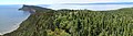
 Cap Bon-Ami, Forillon National Park (7613006968).jpg 3,641 × 2,427; 4.22 MB
-
 Cap Bon-Ami, Forillon National Park (7613010484).jpg 4,272 × 2,848; 4.93 MB
-
 Cap Gaspé, Forillon National Park (7613035850).jpg 3,622 × 2,415; 7.75 MB
-
 Cape Breton Highlands National Park (7618608150).jpg 3,985 × 2,657; 5.01 MB
-
 Eastern Canadian Forests map.svg 1,712 × 1,992; 347 KB
-
 Forillon Nat'l Park (27188308809).jpg 11,206 × 3,119; 37.15 MB
-
 Forillon Nat'l Park (27188322019).jpg 9,869 × 3,122; 36.95 MB
-
 Forillon National Park (7613019592).jpg 3,927 × 2,618; 4.83 MB
-
 Gaspesie Nat'l Park, Quebec (36867733990).jpg 4,032 × 3,024; 5.57 MB
-
 Gaspesie Park, Quebec (37093491842).jpg 4,032 × 3,024; 3.78 MB
-
 Lac du Diable (Mont-Albert) (cropped).jpg 3,103 × 2,420; 5.14 MB
-
 Mary Anne Falls (15531426481).jpg 6,000 × 4,000; 28.88 MB
-
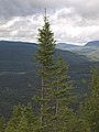 Massif des McGerrigle from Mont Olivine 2.jpg 2,736 × 3,648; 4.85 MB
-
 Massif des McGerrigle from Mont Olivine PN de la Gaspesie 2.jpg 2,736 × 3,648; 5 MB
-
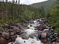 Ruisseau du Diable.jpg 4,032 × 3,024; 4.43 MB
-
 Skyline Trail (21714652009).jpg 5,760 × 3,840; 30.5 MB
-
 Skyline trail, Cape Breton (7618658788).jpg 4,060 × 2,707; 6.02 MB
-

-
 The Sainte Anne River from Passerelle des Eaux-Vives PN de la Gaspesie 1.jpg 3,648 × 2,736; 5.9 MB
-
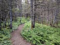
 Trail in PN de la Gaspesie.jpg 2,736 × 3,648; 8.85 MB
-
 Vers le mont Olivine.jpg 3,648 × 2,136; 3.29 MB
-
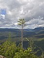
 View from Mont Olivine to the southwest PN de la Gaspesie.jpg 2,736 × 3,648; 4.73 MB
.jpg)
.jpg)
.jpg)
.jpg)
.jpg)
.jpg)
.jpg)
_(cropped).jpg)
.jpg)


.jpg)
.jpg)
.jpg)


.jpg)
.jpg)
Categories:
- Forests in Canada
- Ecoregions of Canada (WWF)
- Canadian Shield & Coastal Taiga-Forests Bioregion
- List of Terrestrial Ecoregions (One Earth)
- Boreal Forests/Taiga Biome (One Earth)
- Ecoregions of Canada (One Earth)
- Ecoregions of Saint Pierre and Miquelon (One Earth)
- Terrestrial Ecoregions of Subarctic America (One Earth)