Category:Edinburgh Trams tracks (Clifton curve - Shandwick crossover)
Jump to navigation
Jump to search
| Object location | | View all coordinates using: OpenStreetMap |
|---|
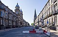
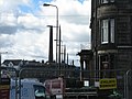
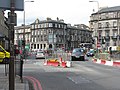
English: The straight section from the Clifton Terrace curve to the crossover in Shanddwick Place, along West Maitland Street, Coates Place, Atholl Place and Coates Cresent (listed west to east).
Subcategories
This category has only the following subcategory.
Media in category "Edinburgh Trams tracks (Clifton curve - Shandwick crossover)"
The following 21 files are in this category, out of 21 total.
-
 Clifton Terrace at Grosvenor Street (geograph 3442571).jpg 640 × 480; 142 KB
-
 Dalry Road (geograph 3442564).jpg 640 × 480; 130 KB
-
 Dalry Road (geograph 3443915).jpg 640 × 401; 123 KB
-
 Edinburgh tram, 11 March 2014 (1).jpg 3,264 × 4,896; 6.05 MB
-
 Edinburgh tram, 11 March 2014 (2).jpg 4,896 × 2,276; 3.27 MB
-
 Edinburgh trams first day of operation 01.JPG 2,896 × 2,120; 1.17 MB
-
 Grosvenor Street (geograph 3512630).jpg 2,000 × 1,268; 1.27 MB
-
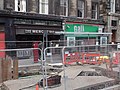
 Installing overhead wires for trams, West Maitland St, Edinburgh (geograph 3547935).jpg 4,320 × 3,240; 2.81 MB
-
 Mercat Bar, West Maitland Street, Edinburgh (geograph 2248873).jpg 800 × 600; 243 KB
-
 Morrison Street, Edinburgh (geograph 3633699).jpg 640 × 427; 82 KB
-
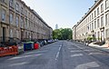
 Palmerston Place (geograph 3512672).jpg 2,000 × 1,265; 928 KB
-
 Reaching for the sky (geograph 3474806).jpg 3,264 × 2,448; 2.77 MB
-
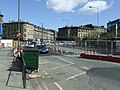
 Road works at Haymarket Torphichen Street (geograph 3474810).jpg 3,264 × 2,448; 3.9 MB
-

-
 Torphichen Street (geograph 3103248).jpg 640 × 449; 120 KB
-
 Torphichen Street, Edinburgh (geograph 3642136).jpg 5,184 × 3,456; 7.56 MB
-
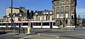
 Tram approaching Haymarket Station, Edinburgh (geograph 4033170).jpg 3,264 × 2,448; 1.79 MB
-
 West Maitland Street (geograph 3103318).jpg 640 × 480; 167 KB
-
 West Maitland Street (geograph 3240379).jpg 3,264 × 2,448; 3.86 MB
-
 West Maitland Street closed for work on tramway (geograph 3129799).jpg 1,024 × 768; 548 KB
-
 West Maitland Street, Haymarket (geograph 3721370).jpg 3,872 × 2,592; 3.94 MB
.jpg)
.jpg)
.jpg)
.jpg)
.jpg)

.jpg)
.jpg)
.jpg)
.jpg)
.jpg)
.jpg)
.jpg)
.jpg)
.jpg)
.jpg)
.jpg)
.jpg)
.jpg)
.jpg)
.jpg)