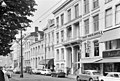
Category:Eendrachtsweg 22, Rotterdam
Jump to navigation
Jump to search
| Object location | | View all coordinates using: OpenStreetMap |
|---|
building in Rotterdam, Netherlands  | |||||
| Upload media | |||||
| Instance of | |||||
|---|---|---|---|---|---|
| Location | Rotterdam, South Holland, Netherlands | ||||
| Street address |
| ||||
| Located on street | |||||
| Heritage designation |
| ||||
 | |||||
|
This is a category about rijksmonument number 32748
|
| Address |
|
Media in category "Eendrachtsweg 22, Rotterdam"
The following 3 files are in this category, out of 3 total.
-
 Rotterdam eendrachtsweg22.jpg 1,771 × 2,797; 482 KB
-
 Voorgevels - Rotterdam - 20191999 - RCE.jpg 1,200 × 808; 245 KB
-
 Voorgevels overzicht - Rotterdam - 20191998 - RCE.jpg 1,200 × 802; 215 KB

