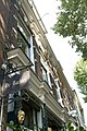
Category:Eewal 67, Leeuwarden
Jump to navigation
Jump to search
| Object location | | View all coordinates using: OpenStreetMap |
|---|
.jpg) | |||||
| Upload media | |||||
| Instance of | |||||
|---|---|---|---|---|---|
| Location | Leeuwarden, Friesland, Netherlands | ||||
| Street address |
| ||||
| Heritage designation |
| ||||
 | |||||
|
This is a category about rijksmonument number 516450
|
| Address |
|
Media in category "Eewal 67, Leeuwarden"
The following 4 files are in this category, out of 4 total.
-
 Voorgevels - Leeuwarden - 20132366 - RCE.jpg 803 × 1,200; 223 KB
-
 WLM - mringenoldus - Winkel, De Barbier (1).jpg 683 × 1,024; 487 KB
-
 WLM - mringenoldus - Winkel, De Barbier (2).jpg 1,024 × 683; 405 KB
-
 WLM - mringenoldus - Winkel, De Barbier.jpg 683 × 1,024; 411 KB

.jpg)
