Category:Eglise St-Amand (Route de Porrentruy 6, Bure JU)
Jump to navigation
Jump to search
| Object location | | View all coordinates using: OpenStreetMap |
|---|
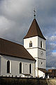
church building in Bure in the canton of Jura, Switzerland  | |||||
| Upload media | |||||
| Instance of | |||||
|---|---|---|---|---|---|
| Part of | |||||
| Location | Bure, Porrentruy District, Jura, Switzerland | ||||
| Street address |
| ||||
| Heritage designation | |||||
 | |||||
Media in category "Eglise St-Amand (Route de Porrentruy 6, Bure JU)"
The following 4 files are in this category, out of 4 total.
-
 2016-Bure-Kirche.jpg 1,280 × 1,920; 2.68 MB
-
 2016-Bure-Vitrail.jpg 1,280 × 1,920; 3.67 MB
-
 Bure, Église Saint-Armand.jpg 2,942 × 2,072; 533 KB
-
 Bure.jpg 300 × 450; 46 KB


